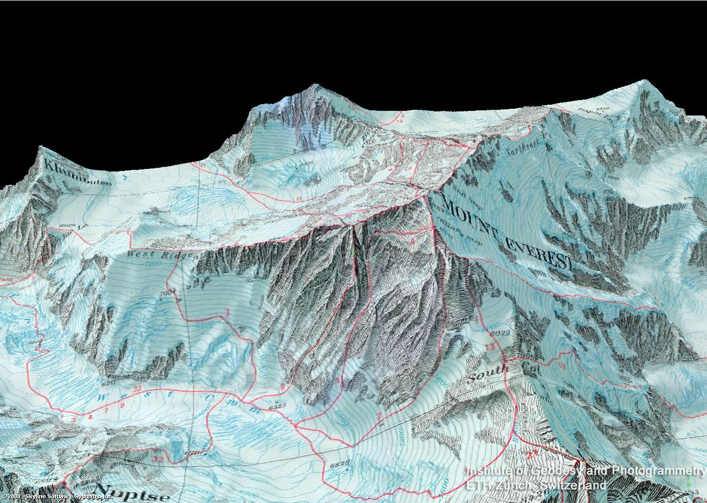
3D model of Mt. Everest with map overlay, 2000. From ref. 10
48
Everest
Part II – The Later Maps
When Edmund Hillary and Tenzing Norgay were standing on the summit of Everest, around 11:30 am NPT (UTC+5:45), 29 May 1953, 107 years after Waugh discovered peak XV and 22 years after the first British expedition to Tibet (see part I), Hillary described the view: “The whole world around us lay spread out like a giant relief map and I could take in with a glance country that we had spent months mapping and exploring on previous trips.” But the mapping of Everest was far from complete and over the next 50 years many expeditions would survey and map the region.
The 1954–55 the French Fédération Française de la Montagne expedition to Makalu, led by Jean Franco, surveyed the region between Makalu and Everest and created a 1:50,000 topographic map of the region. Although I am sure there is a copy of this map somewhere – perhaps in a Parisian library's map drawer – I have nothing here to show you. Sorry.
The Austrian cartographer Erwin Schneider, as part of the 1955 International Himalayan Expedition to Lhotse, began an extensive stereo-photogrammetric survey of the Khumbu region. In 1957 with the the Deutsher Alpinverein and Österreichischer Alpenverein he prepared a 1:25,000 map of Everest.1 The map, drawn by Fritz Ebster, was published in an expanded form in 1960 and has been continuously updated since:
Detail, Mahalangur Himal, 1991
The Schneider map, beautifully printed by Kartographische Anstant Freytag-Berndt, included a wonderful representation of rock and terrain and 40m contours (although, interestingly, no relief shading). It was the first great map of Everest and is still considered a classic.
Meanwhile, back in Britain, George Holland, the RGS’ chief draftsman, began to prepare a new map using nearly 40 years worth of photos and surveys from his archive, as well as the newer French and Austrian surveys. The result, published in 1961 and updated in 1975, was similar in detail to the Scheider maps but significantly expanded the covered area.2 As Ward states “It is now the landmark map of the area, against which all others are judged.”
Detail, Mount Everest, 1975
In the early 1960s Eduard Imhof included this 1:100,000 map in his seminal Schweizerischer Mittelschulatlas. Although not a major project like the Schneider or Holland maps, it is nevertheless a beautiful relief presentation:
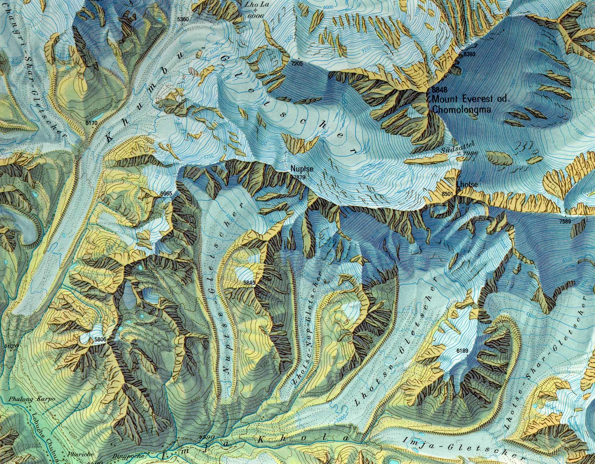
Detail, Mount Everest od Chomolongma, 1962. from ref. 3
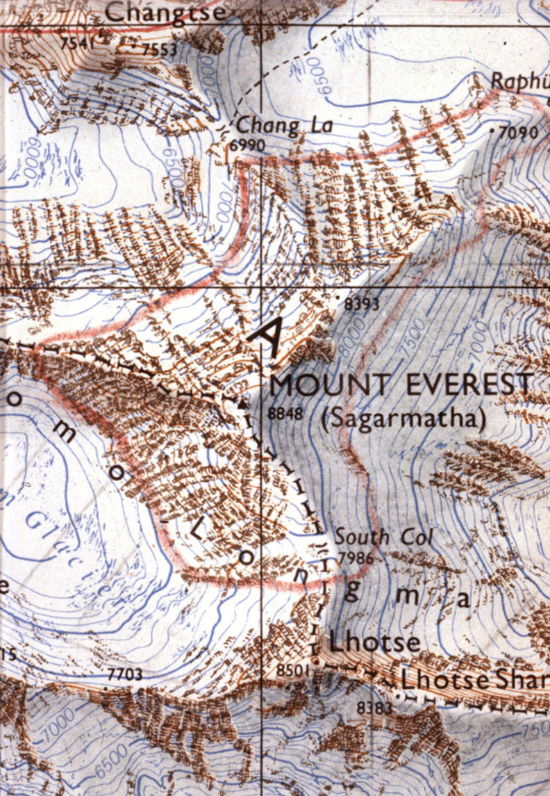
The Chinese, who had been mounting expeditions from Tibet since the 1960s, conducted their own surveys, including a survey between 1966–1968 led by Wang Wenying and a major mapping expedition in 1975. The 35+ member 1975 surveying team set up 10 mapping stations on the mountain and completed China’s first comprehensive survey. Cartographers from Lanzhou University under Chen Jiaming prepared a Chinese language map4 ca.1969 and an updated map, in both Chinese and English, in 1977:
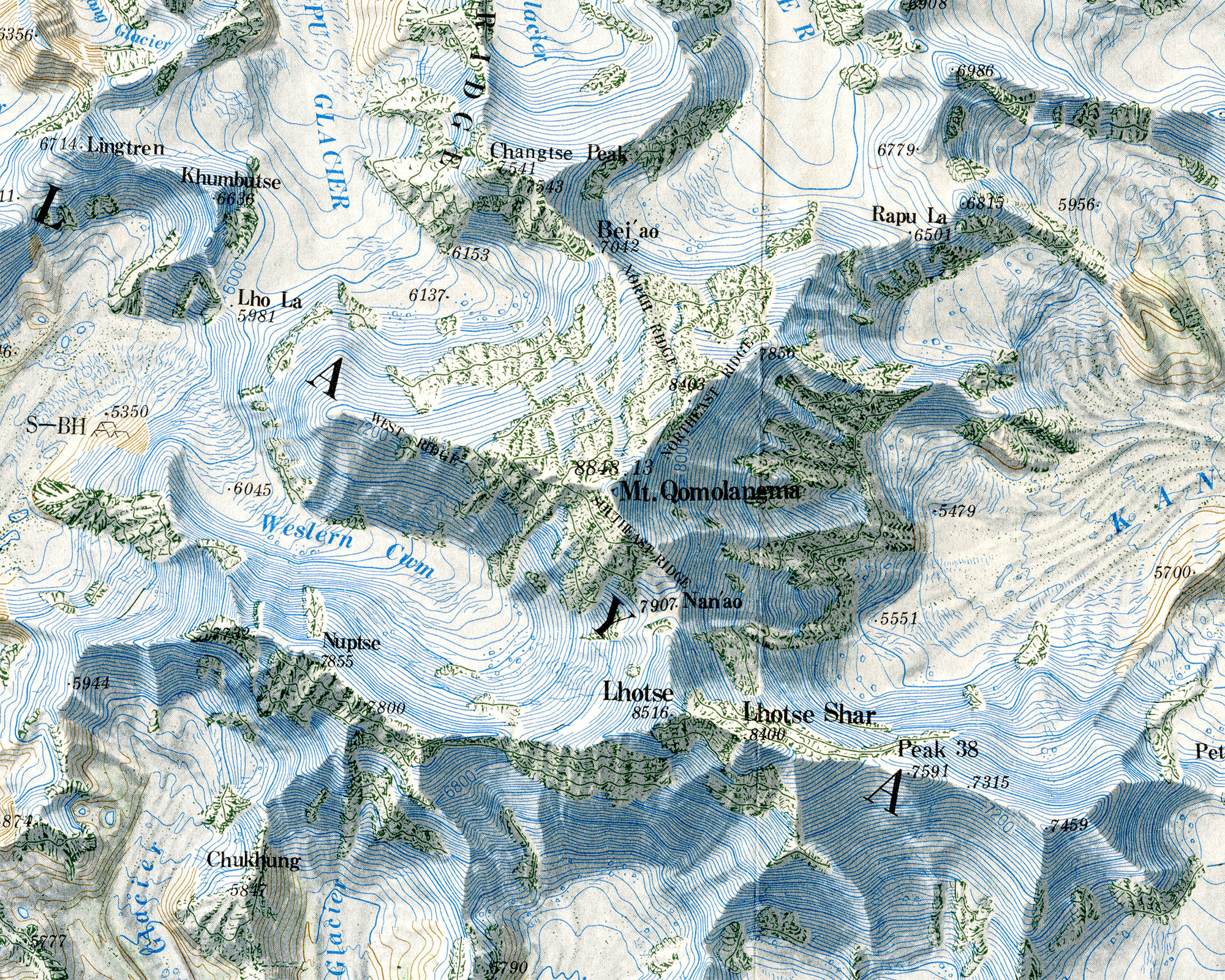
Detail, Mount Qomolangma, 1991 5
The 1:100,000 map, which has been revised several times, while not quite matching the cartographic standards of the German or British maps (lighten up with that airbrush, Chen-Li), nevertheless included many Tibetan place names that don’t appear on the Western maps.
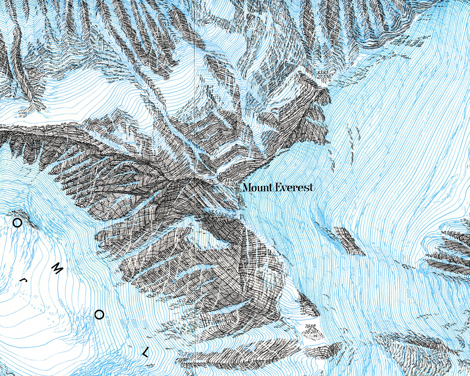
In the early 1980s Henry Bradford Washburn: adventurer, cartographer, mountaineer, museum director, photographer, pilot, et. al., began to fulfill what he called a “52 year-old dream” – his own map of Everest. Wih funding from the National Geographic Society and the Boston Museum of Science, Washburn preformed an entirely new stereo-photogrammetric survey of Nepal and Tibet that included both aerial Swissair Survey photos and Space Shuttle infrared photos:
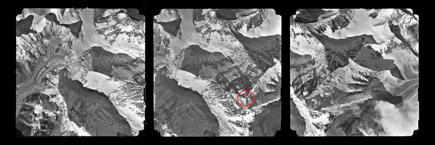
Successive images from the fifth block of the Swissair survey, 1983. Guess where Everest is
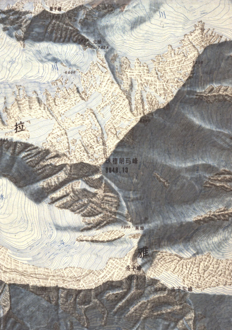
The photos were plotted by Armin Gruen at the Eidgenössische Technische Hochschule’s department of research photogrammetry and contour maps were made by Bob Rosenstihl at Swissair Photos + Surveys. The final 1:50,000 map was drawn by the Bundesamt für Landestopographie, under the cartography director Francis Jeanrichard. In all the project took five years to complete and was published in 1988 as a supplement to National Geographic Magazine (Nov 1988).6–8 The result was not only a masterpiece of Swiss cartographic relief, but a fitting tribute to Washburn’s long career. As Ward stated in his review for the Geographical Journal: “[it] will remain the standard for a generation and reflect great credit on all who have been concerned in [its] making.”9
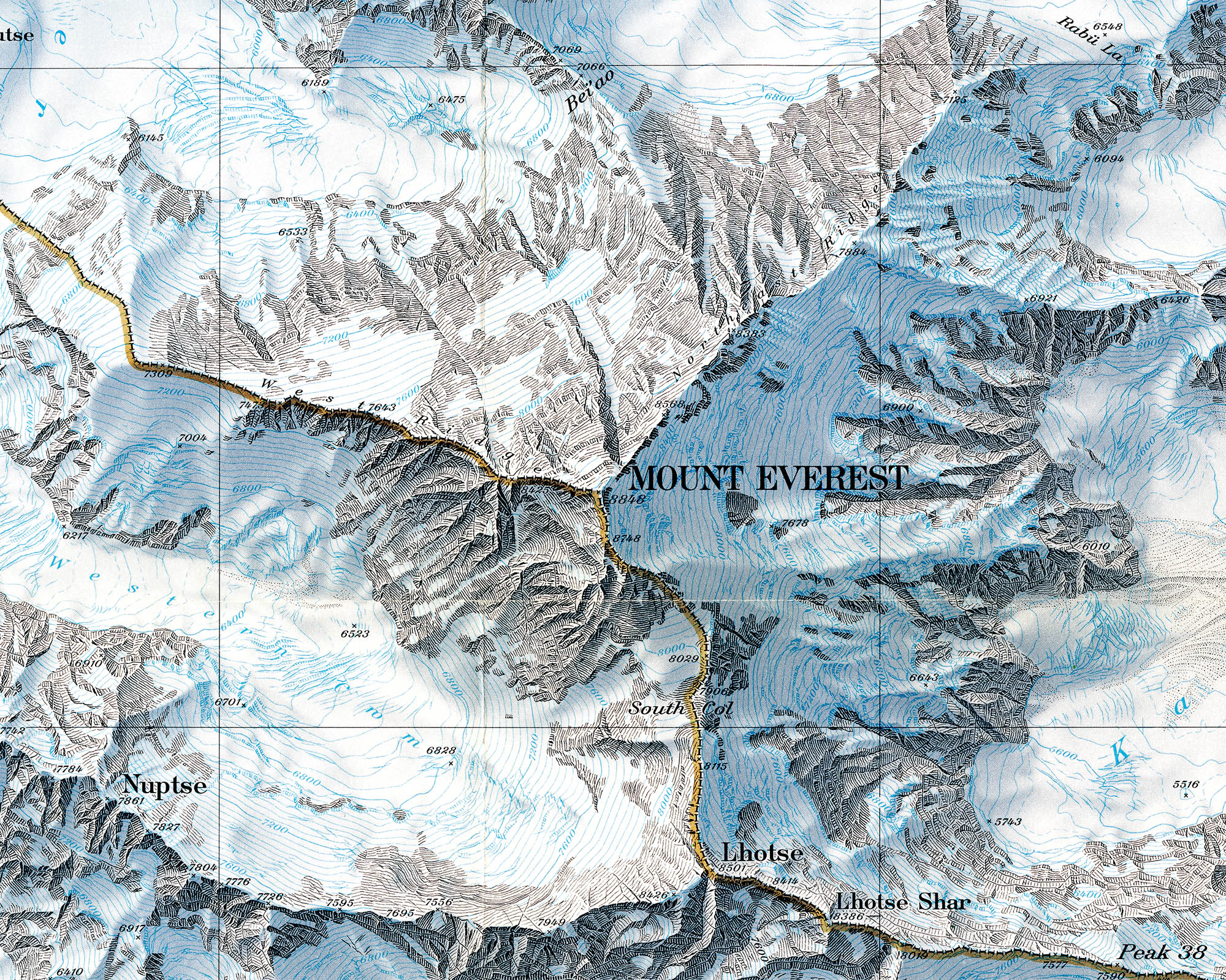
Detail, Mount Everest, 1988
The Washburn map may be one of the last great traditional Swiss relief presentations. Tracing paper, India ink and airbrushes have been largely replaced by geo-visualization databases, raster digital terrain models and GIS software programs. Gruen’s team at ETH, for example, digitized Washburn’s data and modelled the peak in 3D (see the image at the top of this page).10 More recently, the National Geographic Society commissioned a photorealistic 3D model using the same data:11
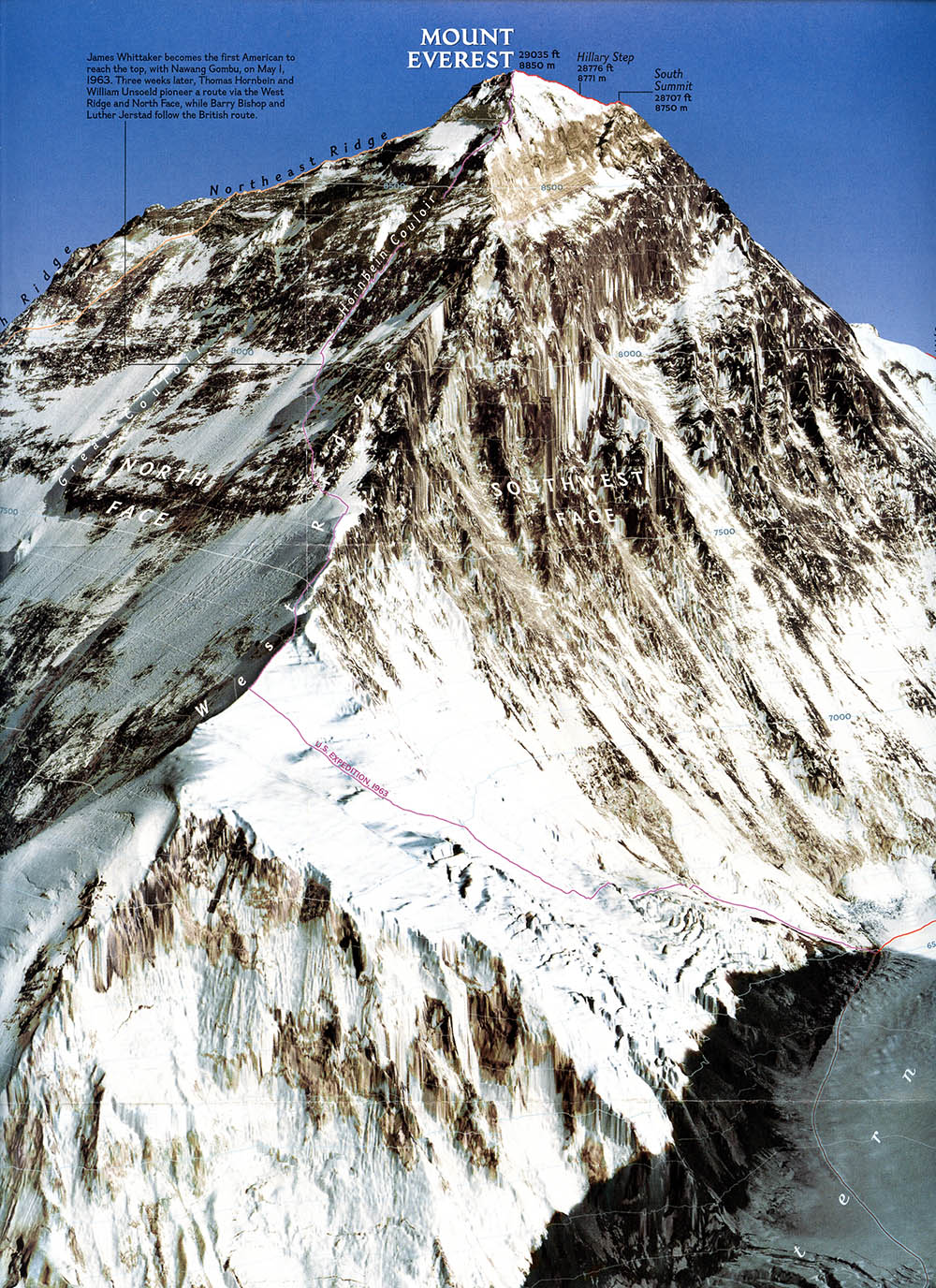
Detail, Mount Everest, 2003. From ref. 11
1. Schneider, Erwin. Mahalangur-Himal. Begleitworte zur Alpenvereinskarte des Everest-gebietes 1:25,0000 Jahrbuch des Deutschen Alpenvereins. 1957 (82) 5–12. Between 1957–1966 Schneider with Forschung-sunternehmen Nepal Himalaya and Fritz Thyssen conducted a series of field surveys in Nepal that resulted in a number of maps between 1:10,000 and 1:100,000. These maps, most of which are still in print, are widely considered the best general-purpose maps of Nepal available.
2. Holland, G.S., Crone, G. R. A New Map of the Mount Everest Region. The Geographical Journal 1962 Mar 128(1) 54–57
3. Imhof, Eduard. Schweizerischer Mittelschulatlas, 13th ed. Zurich: Konferenz der kantonalen Erziehungsdirektoren, 1962. The image used here is from ETH’s wonderful Eduard Imhof Virtual Library.
4. Here is detail from the original Chinese language version:
5. These scans were made directly from the maps. Sorry about the folds, although not so sorry that I intended to do anything about it.
6. For Washburn’s account of the project see: Washburn, B. Mapping Mount Everest. Bulletin of the American Academy of Arts and Sciences 1989 Apr;42(7): 29–44, or, Washburn, B. Mount Everest–Surveying the Third Pole. National Geographic 1988 Nov;174(11): 653–659.
7. The initial print run was almost 11 million. According to Washburn the Swiss wanted to print it but “they couldn’t print 10.6 million of anything.” It was printed by Meehan-Tooker, East Rutherford, New Jersey.
8. True story: In the mid-1990s, when your narrator was looking for the Washburn map, he directly contacted the National Geographic Society. The folded map was USD 14.99, but the back issue of the magazine (including the exact same map as a supplement) was USD 6.00. Thirteen years later, when your narrator was looking for the 2003 3D map at Half-Price Books, the folded map was USD 0.50, but the back issue of the magazine (including the exact same map), was USD 0.25. The economics of National Geographic simply elude me.
9. Ward, Michael. Sagarmatha-Mount Everest-Qomolungma by The National Geographic Society. The Geographical Journal 1989 Nov;155(3): 433–435.
10. Gruen’s project, including a number of 3D models, is online at the ETH Geodetic Sciences page.
11. A New Look at Everest. National Geographic. 2003 May;205(5): 2.
6 Dec 2009, updated 14 Dec 2009 ‧ Cartography