8
Saudi Geological Maps
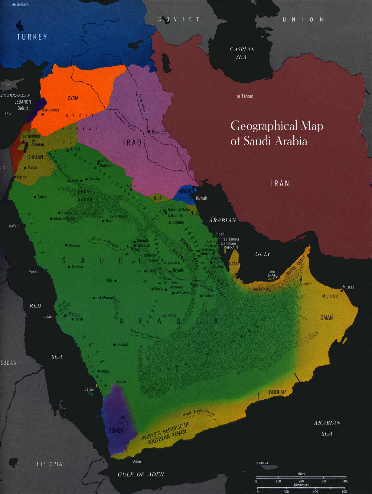
This geographical map of Saudi Arabia, from the surprisingly informative Aramco Handbook,1 could only have been done in the 1960s. The map colors owe more to the Sgt. Peppers cover or Glaser’s Dylan poster than to the efforts of National Geographic or the ETH. And the Handbook’s geological maps are even better:
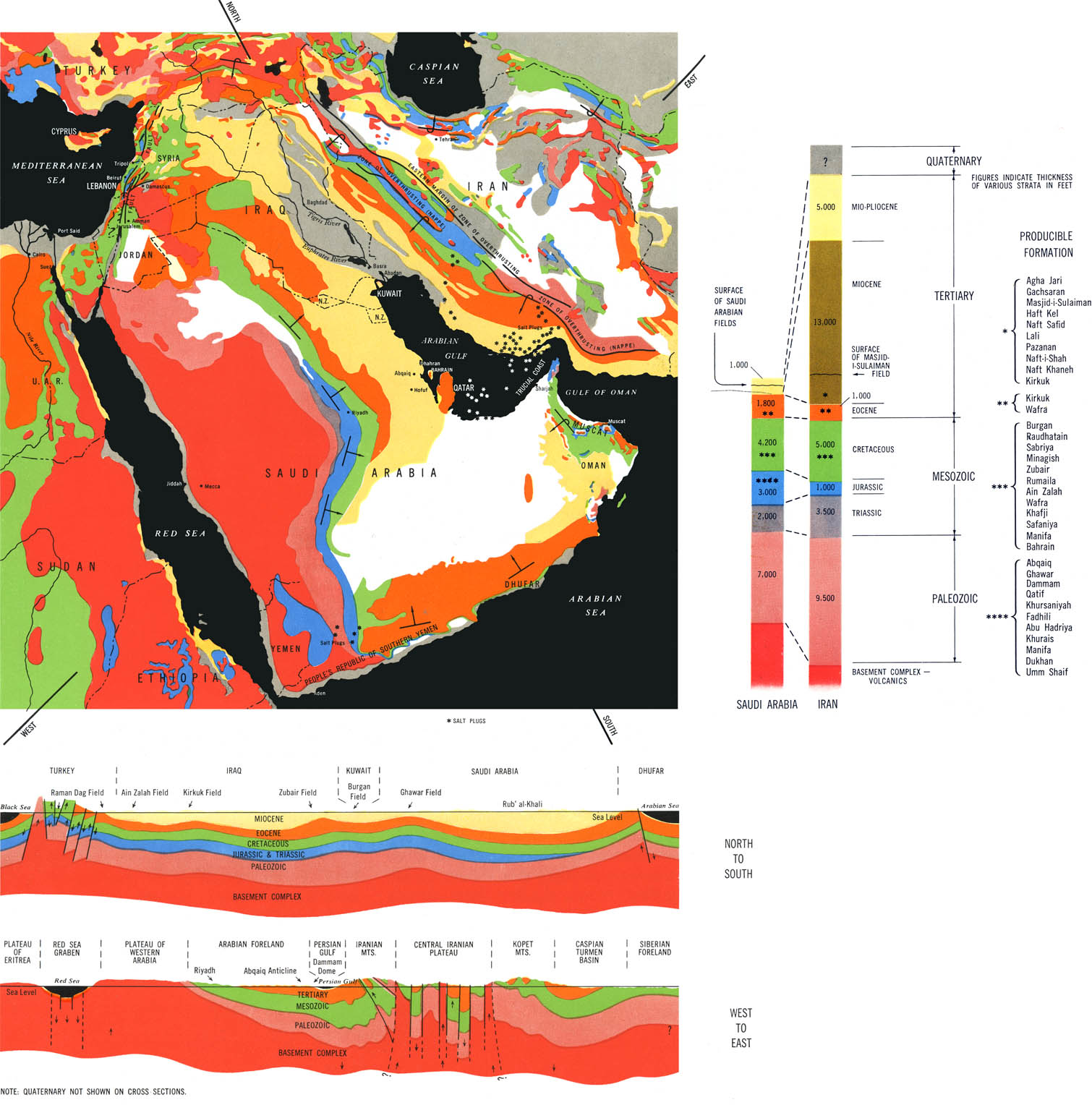
General Geology of the Middle East, from Ref. 1.
The Arabian peninsula consists of two distinctly different geological regions. The western half of the peninsula (and extending into eastern Africa) is an ancient land mass or shield consisting of mostly igneous and metamorphic Precambrian rock. The eastern half of the peninsula is made up of mostly sedimentary limestone rock deposited in layers by expanding and receding ancient seas. These sedimentary layers were then gently folded by tectonic pressure from the east that resulted in the formation of the Zagros Mountains in Iran and Iraq.

General Geologic Map of Saudi Arabia, from Ref. 1.
The point of Saudi geology is, of course, oil. It is in these sedimentary folds (known by geologists as anticlines) that virtually all Saudi oil reserves are located. Ghawar field for example, rests on an anticline above a basement rock fault with an oil producing layer of late Jurassic Arab-D limestone about 280 feet thick and ~ 6,500 feet beneath the surface.
The Ghawar complex, at 174 × 16 miles (1.3 million acres) in size, is by far the largest conventional oil field in the world. Since its discovery in 1948 it has yielded more than 60 billion bbls. Currently it is estimated to produce 5 million bbl/day,2 which accounts for around 60% of the total Saudi output or more than 6% of the worlds output.3
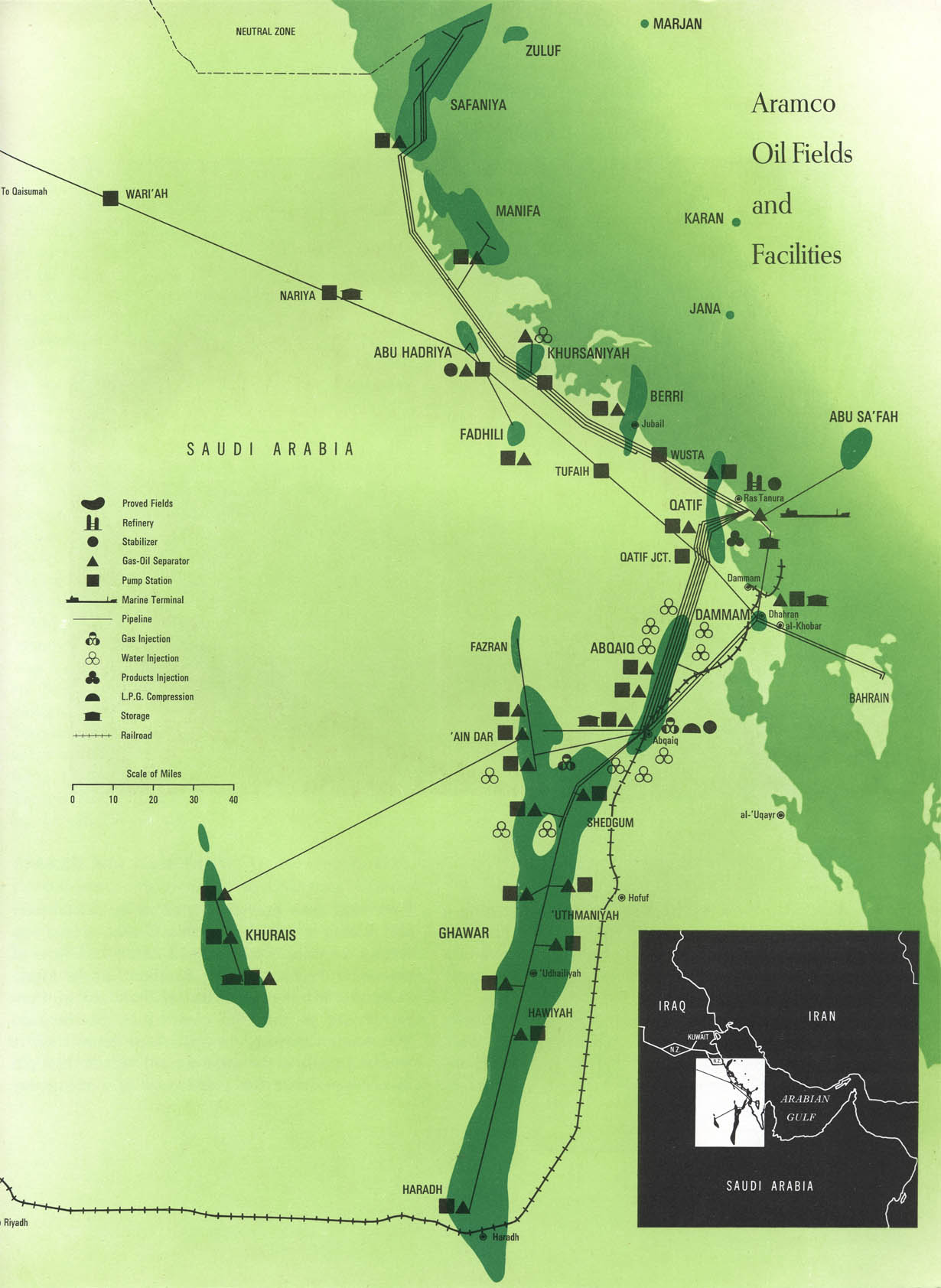
Ghawar and nearby oil facilities, ca.1967, from Ref. 1.
1. Aramco Handbook: Oil and the Middle East. Dhahran, Saudi Arabia. Arabian American Oil Company. 1968.
2. The actual output and reserves are unknown because Saudi Aramaco, the nationalized oil company, does not release production data. It has, however, been suggested by outside sources that production at Ghawar peaked in 2005.
3. The five largest sources of oil for the US are: the US itself (5.1 million bbl/day, 34%), Canada (2.4 mbbl), Mexico (1.5 mbbl), Saudi Arabia (1.4 mbbl), Venezuela (1.3 mbbl), and Nigeria (1.1 mbbl). So the Ghawar field alone accounts for around 4.6% of US oil requirements. For a complete list of US oil imports see the Petroleum Navigator at the DOE Energy Information Administration site.
20 Dec 2008 ‧ Cartography