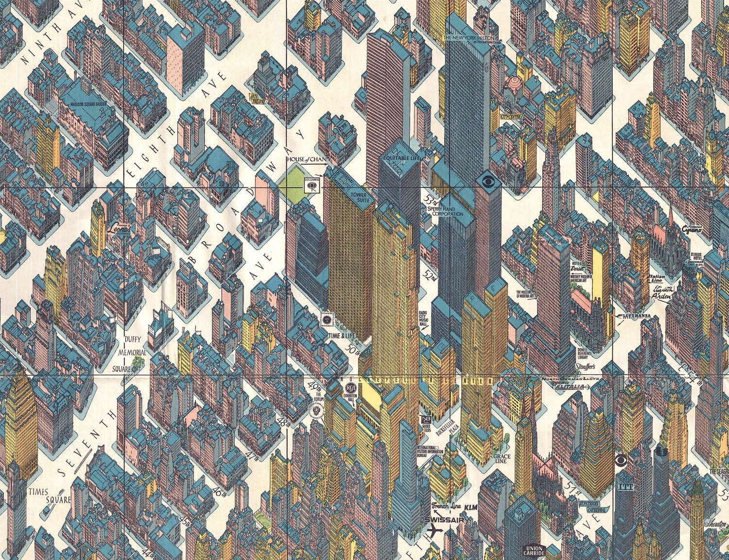
Detail, Rockerfeller Center, Herman Bollman, 1962
110
The Streets of New York
Part III – The Three-Dimensional Maps
Aside from, perhaps, the Castillo Plan, the first three–dimensional “maps” of the city were the bird’s-eye views of the late 19th century. The panoramic, or bird’s-eye, map became popular with the rise of lithography and by the 1860s most major American lithographers were offering views of various cities.1 New York City, for obvious reasons, was an especially attractive subject. Here are a few typical examples:
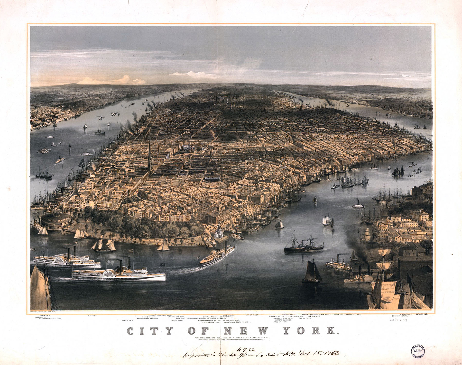
Charles Parsons/Nathaniel Currier, 1856. LOC
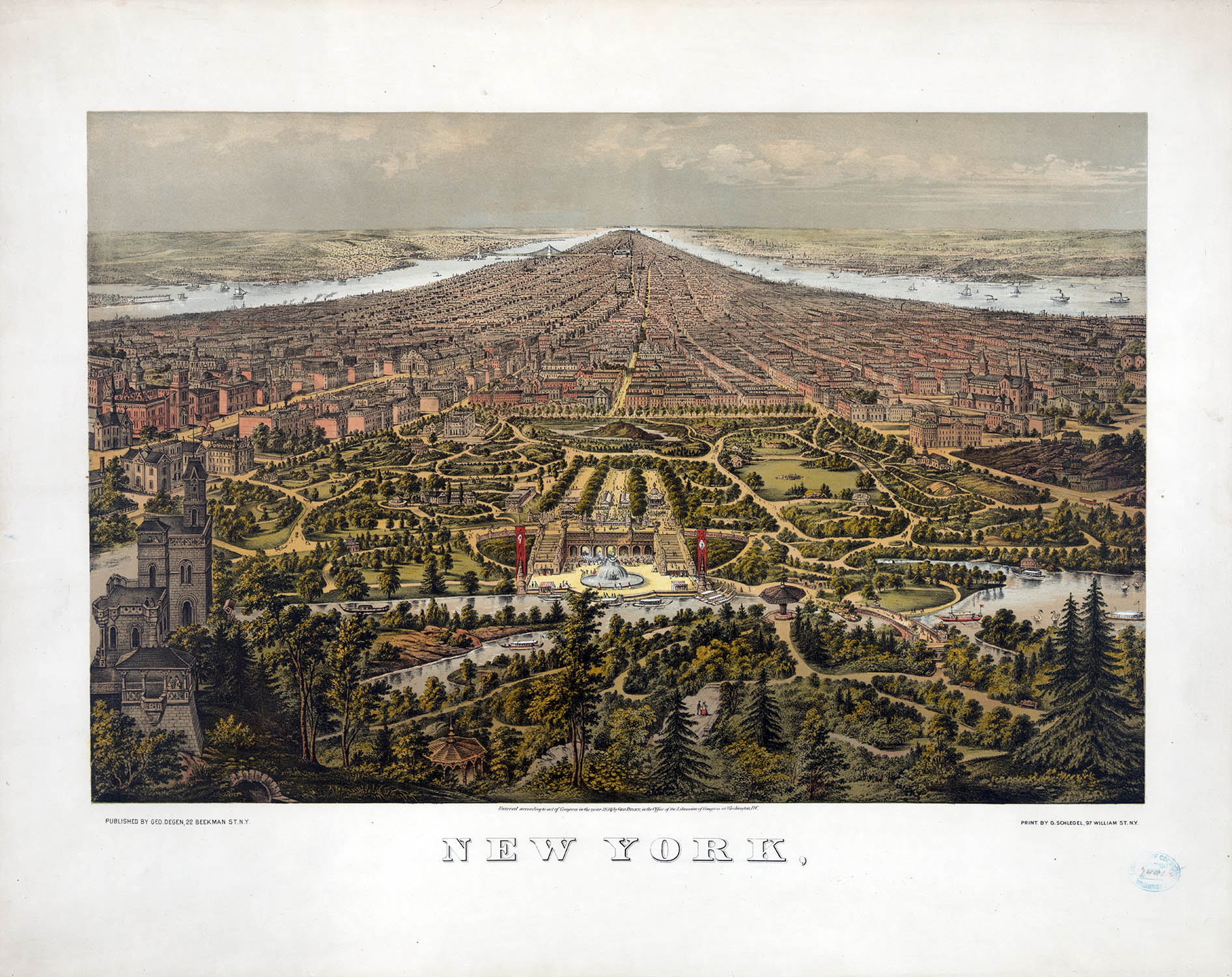
George Schlegel/George Degen, 1873. LOC
The bird’s-eye maps were not what you would call cartographically rigorous – especially in regard to scale. Nevertheless they would remain popular until replaced by panoramic photos in the early 20th century. The first true attempt at a perspective map of the city was by Will Taylor in 1879. His four-sheet engraving, published by Galt & Hoy, attempted to label all roads and piers and depict buildings to (at least a more appropriate) scale using a vanishing perspective. It was a stunning achievement for the time.
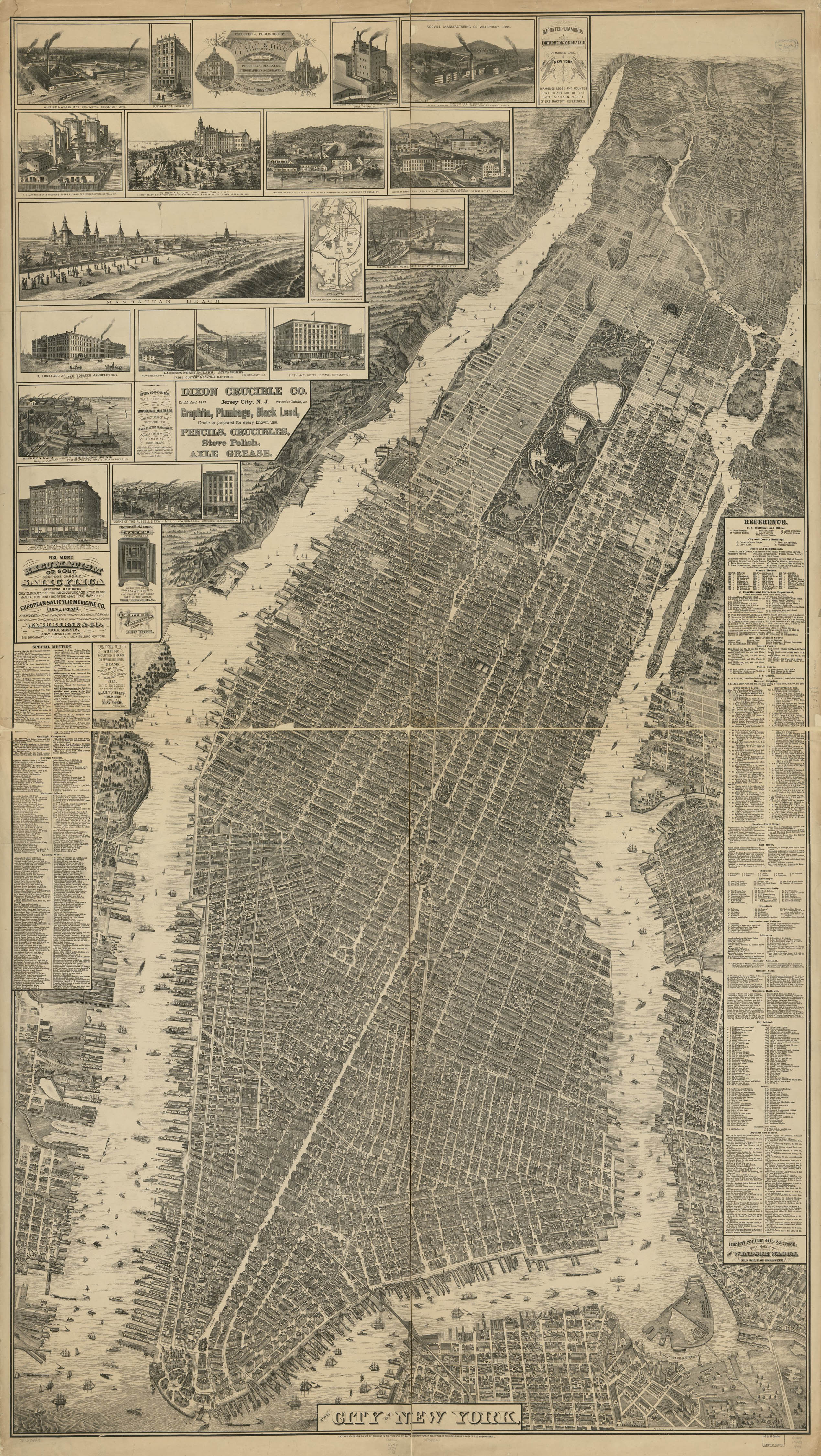
The Taylor Map, LOC
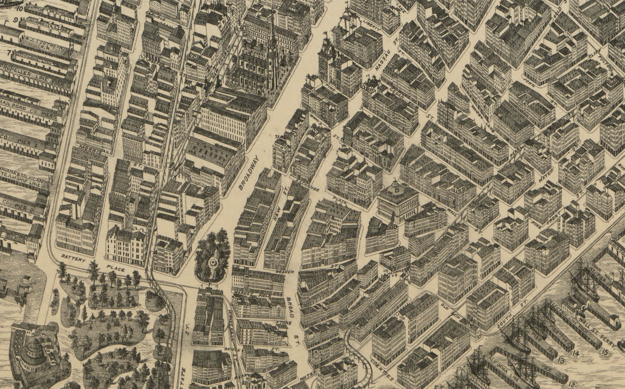
Detail, Battery Park–Trinity Church/Wall Street
By the end of the 19th century, with the introduction of structural steel (as well as the safety elevator) and coupled with the rising cost of land, New York City underwent a remarkable development of high-rise buildings and skyscrapers. Between 1870–1974, 11 of the 14 tallest buildings in the world were constructed in Manhattan and today it is home to 216 buildings at least 492 ft (150 m) tall.2,3
Advances in photogrammetry and remote sensing made two-dimensional maps of Manhattan more accurate then ever, such as this aerial mosaic photographed by Fairchild for Arthur Tuttle, city engineer, in 1924:4
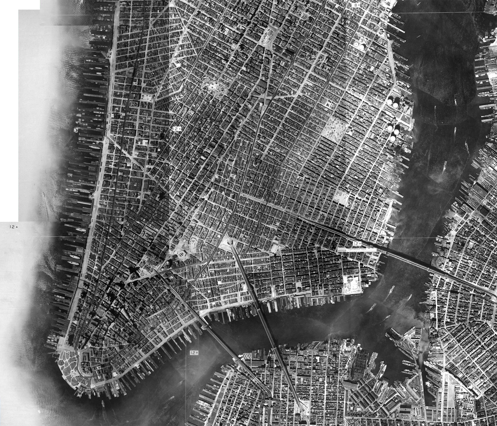
Detail, Fairchild mosaic, NYCityMap
Although the traditional maps were becoming more accurate, the ever-increasing height and sheer density of buildings made perspective mapping increasingly problematic. This map, prepared as a 1939 World’s Fair souvenir by Alexander Gross shows the limitations of traditional perspective.
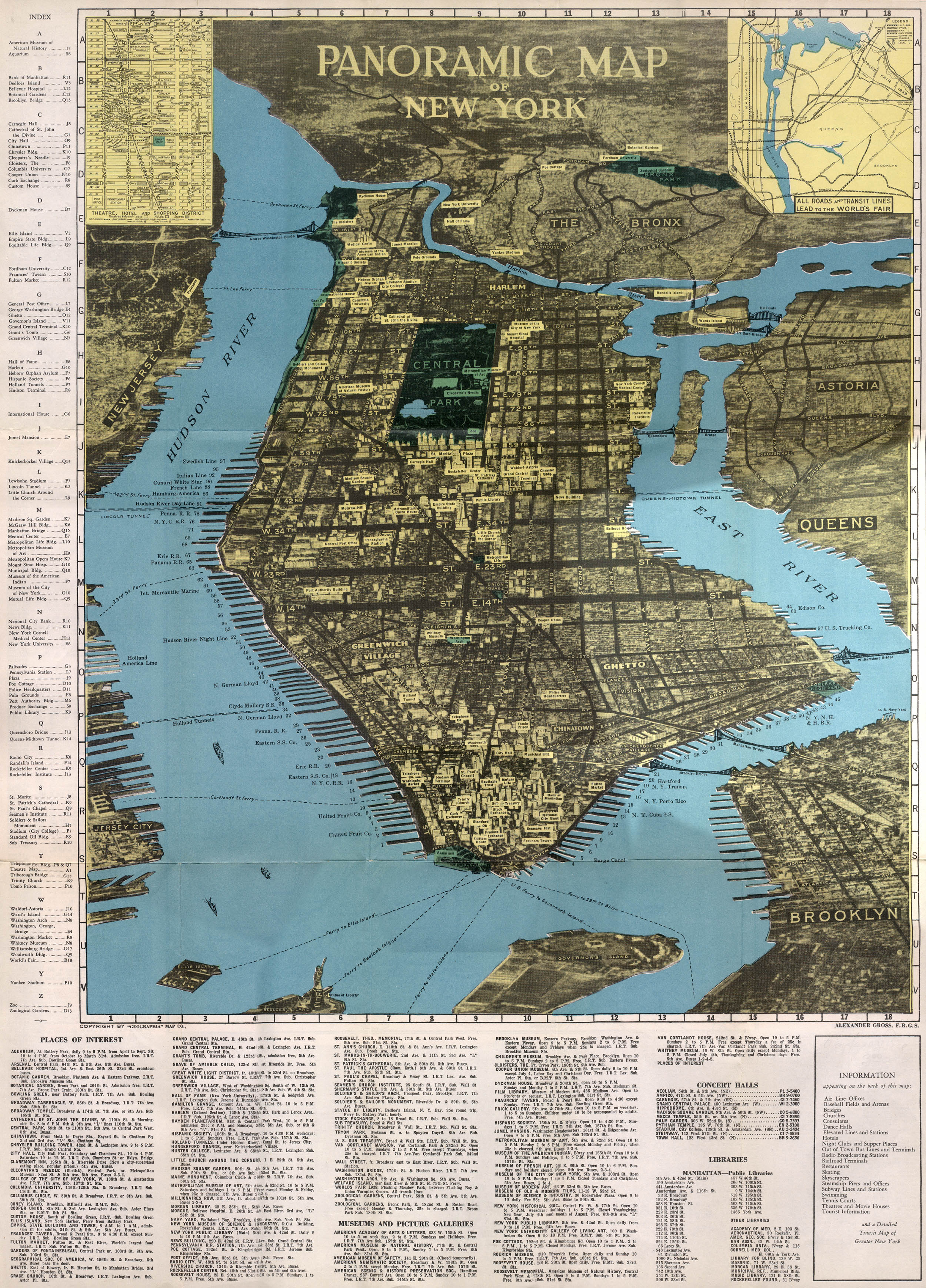
Detail, the Gross Map. Dave Kellam
The thorny problems with perspective mapping of NYC were finally solved by the German graphic artist turned cartographer Herman Bollmann. In the late 1940s Bollmann began drawing picture-plans, or bildkarten, of European cities using an oblique “optically modified” axonometric projection. Initially Bollmann drew his maps by direct observation using a light table in the field and by the 1960s was employing a special camera (mounted on a VW).5
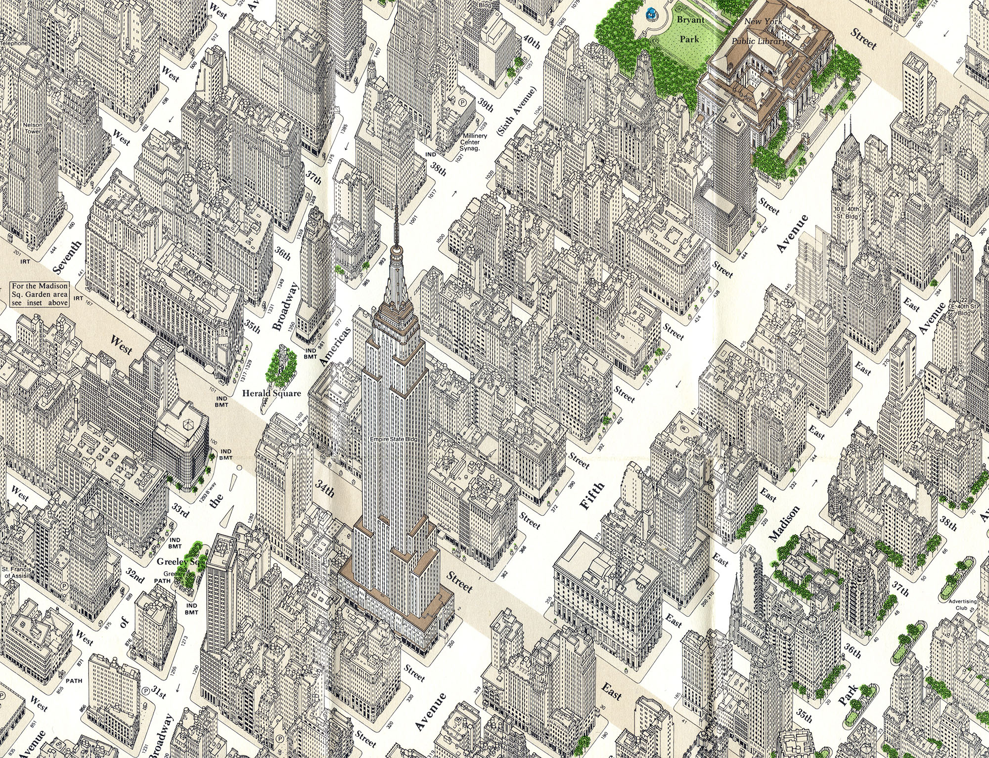
His New York Picture Map, published in 1962 by Pictorial Maps, was by far his most ambitious project. Over the course of only eight months, aided by 17,000 aerial and 50,000 ground photos, Bollmann and his staff created a map that not only showed an unobstructed view of Midtown, nearly to perfect scale, but included a remarkable level of architectural detail. Kevin Brown of Geographicus called it “one of the greatest cartographic feats of all time.”6
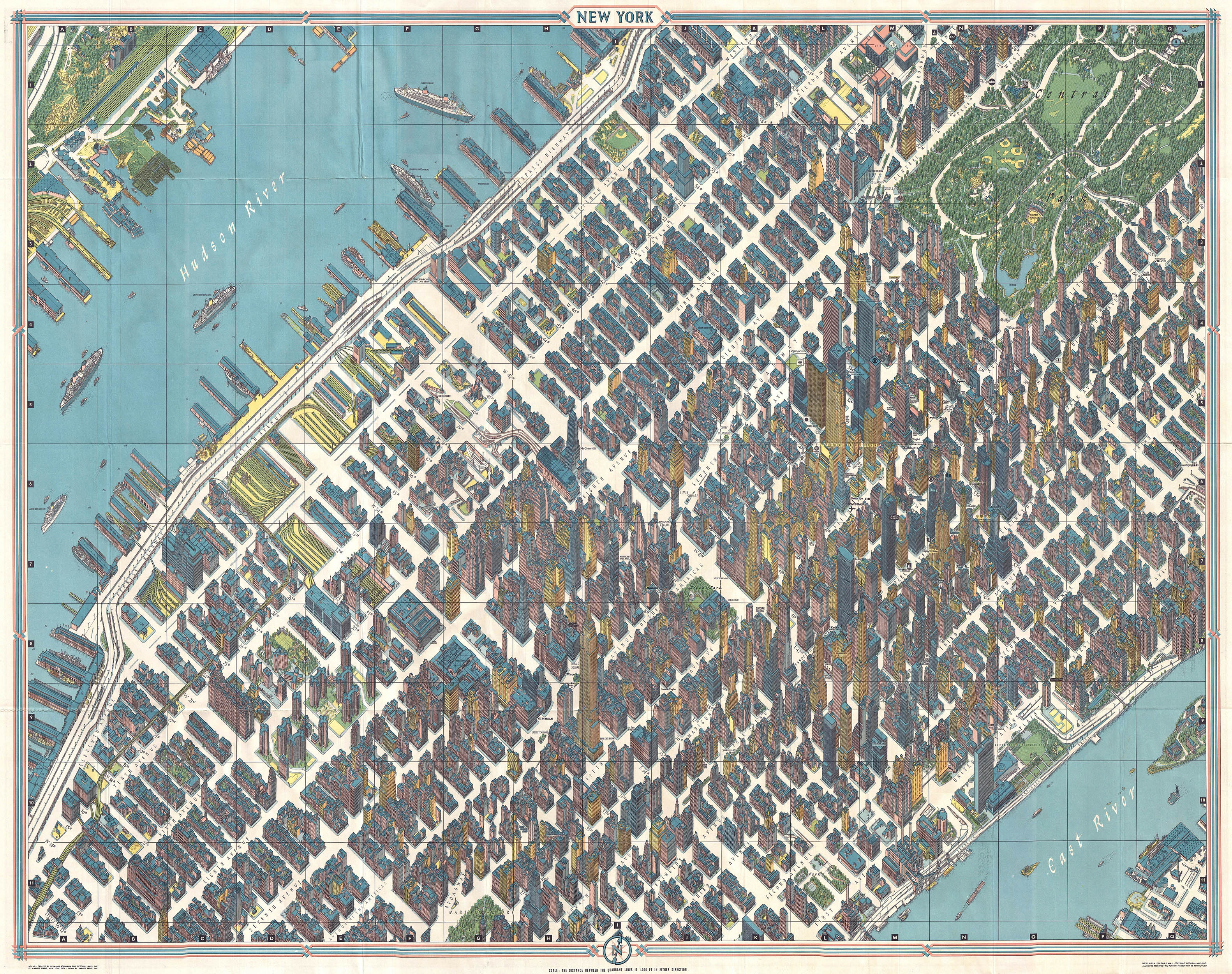
The Bollman Map, 1962. Geographicus
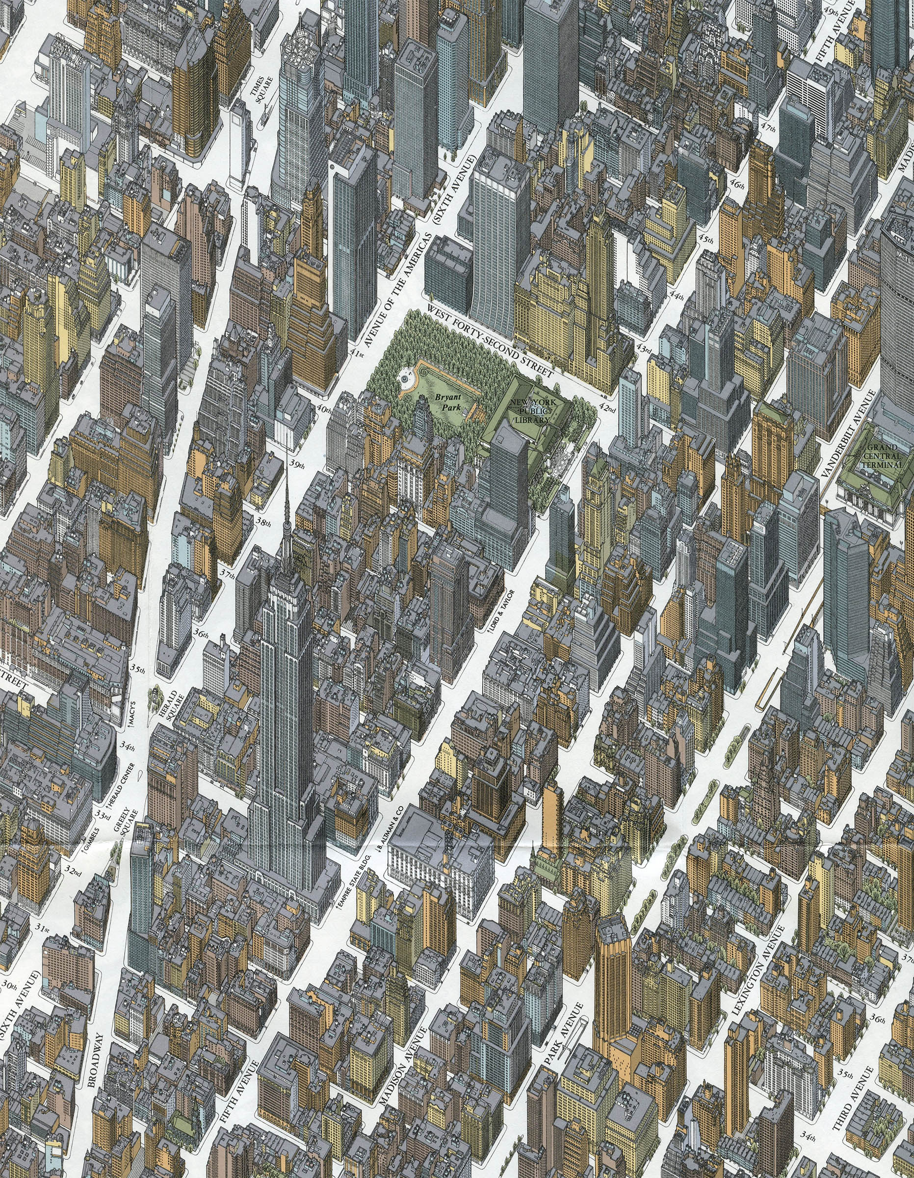
Around the time Bollmann published his map, Constatine Anderson began work on his own axonometric projection. It took more than 20 years, thousands of aerial photos and probably more than a little OCD for him to singlehandedly produce the Map of Midtown Manhattan. The map, published in 1985, shows every single window, door, awning, even telephone booth and mailbox in Midtown.
Detail, the Anderson map, 1985. Michael Stoll
This map, the Bird’s-eye View of New York, was published by Tadashi Ishihara in 2000. It combines the some of the coverage (and color) of the Bollmann map with some of the detail of the Anderson map.
Detail, the Ishihara map, 2000. Michael Stoll
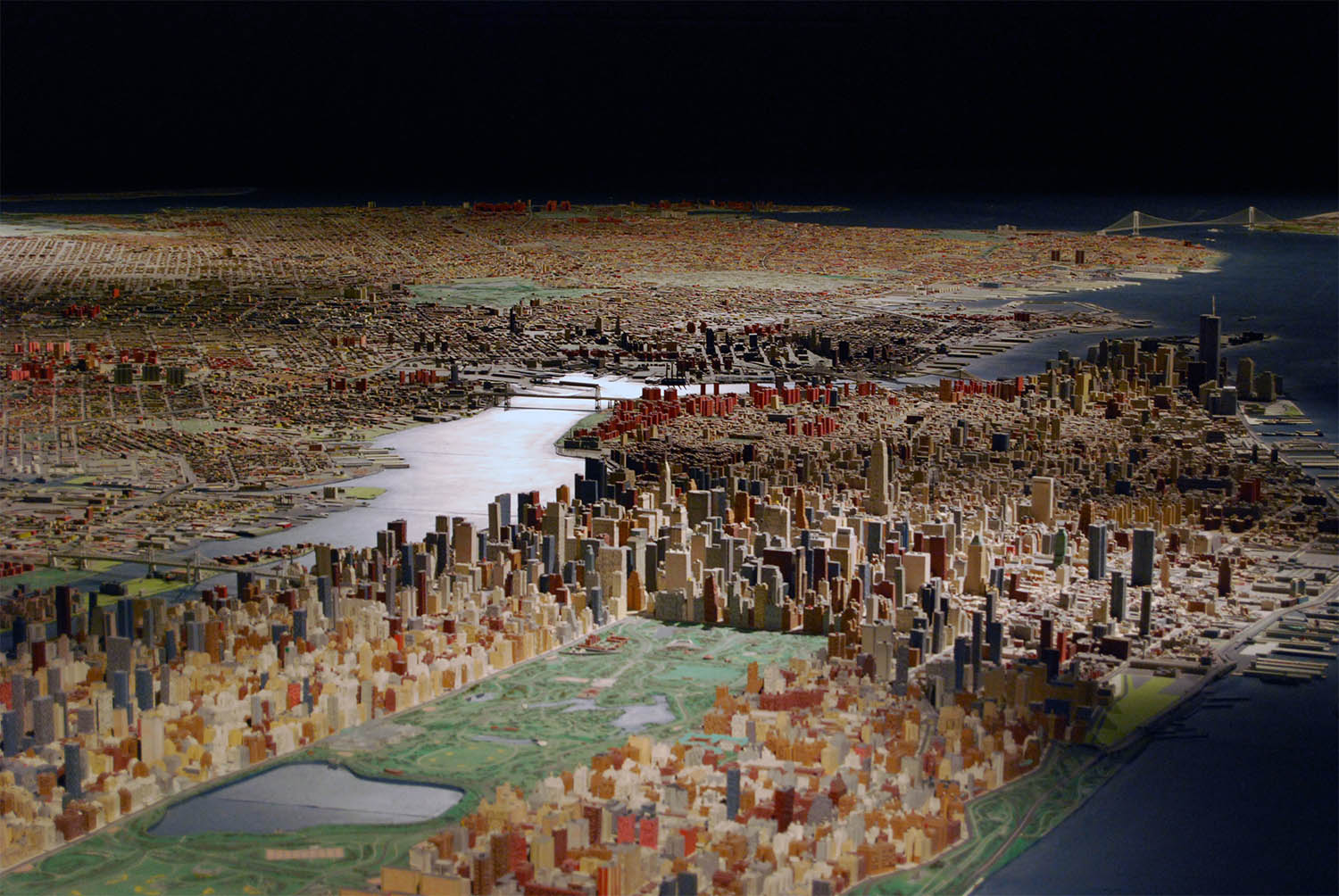
Of course there are three-dimensional maps, then there are three-dimensional maps. The Panorama of the City of New York was originally constructed as an attraction for the 1964 World’s Fair. The 9335 ft2 1:2000 scale display includes 895,000(!) wood and plastic structures and took Robert Moses and a team of 100 more than two years to build.7
1. Eventually your humble narrator will do a proper post about bird’s-eye views. In the meanwhile see Panoramic Maps, 1847–1929 at the LOC’s American Memory project. For many super high-res examples see Chad Freidrichs’ appropriately named Big Map Blog. For more New York-specific examples see Bibliodyssey’s wonderful post: Bird’s Eye New York.
2. Here is a list of New York City buildings which were, at the time, the tallest in the world: Equitable Life Building (142 ft/8 floors – 1870), New York World Building (309/20 – 1890), Manhattan Life Insurance Building (348/18 – 1894), Park Row Building (391/30 – 1899), Singer Building (612/47 – 1908), Met Life Tower (700/50 – 1909), Woolworth Building (792/57 – 1913), 40 Wall Street (927/71 – 1930), Chrysler Building (927/77 – 1930), Empire State Building (1250/102 – 1930), One World Trade Center (1368/110 – 1972).
3. According to Emporis, NYC currently has 216 buildings that are at least 492ft tall (which is apparently one definition of a skyscraper), second only to Hong Kong with 281. True Fact: the 12 million ft2 of office space destroyed in the 9/11 attack equals the entire extant office space in the city in which I am writing this footnote.
4. The original plates were published in Tuttle, Arthur. Sectional aerial maps of the City of New York. New York: Bureau of Engineering, 1924, and are available online at the NYPL.
5. For more about Bollmann’s work see: Hodgkiss, A.G. The Bildkarten of Herman Bollmann. Cartographica 1973 Dec;10(2): 133–145.
6. You owe it to yourself to read Brown’s epic review and description of the map on Geographicus.
7. The Panorama was maintained by Lester Associates until 1970 and updated again in 1992. Today it is the centerpiece of the Queens Museum of Art. See their site for more information.
13 Dec 2011, updated 21 Dec 2011 ‧ Cartography