6
Kort over Danmark
Danish National Mapping
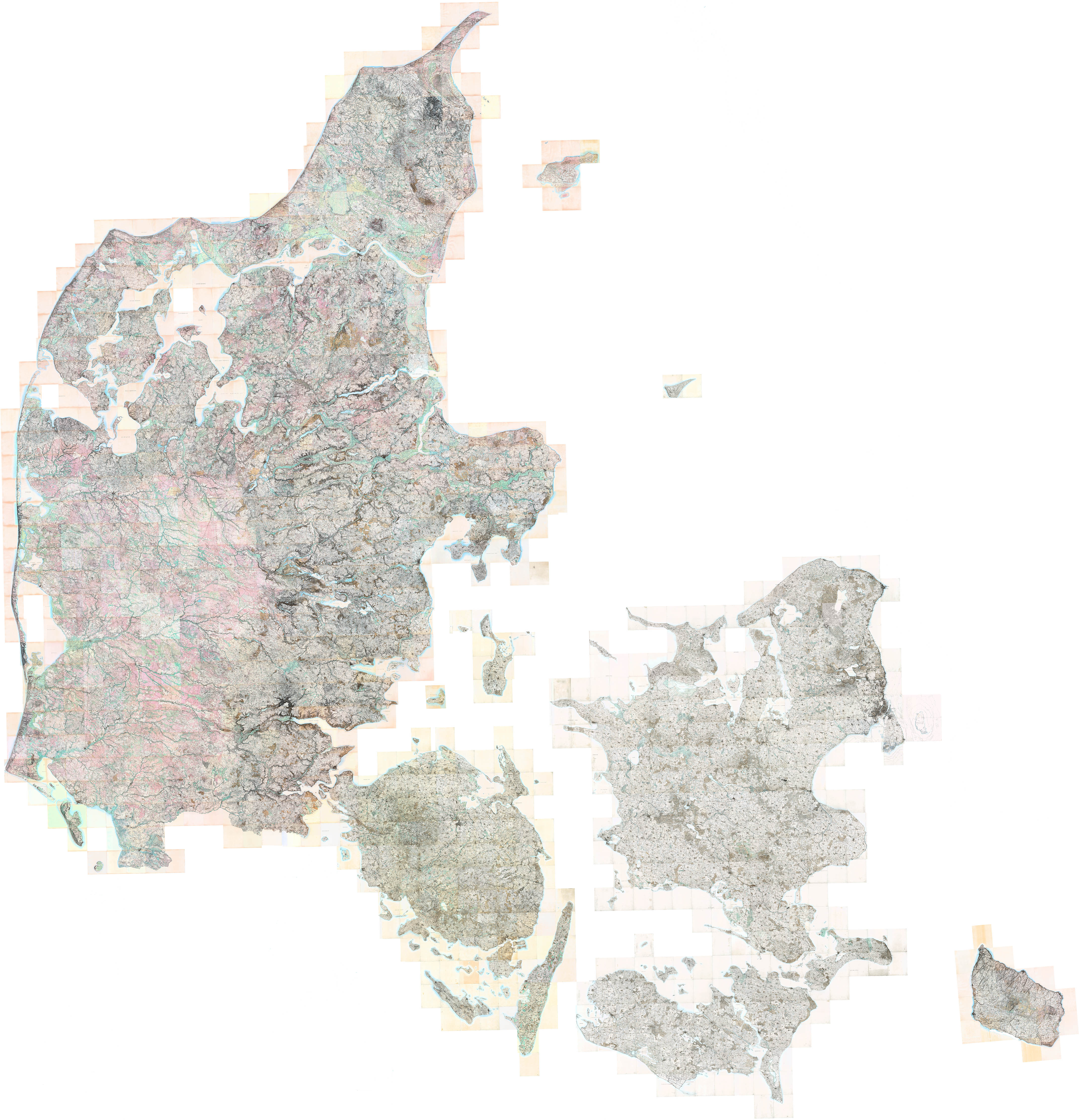
This map, the Hoje Målebordsblade, is mosaic1 of several hundred individual 1:20,000 sheets and was the first official civilian topographical map of Denmark.2 The survey, by the Generalstabens topografiske Afdeling, was done between 1842–1895, with the first lithographic sheets published in 1862.
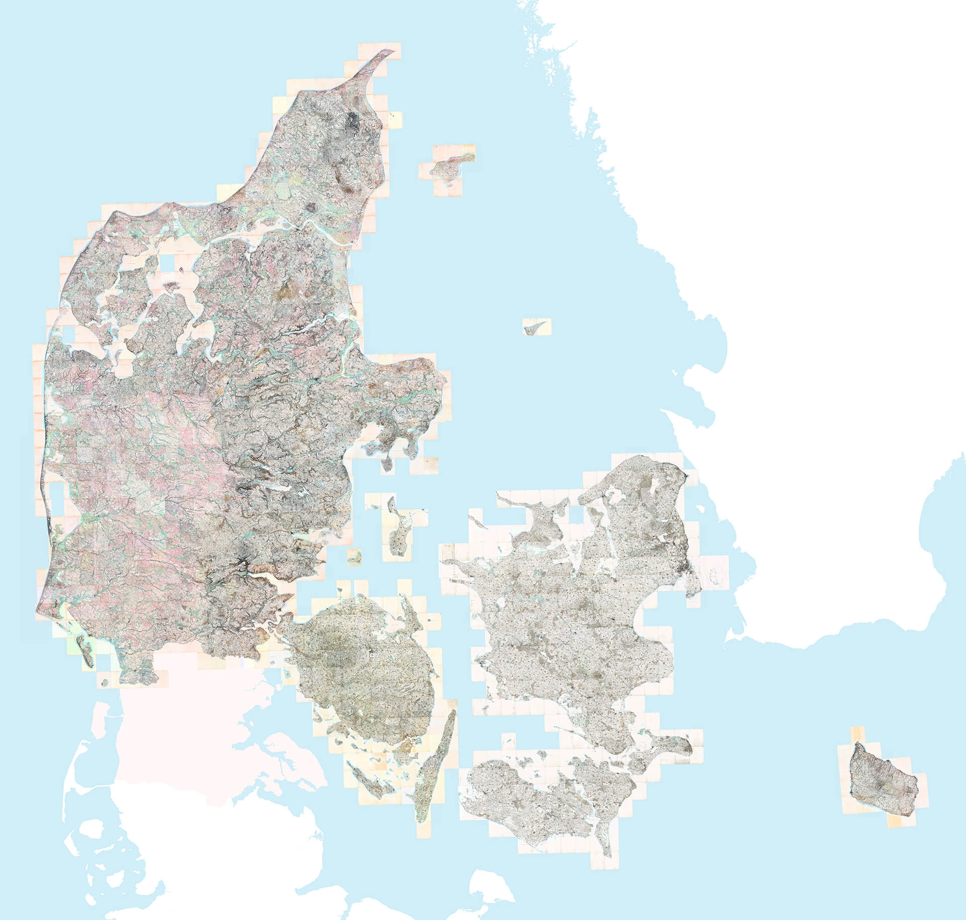
Here is the same mosaic, with everything (except Bornholm) in the right place and in proper geographical context:
Before the 15th century there was little geographical knowledge of Denmark, except for sketchy details of Scandinavia from Cresques Abraham’s Catalan Atlas of 1375. It was not until 1427 that Claudius Claussøn Svart, a Dane who spent most of his life in Italian universities, provided the first somewhat tolerable outline of Scandinavia in the 1427 edition of Ptolemy’s Cosmographia. It would be another 100 years until the earliest examples of Danish cartography appear, with Marcus Jordan’s Cimbricae Chersonesi in 1552:
Cimbricae Chersonesi, Jordan, 1552
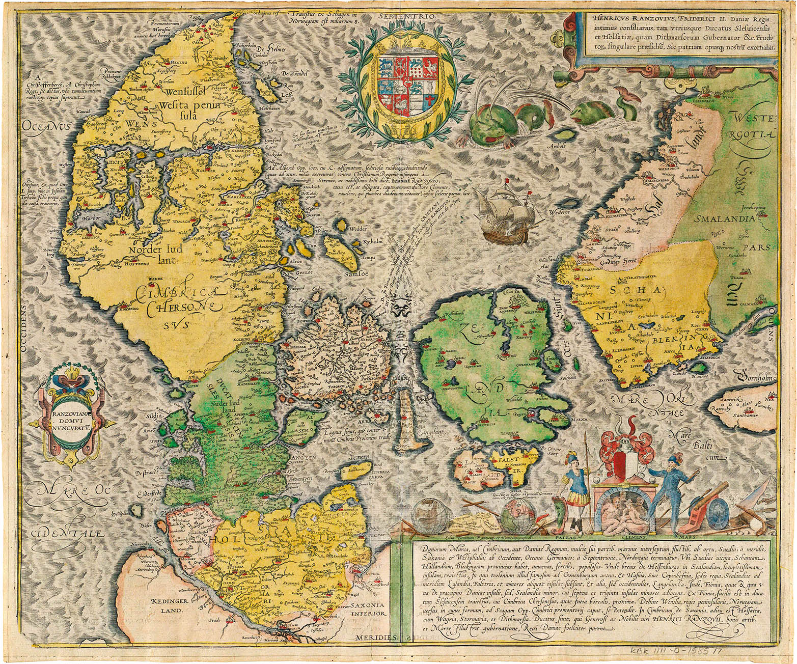
However, even after Jordan’s work, most maps of Denmark were still published in Amsterdam, Antwerp, Paris or Nuremberg:
Regni Daniæ, Hugo Allardt, Amsterdam, 1665
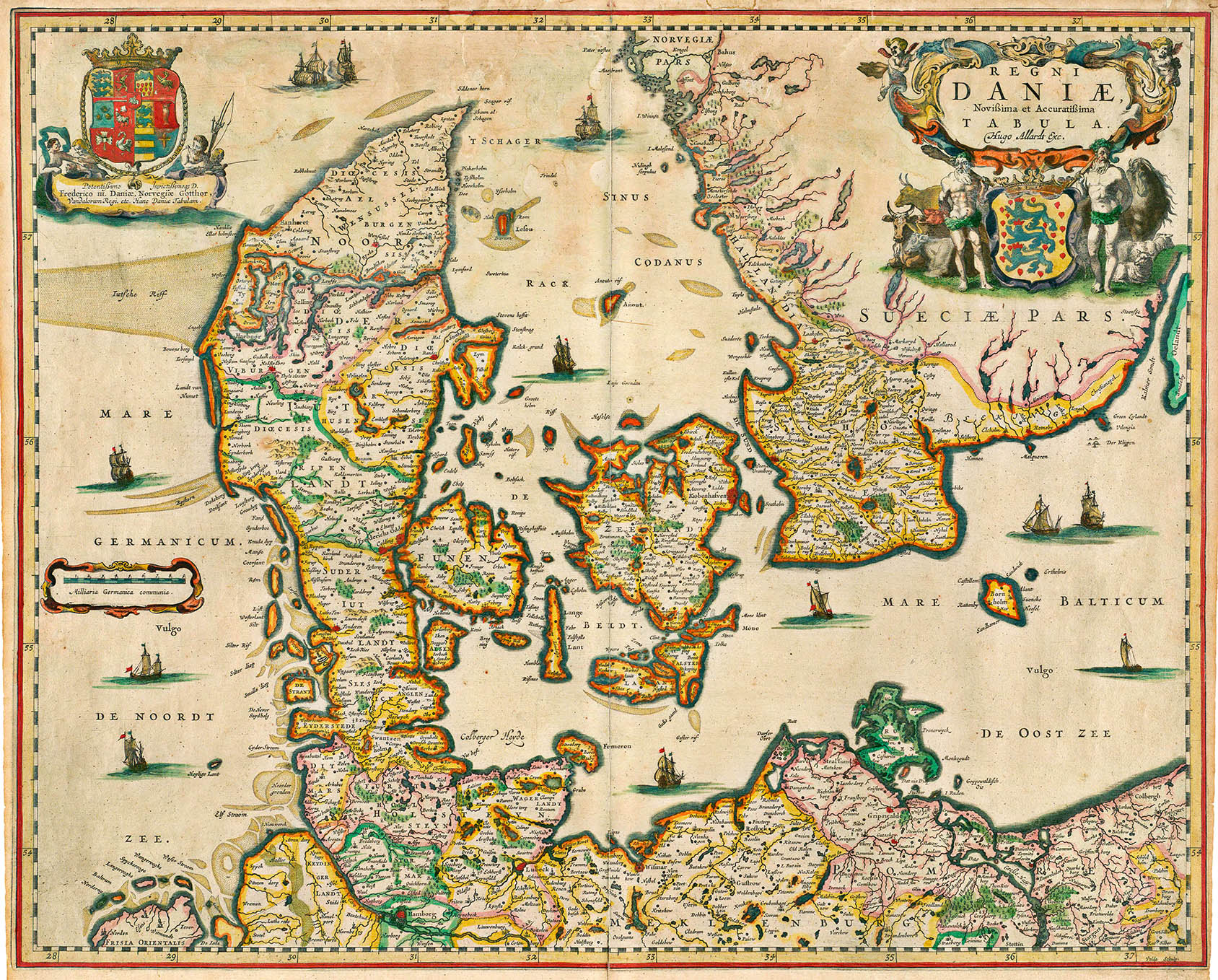
The next major Danish cartographer was Johannes Mejer, a mathematician and geographer to the court of King Frederick III. He published a number of maps, including a survey of Schleswig and Holstein (1638–1648) which was published in Danckwerth’s Atlas “Newe Landesbeschreibung der zwey Hertzogthümer Schleswich und Holstein.” Mejer’s maps would remain the standard in Danish cartography for another century and were widely used in other European atlases, including Johann Blaeu’s seminal Atlas Major of 1665.
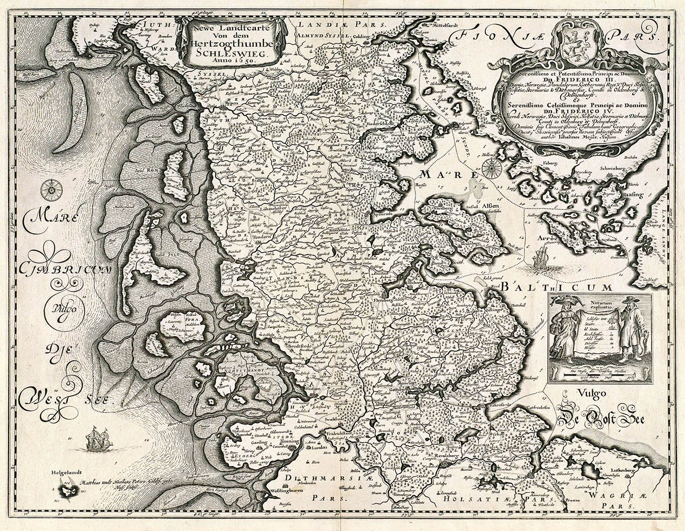
Hertzogthumbe Schleswieg, Mejer, 1650. From Danckwerth’s Atlas1
The first complete triangulation and plane-table mapping of Denmark was begun in 1762 by the Videnskabernes Selskab (the Danish Royal Society) and would take more than 60 years to complete. In the meanwhile the military, dependent on these surveys for obvious reasons, could not accept this leisurely pace and in 1808 the Generalstaben (General Staff), under the direction of Capt. O. N. Olsen, began their own survey. The 1:20,000 scale military maps were never made available to the public. But in association with the Videnskabernes Selskab, a 1:480,000 scale map was published in 1841. It was the first official map of the country:
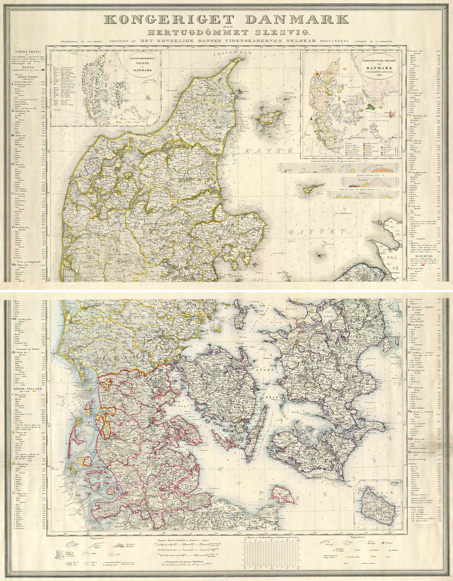
Detail, Kongeriget Danmark, Olsen, 1841
In 1842 the Generalstaben and the cartographic part of the Videnskabernes Selskab were combined into the Generalstabens topografiske Afdeling. This new department began a new survey of the Kingdom that resulted in the Hoje Målebordsblade. Here are two more details:
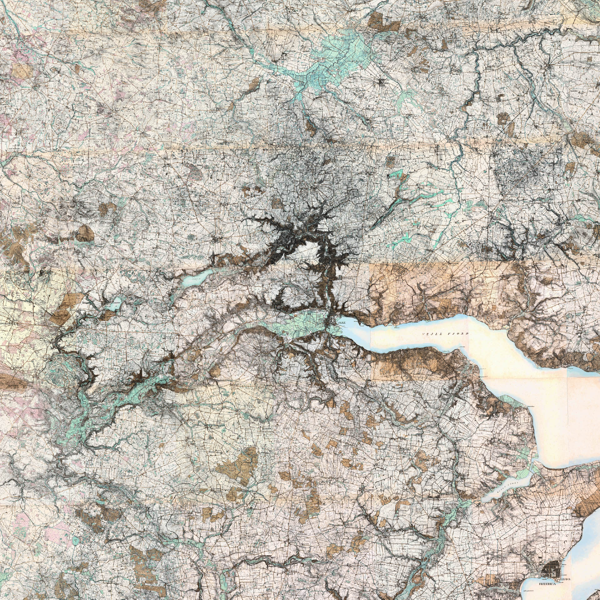
Detail, Vejle, Jylland
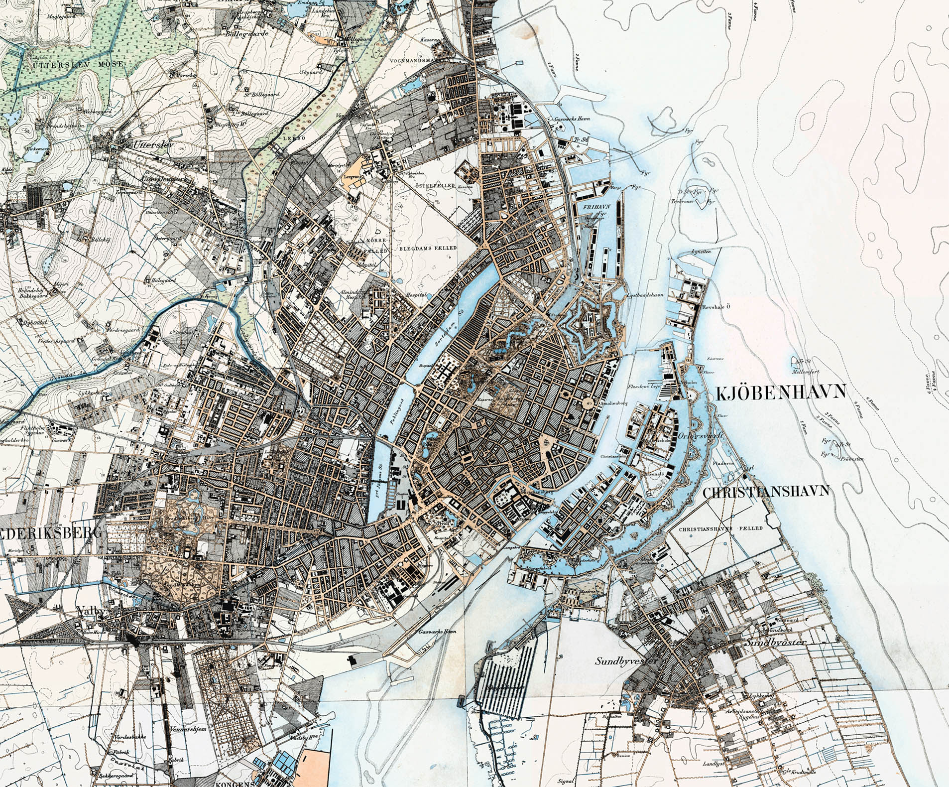
Detail, Nyhavn, København
On 31 March 1928, the Generalstabens Topografiske Afdeling and Den danske Gradmaaling were merged into a new department, the Geodætisk Institut. The Institut continued to periodically survey the country and publish new topographical maps. A second ordinance survey, resulting in the Lave Målebordsblade, was completed between 1901–1971 (with complete sets of maps published in the 1930s and 1950s) and the 4cm-kort (also published as the 2-cm kort and 1-cm kort) was produced between 1957–2002.
On 10 Sept 1987 the Geodætisk Institut was combined with Matrikeldirektoratet and Søkortarkivet to form Kort & Matrikelstyrelsen, which is responsible for the current official topographical maps, the Top10dk.

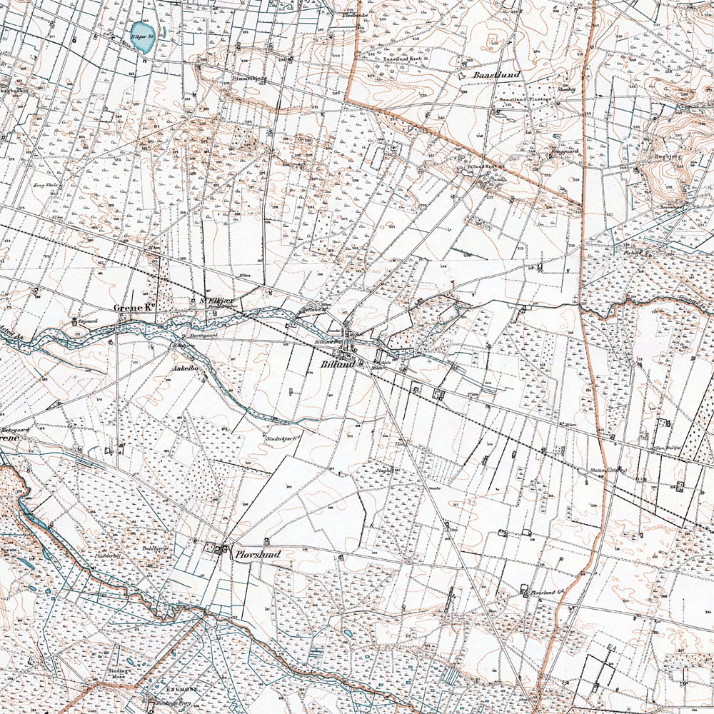
Detail, Billund,3 Hoje Målebordsblade
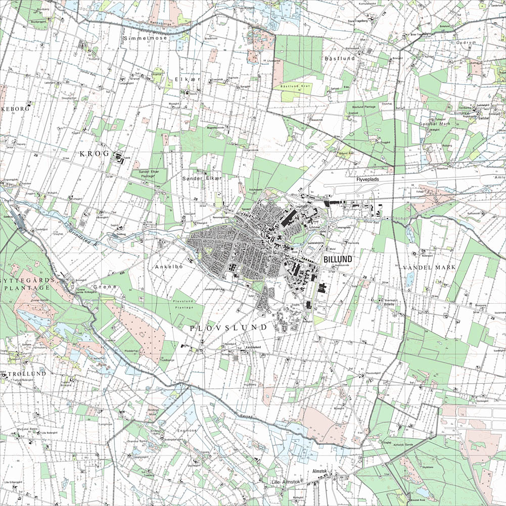
Detail, Billund, Lave Målebordsblade
Detail, Billund, 4-cm kort
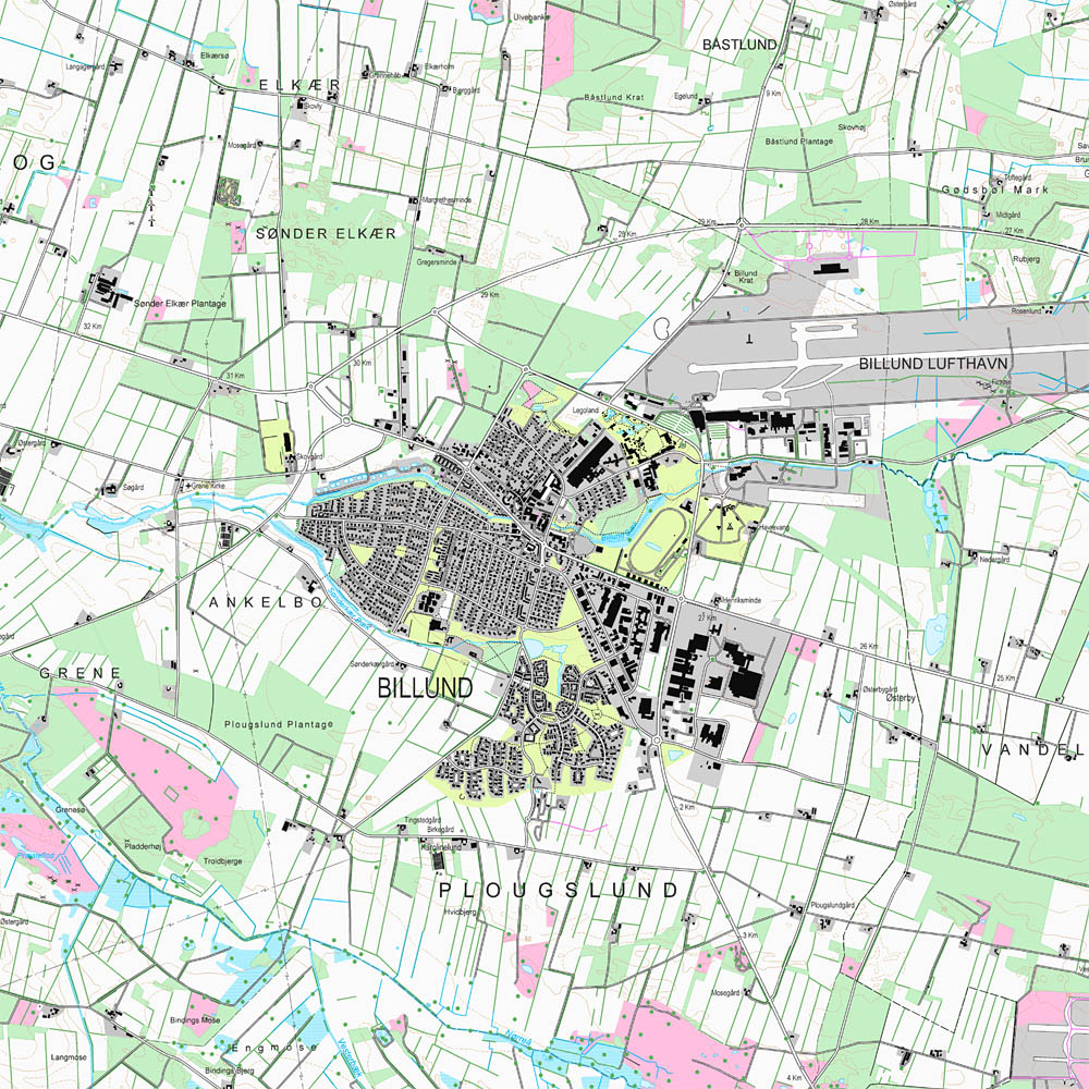
Detail, Billund, Top10dk
1. The Hoje Målebordsblade, as it is presented here, is a mosaic consisting of several thousand individual screen caps from KMS and separately constructed outlines of the surrounding land masses of Germany and Sweden. Looking back, your humble narrator is quite sure that he would never attempt something this foolish again.
2. Kongeriget Danmark, or the Kingdom of Denmark, consists of the Jylland (Jutland) peninsula and the major islands of Fyn (Funen), Sjælland (Zealand) and Bornholm as well as some 440 smaller named islands and the territories of Færøerne (the Faeroe Islands) and Grønland (Greenland). At various times in its history the Kingdom also included Iceland, major parts of Norway, Southern Sweden and the Northern German province of Schleswig-Holstein.
3. The home of Lego (see here), which has twice been voted the “Toy of the Century.”
10 Nov 2008, updated 12 Jun 2011 ‧ Cartography