
Detail, Zentralschweiz, 1:200,000. 1958
71
Schweizerischer Mittelschulatlas
Imhof wie ein Kartographische Rockstar
Eduard Imhof was born in Schiers on 25 Jan 1895 to the geographer Dr. Eduard Imhof and his wife Sophie.1 At the age of 19 he enrolled in ETH Zürich,2 and after several interruptions for military service, was awarded a geodesist/surveyor diploma in 1919.
He returned to ETH as an assistant to his mentor Prof. Fridolin Becker, himself a cartographic god widely viewed as the inventor of the Swiss style shaded relief map.3 In 1925, the year after Becker’s death, Imhof became an assistent professor and founded the Kartographische Institut (Institute of Cartography). Although the Institute was initially little more than a hand-painted sign above his small office, it was nevertheless the first of its kind in the world.
In 1925 he produced his first major work - the Schulkarte der Schweiz 1:500 000 (the School map of Switzerland). Over the years he would update the national school map several times as well as produce school maps for nearly half of the cantons in the Federation. He even did the school map for the Austrian Bundesländer of Vorarlberg.
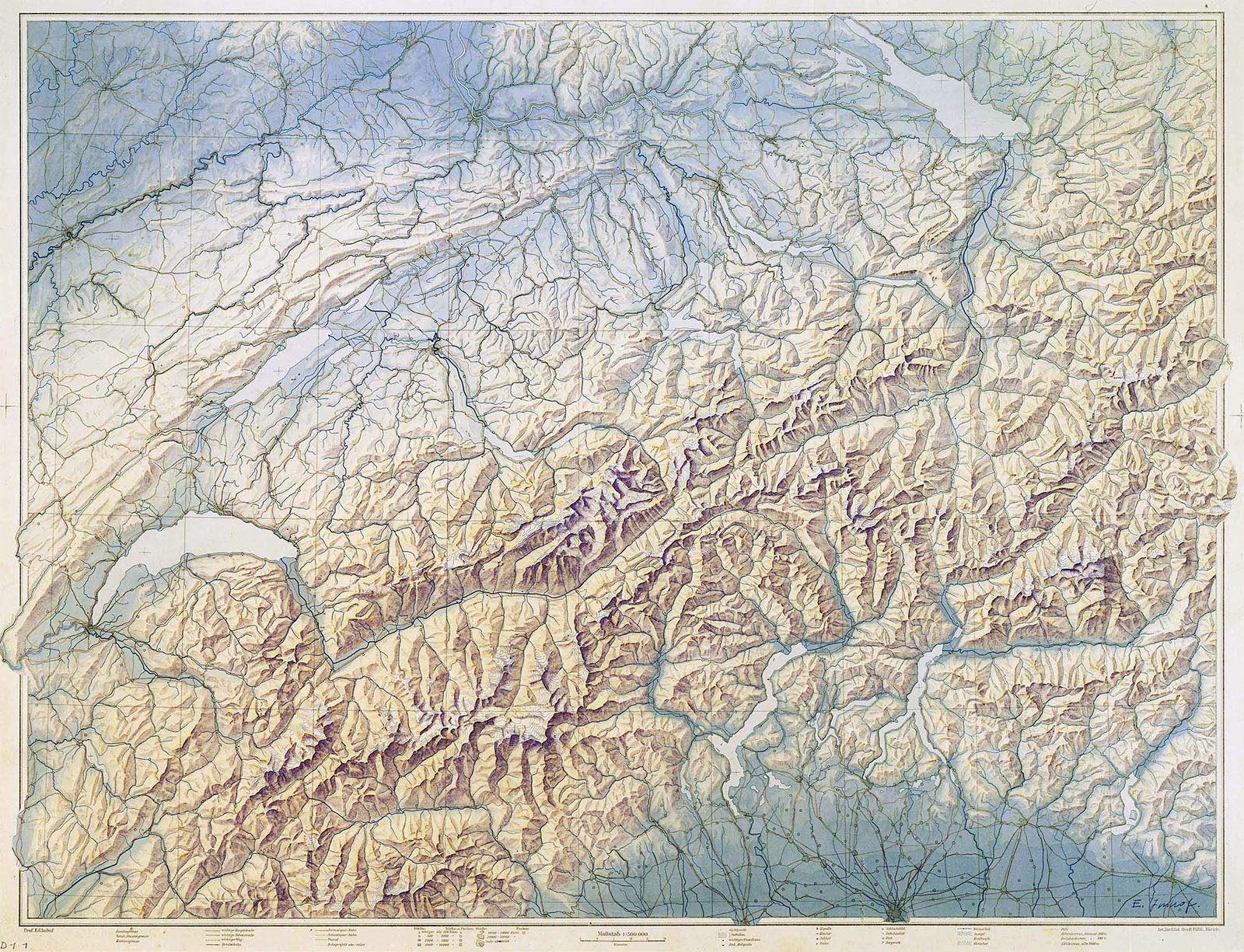
Schülerkarte der Schweiz 1:500,000. 1924. From ref. 1
The school maps attracted the attention of the Konferenz der Kantonalen Erziehungsdirektoren who, in 1927, asked him to oversee the fifth edition of the Schweizerischer Mittelschulatlas (The Swiss High-school Atlas), the official text of the Swiss secondary school geography curriculum.4 The first Imhof-directed edition was published in 1932, and was followed by the official primary school atlas, the Schweizerischer Sekundarschulatlas, in 1934.5
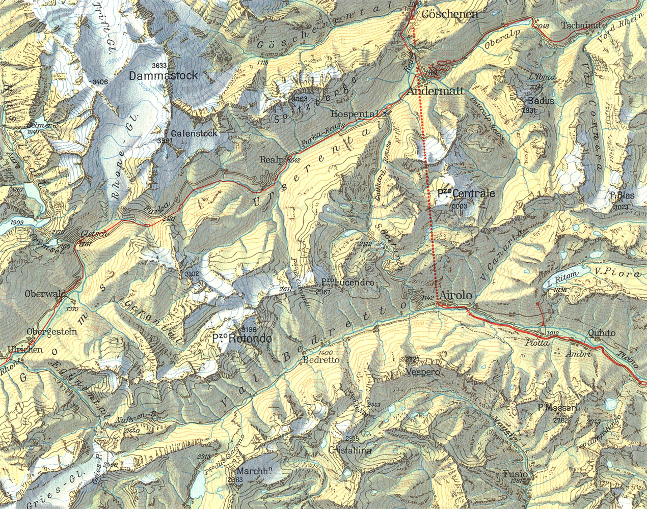
Gotthard-Gebiet, 1:200,000. 1958. The red line indicates the famous rail tunnel
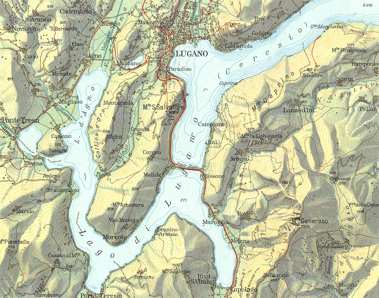
Luganersee, 1:100,000. 1958
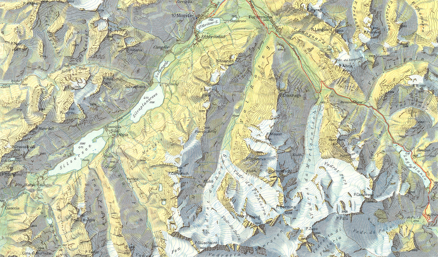
Oberengadin, 1:100,000. 1958
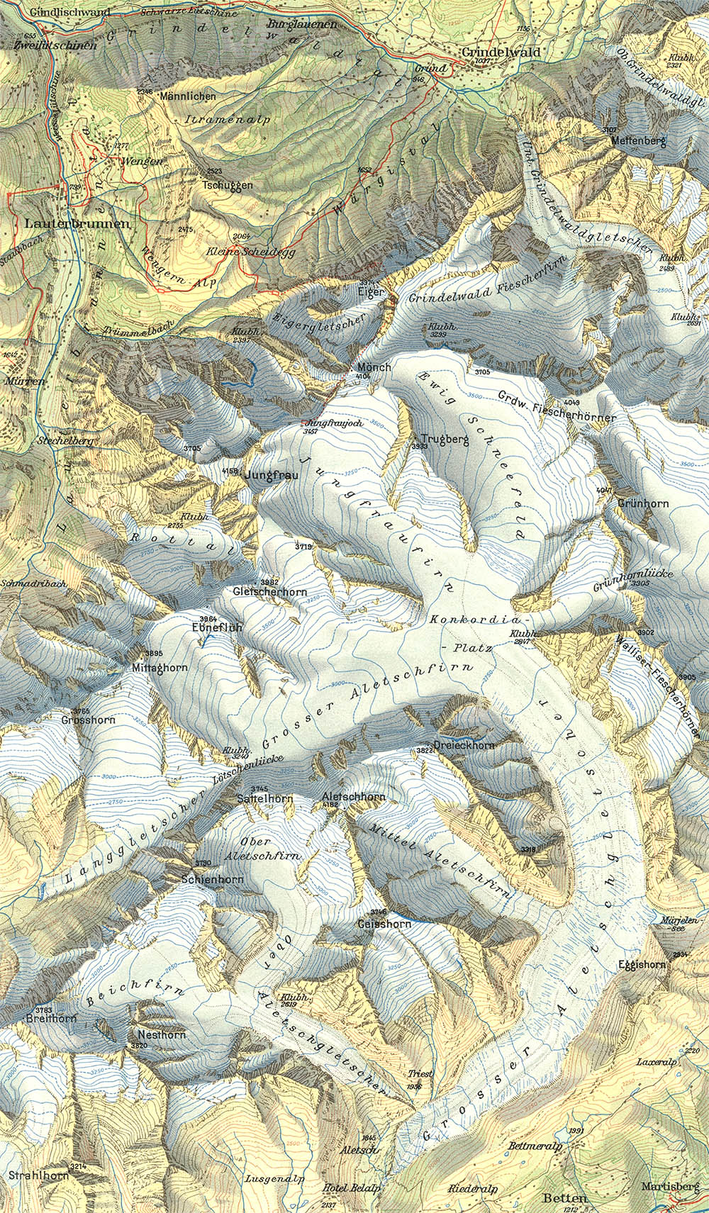
Jungfraugruppe und Aletschgletscher, 1:100,000. 1958
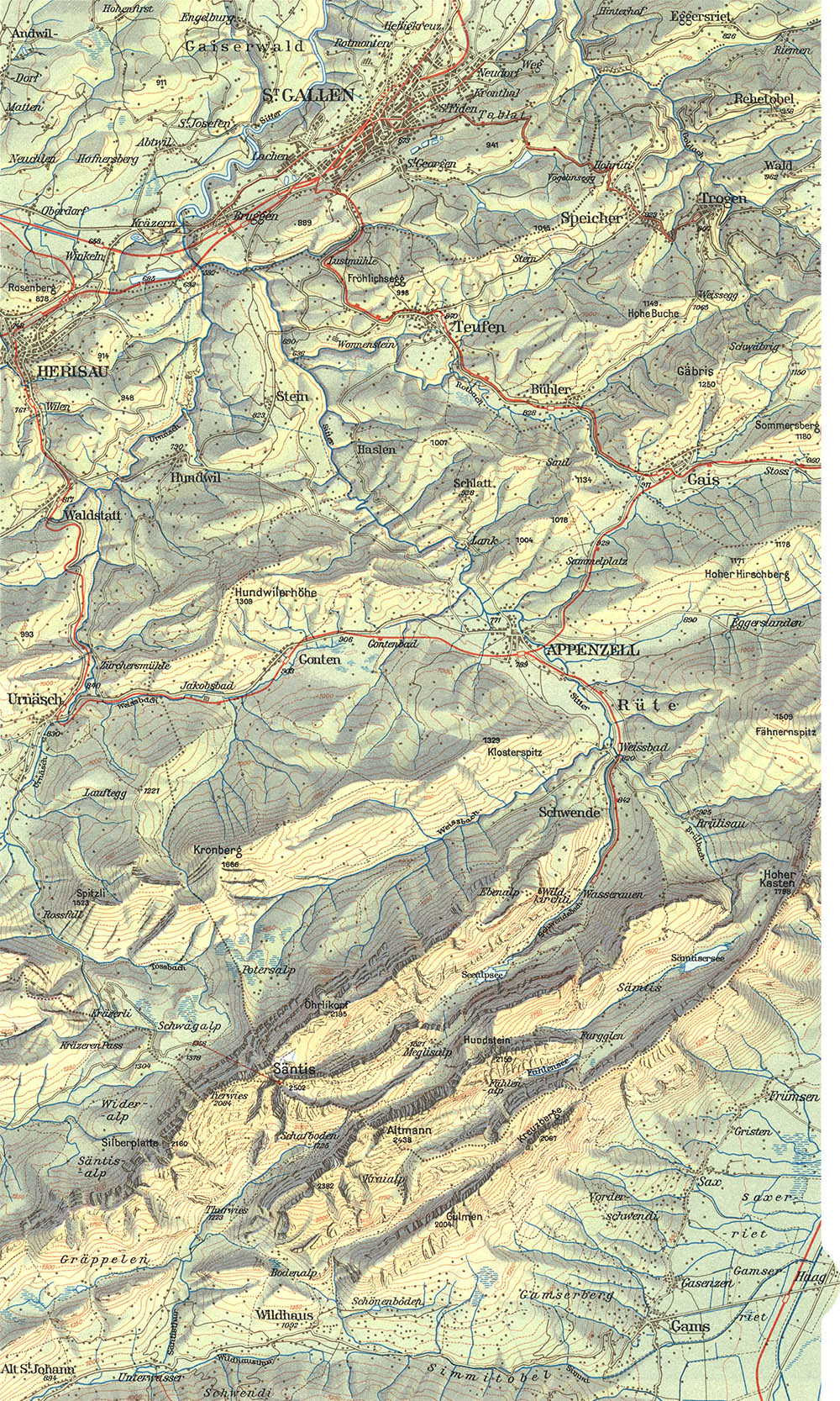
Säntisgruppe und Appenzellerland, 1:100,000. 1958
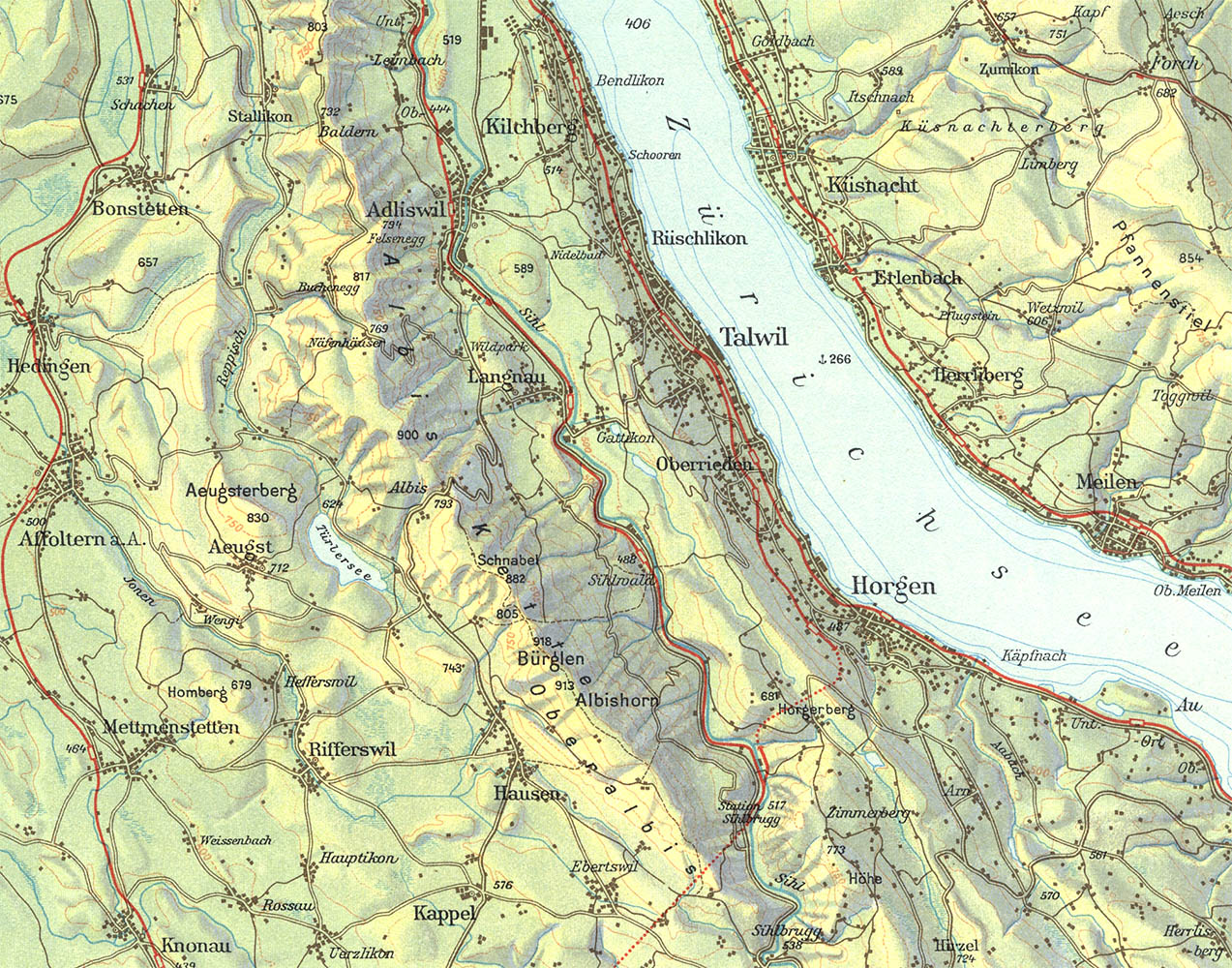
Zürichsee-Landschaft, 1:100,000. 1958
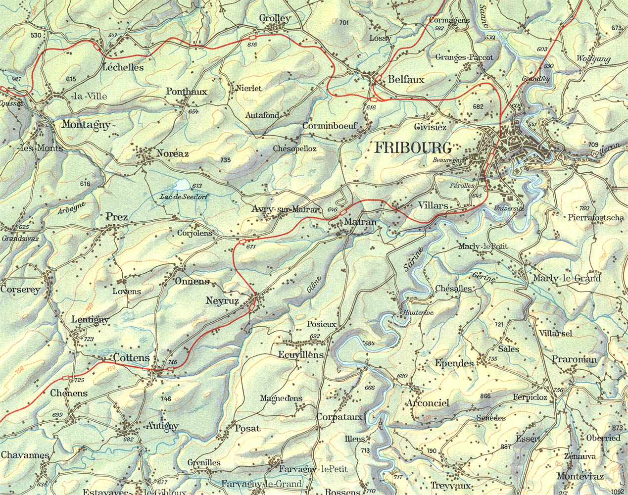
Freiburger Landschaft, 1:100,000. 1958
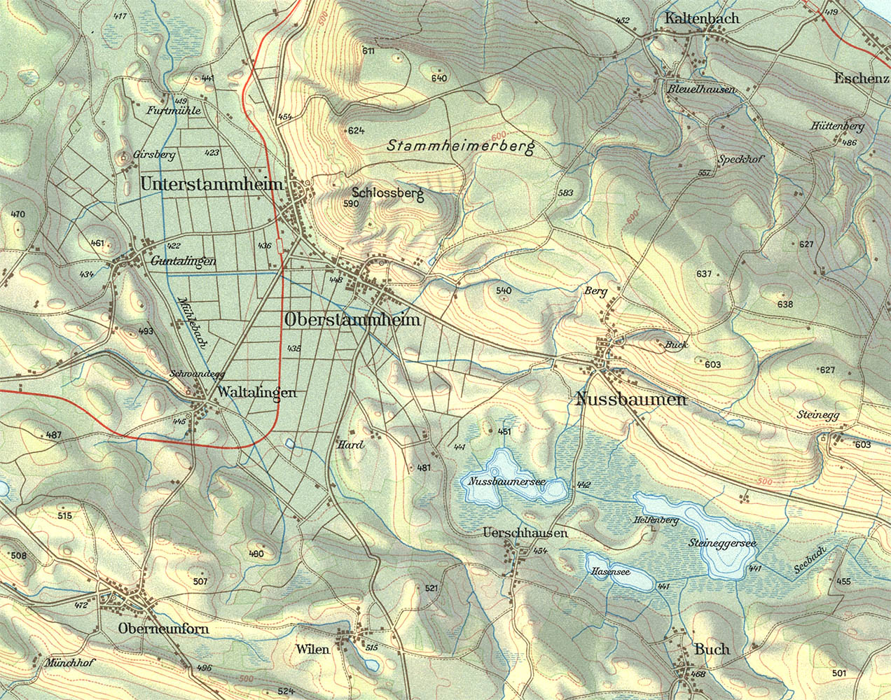
Glaziallandschaft im Stammheimerial, 1:50,000. 1958
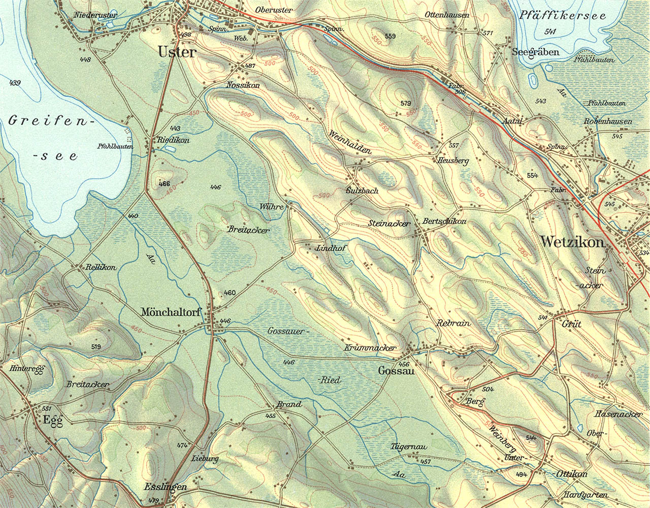
Glaziallandschaft im Glattal, 1:50,000. 1958
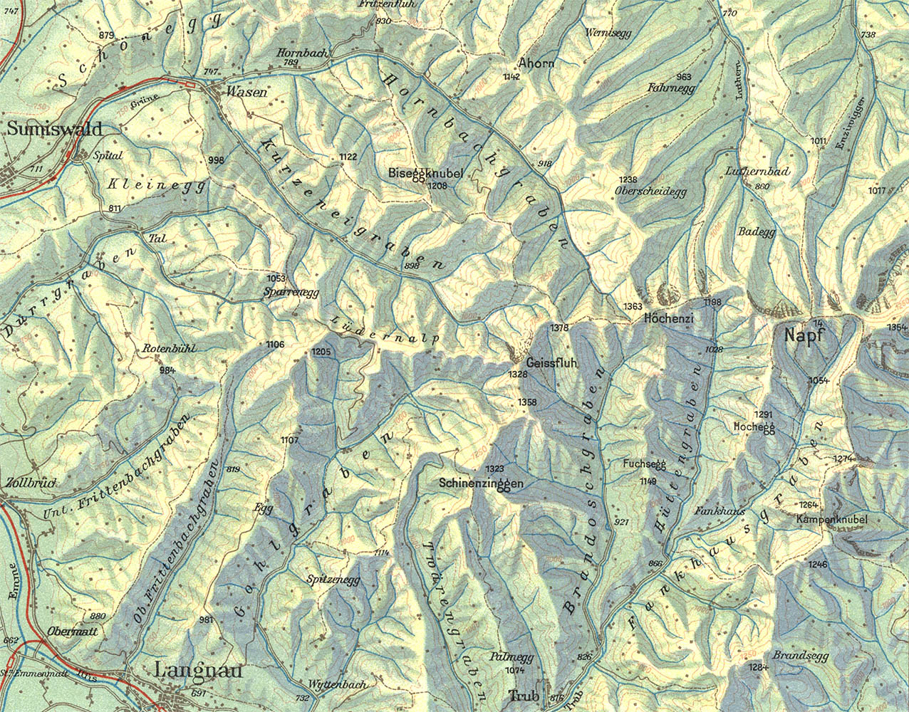
Napfgruppe, 1:100,000. 1958
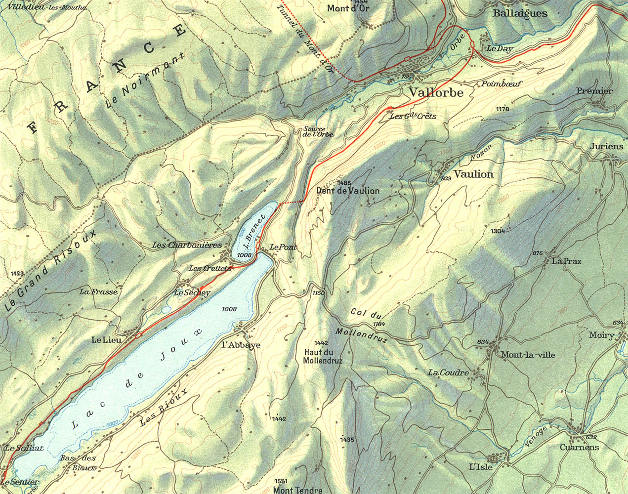
Waadtländer Faltenjura, 1:100,000. 1958

Berner Faltenjura, 1:100,000. 1958
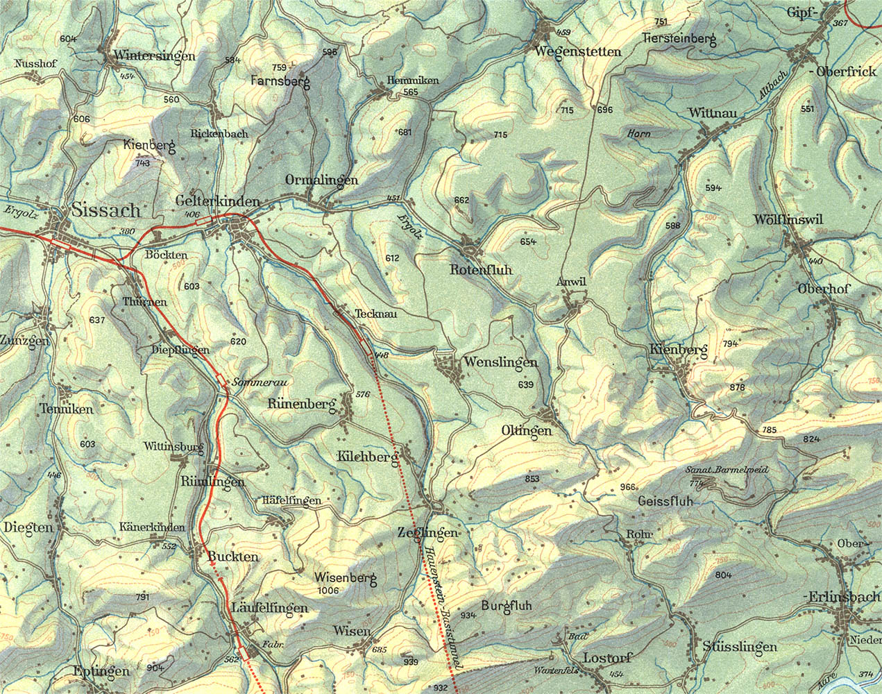
Basler- und Aargauerjura, 1:100,000. 1958
Imhof thought as deeply and essentially as any 20th century cartographer (meaning as deeply and essentially as anyone ever) about cartographic design, including the topics of relief depiction, hatchure vs. shading, rock drawing, symbols, hypsometric color tinting, et. al. For more than 40 years he used the School atlases and maps as a test-bed to illustrate his theories on map art and design. The maps shown here, from the 1958 XII edition, were the last to be rendered with hachures (by Oswald Winkel) and hypometric colors. Beginning with the 1962 edition the maps were prepared with hill-shading.
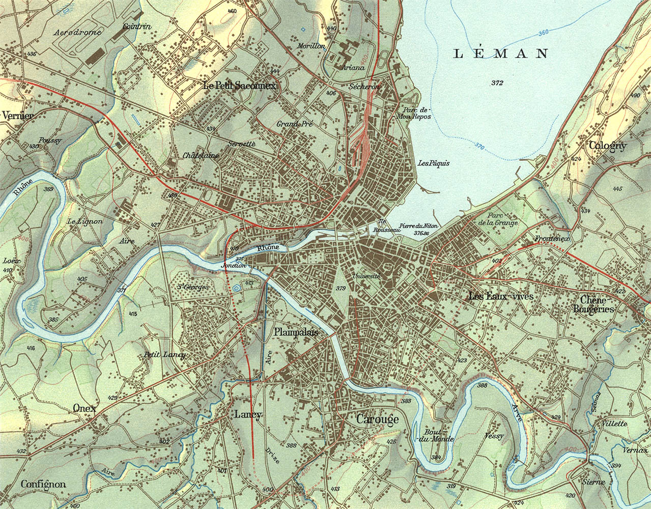
Genf, 1:50,000. 1958
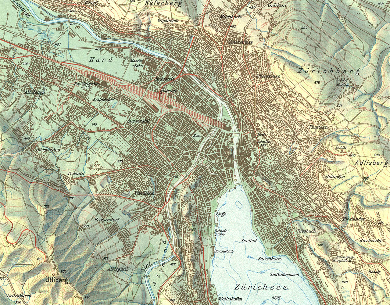
Zurich, 1:50,000. 1958
Imhof ended up not only redefining the School map, but Swiss relief cartography in general.6 His work spread outside of academia and in 1961 he was asked by the Bundesamt für Landestopografie (the Federal Office of Topography, or just Swisstopo) to oversee production of the Atlas der Schweitz.7 The project, supported by Swisstopo’s significant resources, consisted of more than 400 maps and took 18 years to complete. The first edition in 1979 was, not surprisingly, a landmark in cartography.
In 1965. the year he retired from ETH and after hundreds of maps, scientific papers, book chapters and several books proper, he published the seminal Kartographische Geländedarstellung. The book contained everything Imhof had learned about relief cartography over his distinguished career and wrapped it up nicely with a bow. It was not only the Mother of all cartography textbooks, but perhaps one of the most important books ever written on information design.8
Around 1972 he began work on his last major project - a completely new relief design of the entire country. The final map, which took ten years to prepare, was published as the Relief der Schweiz, ein Kartengemälde 1:300 000 von Eduard Imhof in 1982.
Imhof died on 27 April 1986 at his long-time home on Lake Zürich.
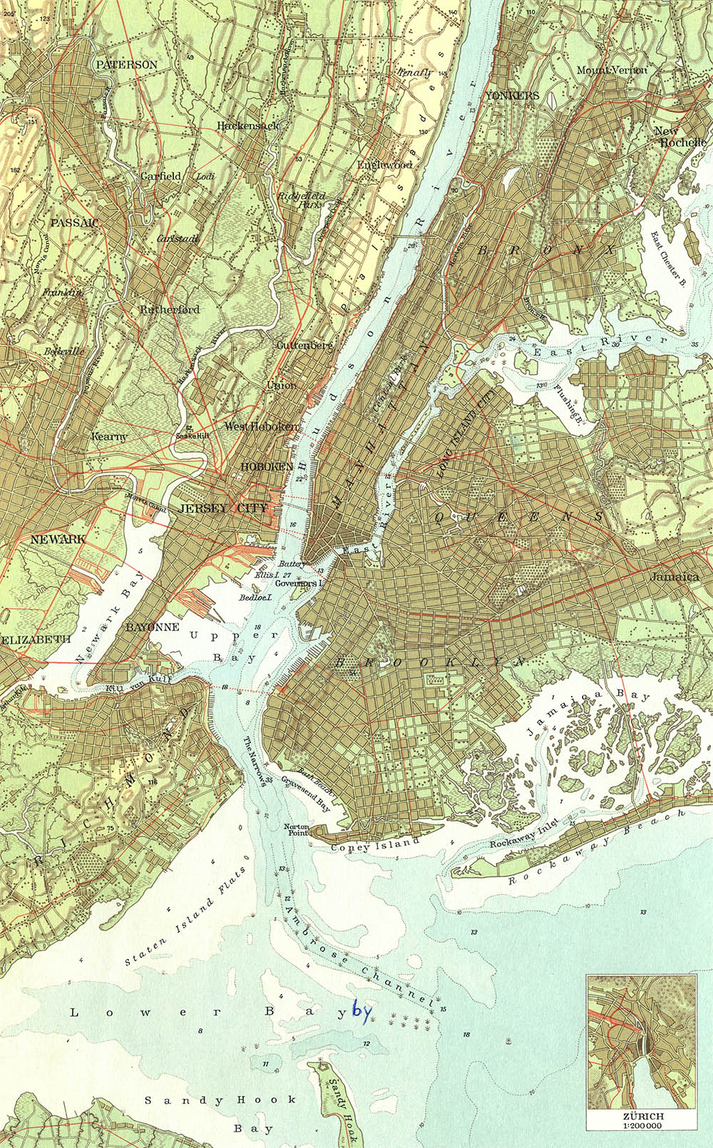
New York, 1:200,000. 1958
1. For everything you need to know about Imhof, see ETH’s wonderfully comprehensive Virtual Library Eduard Imhof (Eduard Imhof - Kartograph und Künstler), which was based on an exhibit by by Katrin Turconi and Eduard’s widow Viola Imhof.
2. Officially Die Eidgenössische Technische Hochschule Zürich, but even the Swiss think that the name is too long. They also just call it ETH Zurich.
3. For an overview of the history of cartography at ETH see: Hurni, Lorenz. Cartographic Mountain Relief Presentation: 150 Years of Tradition and Progress at ETH Zurich. ICA workshop. The pdf is available at Mountaincartography.org
4. Hrsg. Konferenz der kantonalen Erziehungsdirektoren. Schweizerischer Mittelschulatlas. Zürich: Lehrmittelverlag des Kantons Zürich, 1932. Because the Swiss speak entirely too many languages (officially four) the altas was published in German, Italian and French. Imhof served as editor and chief cartographer for a total of 11 editions of the atlas, from 1932–1976. For a complete bibliography see the ETH’s Virtual Library. The images here are scans from the 12th edition, 1958. The school atlas, now known as the Schweizer Weltatlas is completely interactive (interactiv) and available as a downloadable java program.
5. Hrsg. Konferenz der Kantonalen Erziehungsdirektoren. Schweizerischer Sekundarschulatlas. Zürich: Lehrmittelverlag des Kantons Zürich, 1934. Imhof served as editor and chief cartographer for the first 12 editions, from 1934–1976. Again, see the ETH’s Virtual Library.
6. For a more complete and scholarly review of Inhofs contributions and legacy see: Hurni, Lorenz. “Cartographic Relief Presentation Revisited - Forty Years after Eduard Imhof“ in Landform - Structure, Evolution, Process Control. Lecture Notes in Earth Sciences, 115. Berlin: Springer, 2010. pp. 1–20. The text of which is available on Google Books.
7. Herausgeben im Auftrag des Schweizerischen Bundesrates. Altas der Schweiz. Wabern-Bern: Verlag des Bundesamtes für Landestopographie. Lieferungen 1, 1965–9, 1978. The current verson – the Atlas of Switzerland 2 is available on CD-Rom or DVD for the rather steep price of 249 CHF.
8. Imhof, Eduard. Kartographische Geländedarstellung. Berlin, De Gruyter, 1965. The title was later translated into English: Cartographic Relief Presentation. Berlin: De Gruyter, 1965. De Gruyter’s press run was perhaps 2500 copies and the book become something of a rarity, with copies selling upward of 500 USD. Fortunately the GIS software company ESRI reprinted it in 2007. The majority of ESRI’s reprint is on Google books.
In his review of the 2007 edition Jeff Thurston wrote: “There are very few books that cause me to read in awe, ponder quietly in appreciation and realize just how significant others hard work, perception of the world and their passionate devotion to their profession can be.” Edward Tufte, never shy about criticizing poor design, wrote that “the book is about how to show mountains on maps (which means that it is about nearly everything...)” and “is required reading for anyone serious about information and interface design.”
10 Sept 2010, updated 15 Sept 2010 ‧ Cartography