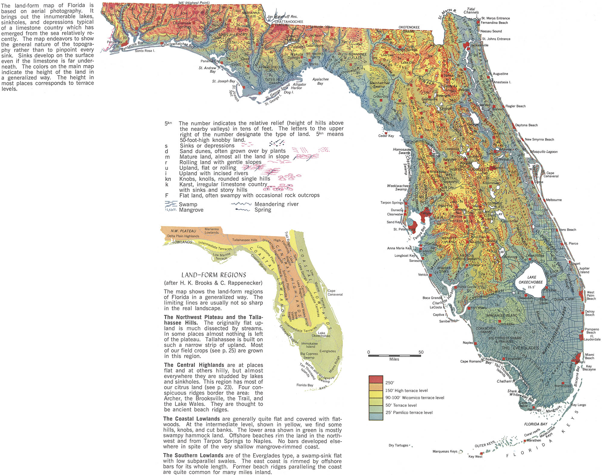
Detail, Landforms of Florida
Altas of Florida
Erwin Raisz and the Landform Map
Erwin Josephus Raisz was born 1 Mar 1893 in Lőcse, Hungary. Following his father’s footsteps, he received a degree in civil engineering from the Royal Joseph Technical University in 1914.1 In 1923, after service in WWI, he emigrated to the US where he began began working for the Ohman Map Company while studying geology at Columbia. During this time he began to experiment with depicting geological features symbolically – the physiographic (or landform) map. Here is an early classic:
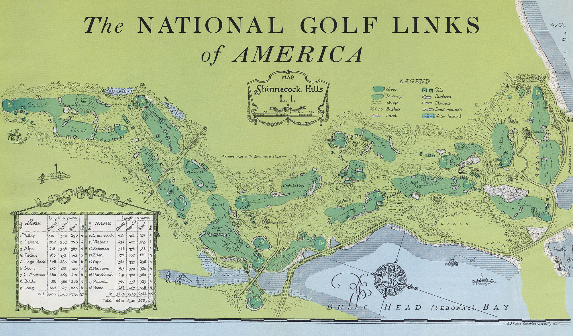
Detail, National Golf Links of America, 1928 2
After receiving his doctorate, Raisz joined the newly-formed Institute of Geographical Exploration at Harvard and would spend the next 20 years teaching cartography and curating Harvard’s map collection. In 1931 he published the seminal “Physiographic Method of Representing Scenery on Maps.” 3 and in 1938 his first textbook, General Cartography.4 The book was called “the most ambitious and comprehensive book on cartography in the English language.” 5 and would be the primary collegiate textbook on the subject for the next 15 years.
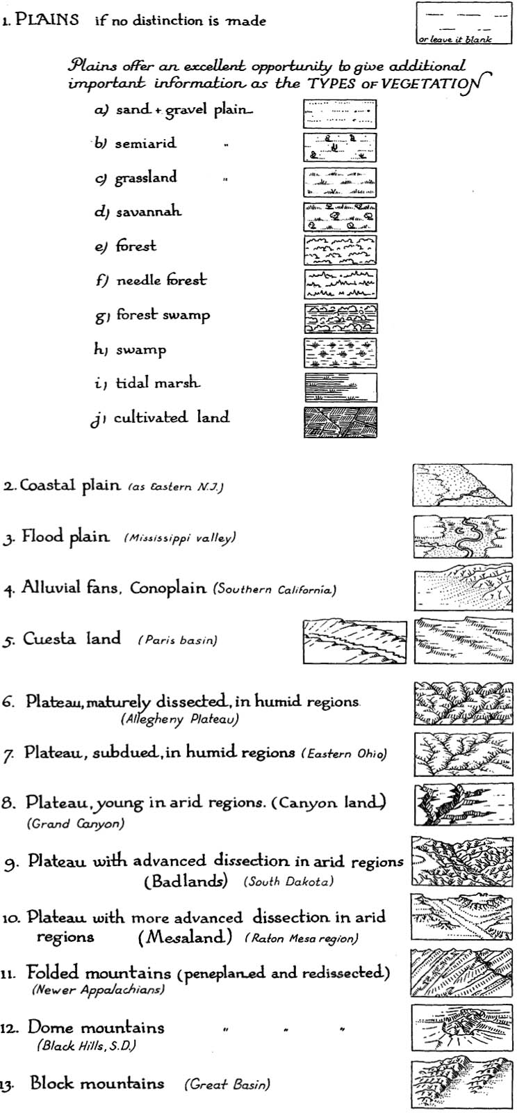
Representative landforms, 1931 3
On first glance Raisz’s terrain symbols look like nothing more than updated versions of the crude “bump” maps of the 17th century, but looking closer his landforms create a startlingly three-dimensional view. On even closer examination an incredible wealth of geographic information is presented. His idiosyncratic hand-lettered pen and ink drawings were cartography, information design and fine art all at once. “...my whole aim in life has been to close the gap between map and land,” he said.
Here is a later version of his seminal Physiographic Map of the United States, which Richard Pike of the USGS called “a national treasure:”
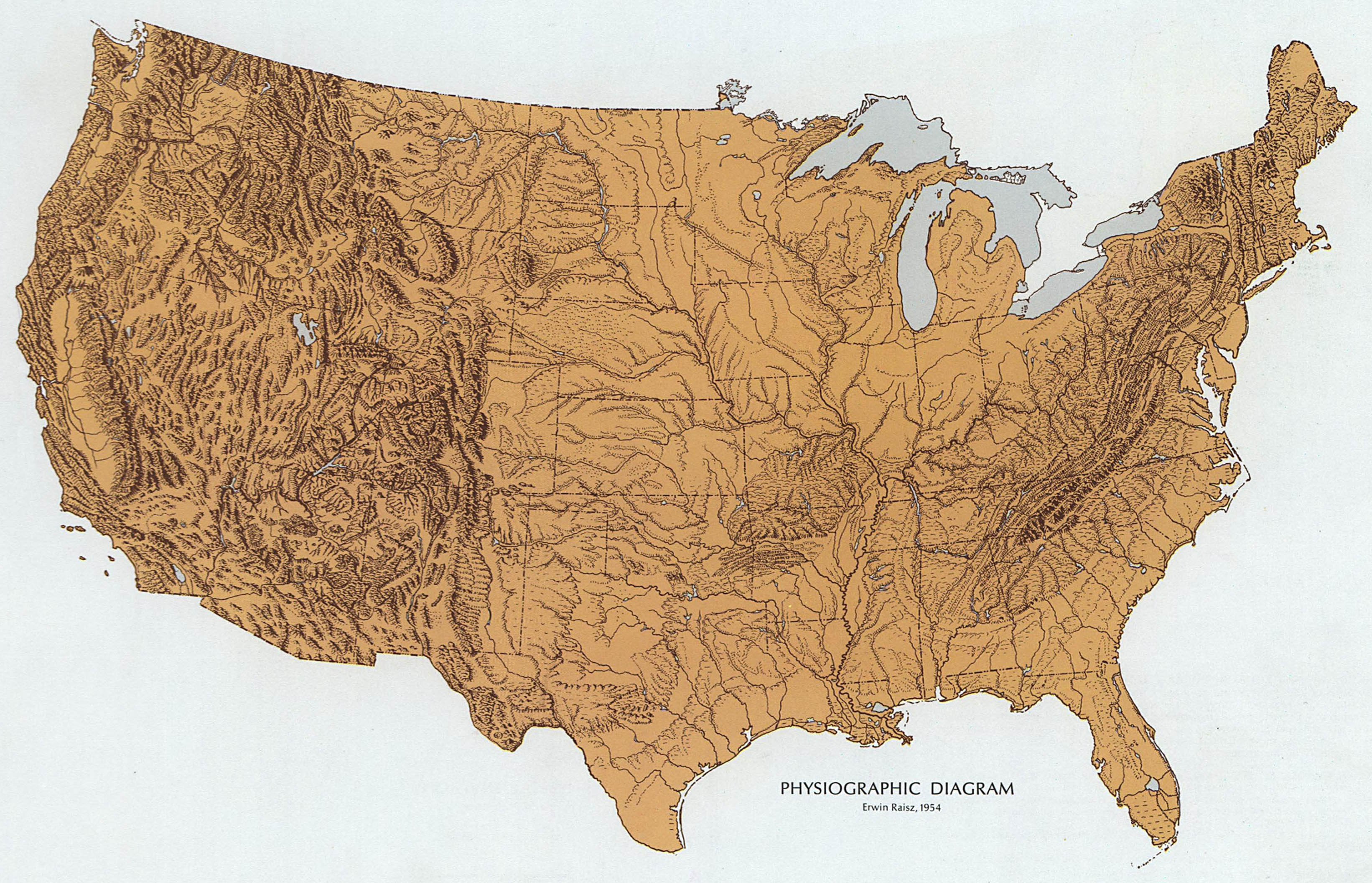
Physiographic Diagram, 1951. The National Atlas
In 1951 the Geography Department at Harvard was inexplicably eliminated and Raisz, now out of a full-time job, split his time between his studio in Cambridge and teaching assignments at Clark University, the University of Virginia and finally the University of Florida. Over his 40-year career Raisz, called “the John Henry of cartography,” would publish thousands of maps covering every imaginable topic, hundreds of papers, several textbooks and three atlases.
His first altas, The Altas of Global Geography, was published in 1944.6 Harper & Brothers described it as “An entirely new kind of atlas - a book of global maps giving a plane's- eye view of tomorrow's geography.”

Europe, 1944. From ref. 6
Working with the Cuban cartographer/geographer Geraldo Canet, Raisz published the under-appreciated (and difficult to find) Atlas de Cuba in 1949.7 Here is the supplementary map included with the book:
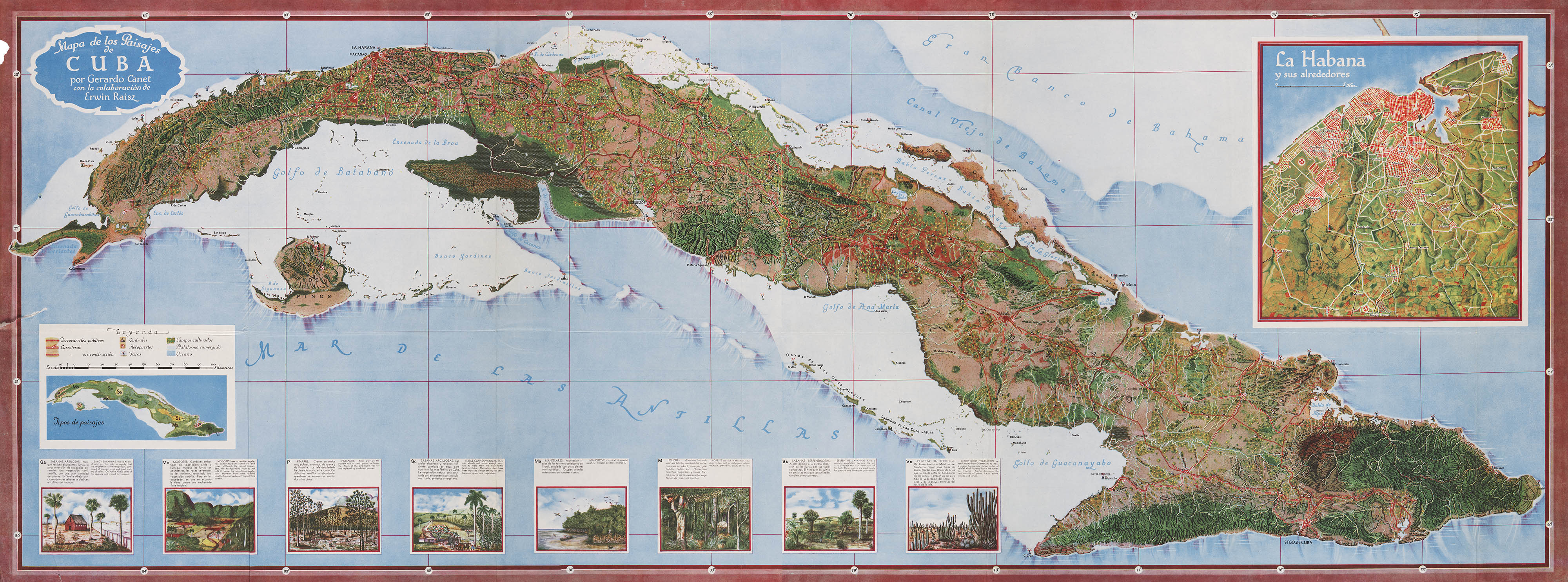
Detail, Mapa de los Paisajes de Cuba, 1949. From ref. 7
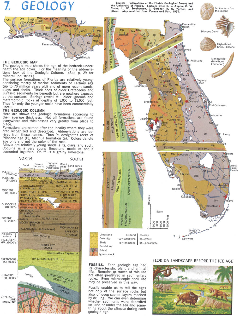
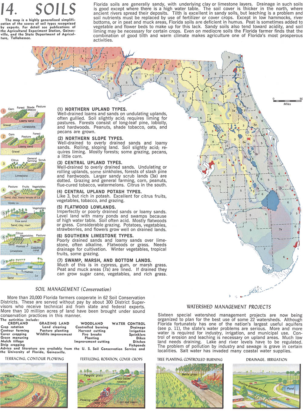
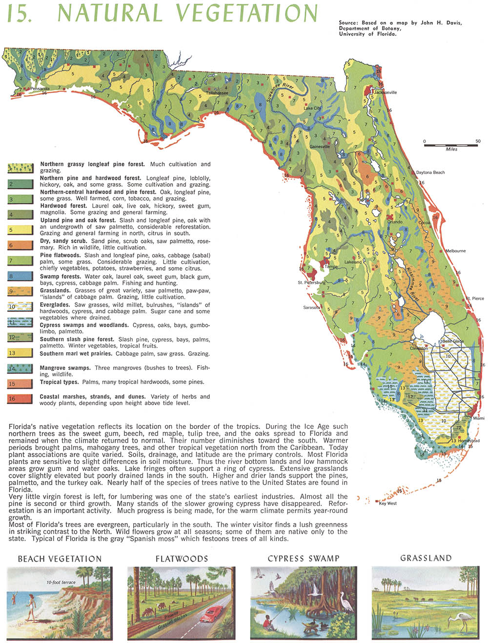
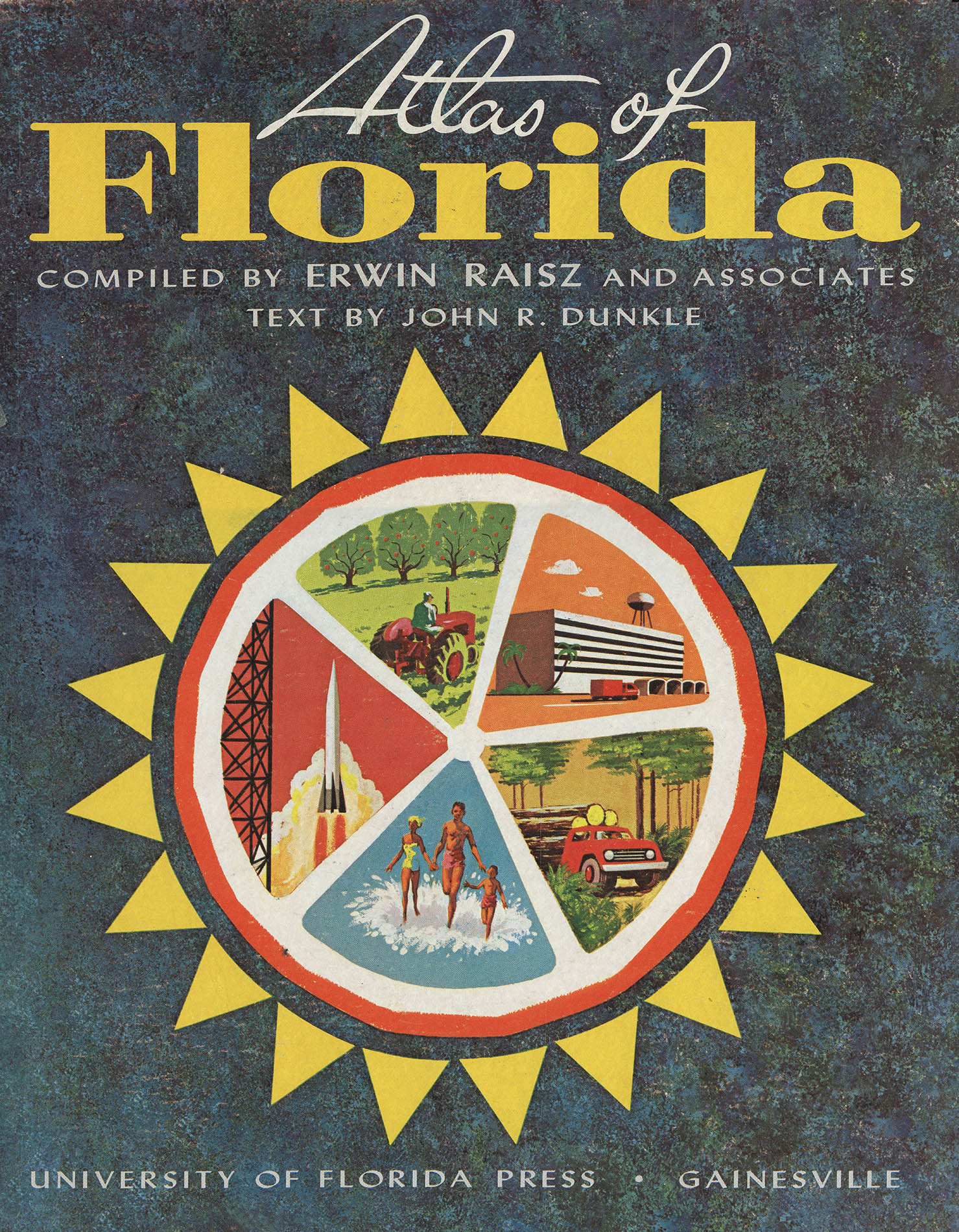
In 1964, while teaching at the University of Florida in Gainesville, he, along with the geography professor John Dunkle, published his third atlas – the Altas of Florida.8 It was the first statistical atlas of the state. Although intended for school-age children and now wistfully dated, the maps encapsulated nearly everything Raisz had learned about landforms, cartograms and projections in a long and distinguished career:
The Atlas of Florida would turn out to be Raisz’s swan song. He died suddenly on 1 Dec 1968, at age 75, while enroute to a conference in New Delhi.
1. For more biographical information see: Robinson, A.H. Erwin Josephus Raisz 1893–1968. Annals of the Association of American Geographers. 1970 Mar;60(1): 189–193, or Harrison, R.E. Obituary: Erwin Raisz (1893–1968). Geographical Review, 1969 Jul;59(3): 448–449.
2. From Wind, Herbert Warren (ed). The Complete Golfer. New York: Simon & Schuster, 1954 (WorldCat). We’ve discussed Wind previously. The original map was prepared in B&W and was later colored for the book. Among golf course architecture fans, Raisz’s map is considered a masterpiece right up there with MacKenzies’s 1927 St. Andrews map (and that’s another, perhaps future post).
3. Raisz E. The Physiographic Method of Representing Scenery on Maps. The Geographical Review. 1931 Apr;21(2): 297-304.
4. Raisz, Erwin. General Cartography. New York: McGraw-Hill, 1938 (WorldCat).
5. “General Cartography by Erwin Raisz.” The Geographical Journal. 1940 Nov;96(5): 351–355
6. Raisz, Erwin. The Altas of Global Geography. New York: Global Press, 1944 (WorldCat, online).
7. Canet, Geraldo, Raisz, Edwin. Atlas de Cuba. Cambridge, Massachusetts: Harvard University Press, 1949 (WorldCat). Some of the Atlas is presented on John Krygier’s Making Maps blog.
8. Raisz, Erwin, Dunkle, John. Altas of Florida. Gainesville, Florida: University of Florida Press, 1964. (WorldCat, online). The 52 page, oversized (8¼ × 14¼") book was an all-Florida affair: It was printed by Rose Printing, Tallahassee. the special plastic-inpregnated cover was printed by Paramount Press, Jacksonville and the book was bound by Dobbs Manufacturers, St. Augustine.
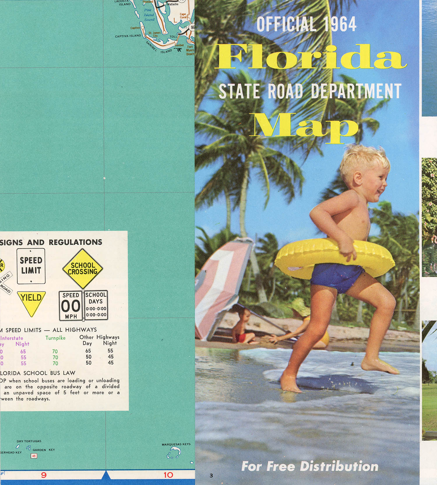
The first (and only) edition included a copy of the official 1964 State Road Department map:
3 Jul 2011, updated 6 Jul 2015 ‧ Cartography