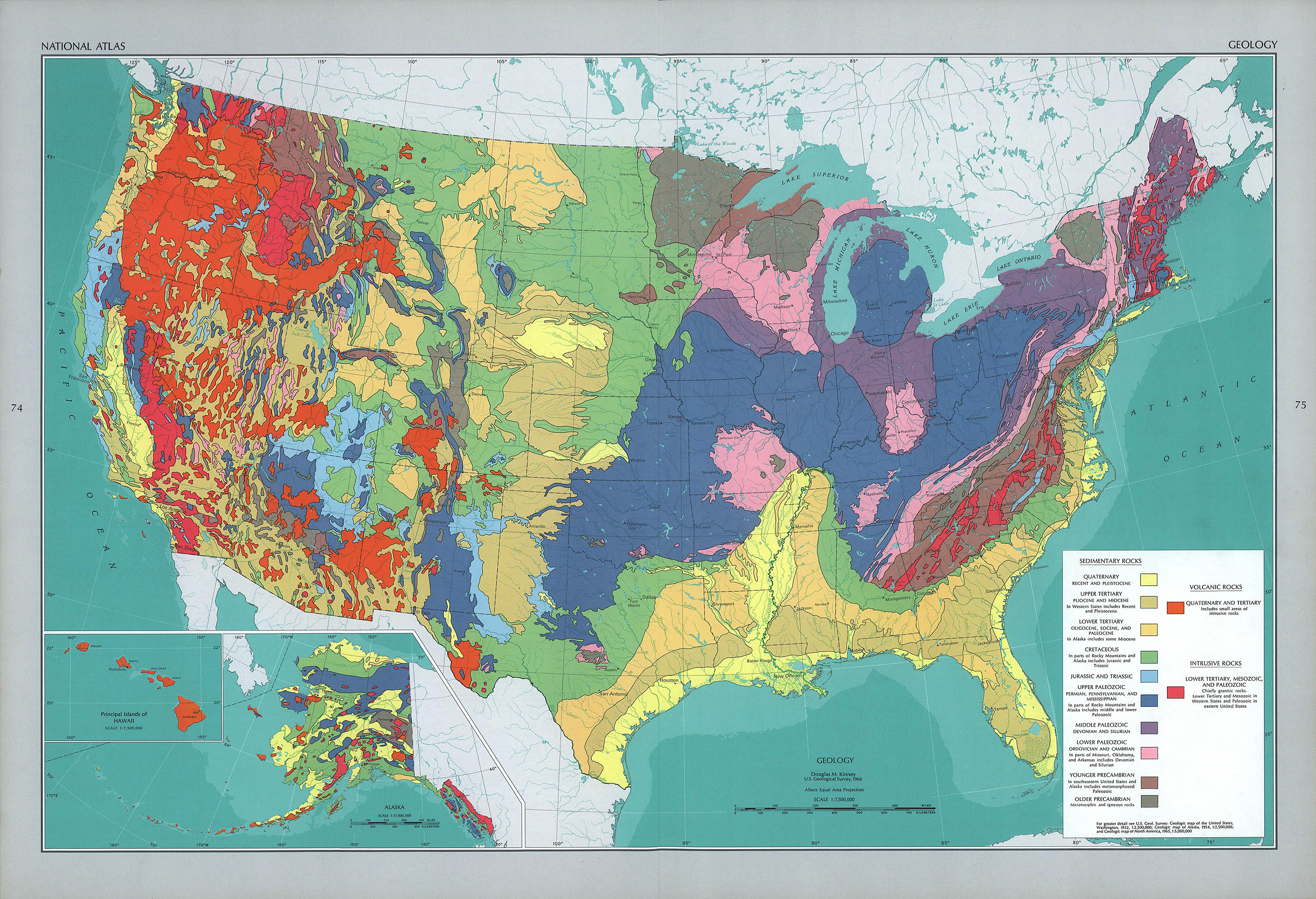
Geology, 1966. From ref. 3
129
The National Altas
Part II - The National Altas of the United States of America
After Walkers 1874 Statistical Altas it would be another 70 years before the idea of a National Atlas was revisited. In 1952 the American Geographical Society showed a 400 page prototype atlas to the commercial map publishers but they showed little interest – it was simply too complex and unprofitable – so the National Academy of Sciences established an interagency group to prepare an official National Altas.
It turned out to be an impossible task1 to coordinate and in 1961 the project was turned over to a single agency – the USGS. Dr. Arch Gerlach (1911–1972), chief of the Library of Congress Geography and Map Division, was appointed editor.2 By all accounts Gerlach was a natural leader and he eventually enlisted representatives of more than 80 Federal agencies and bureaus, as well as an advisory board of professional and academic cartographers to contribute to the project.
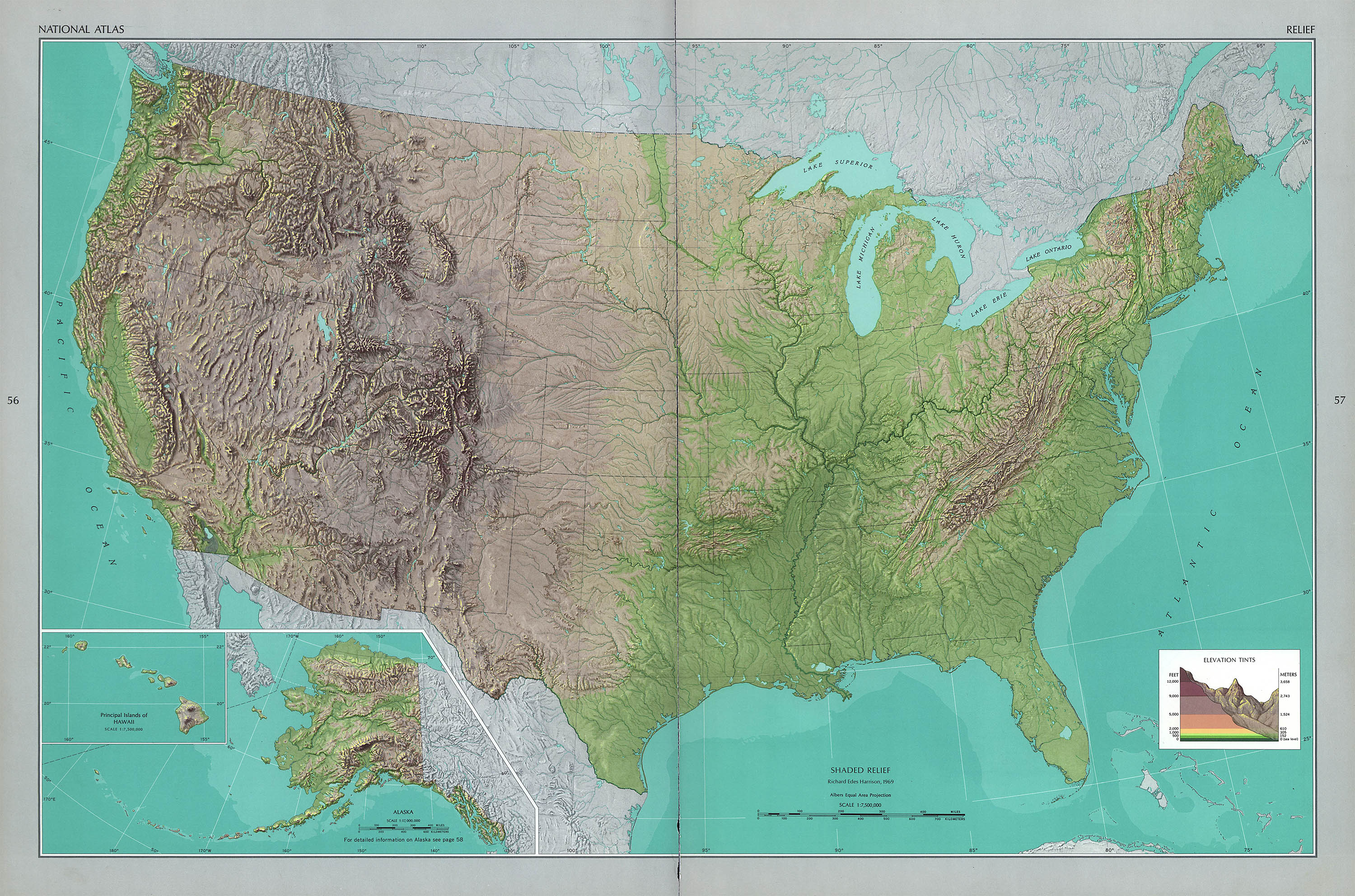
Shaded Relief, 1969
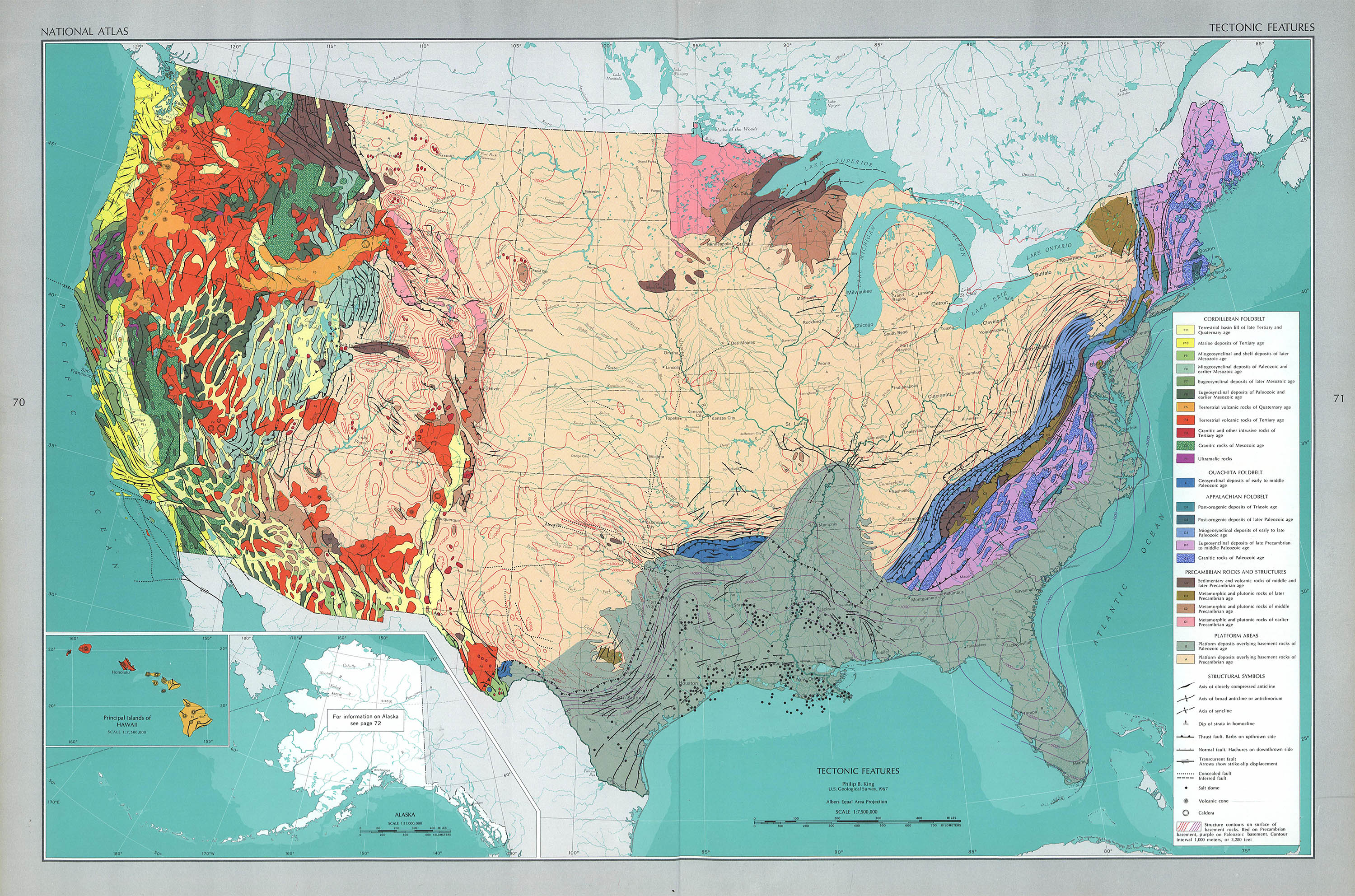
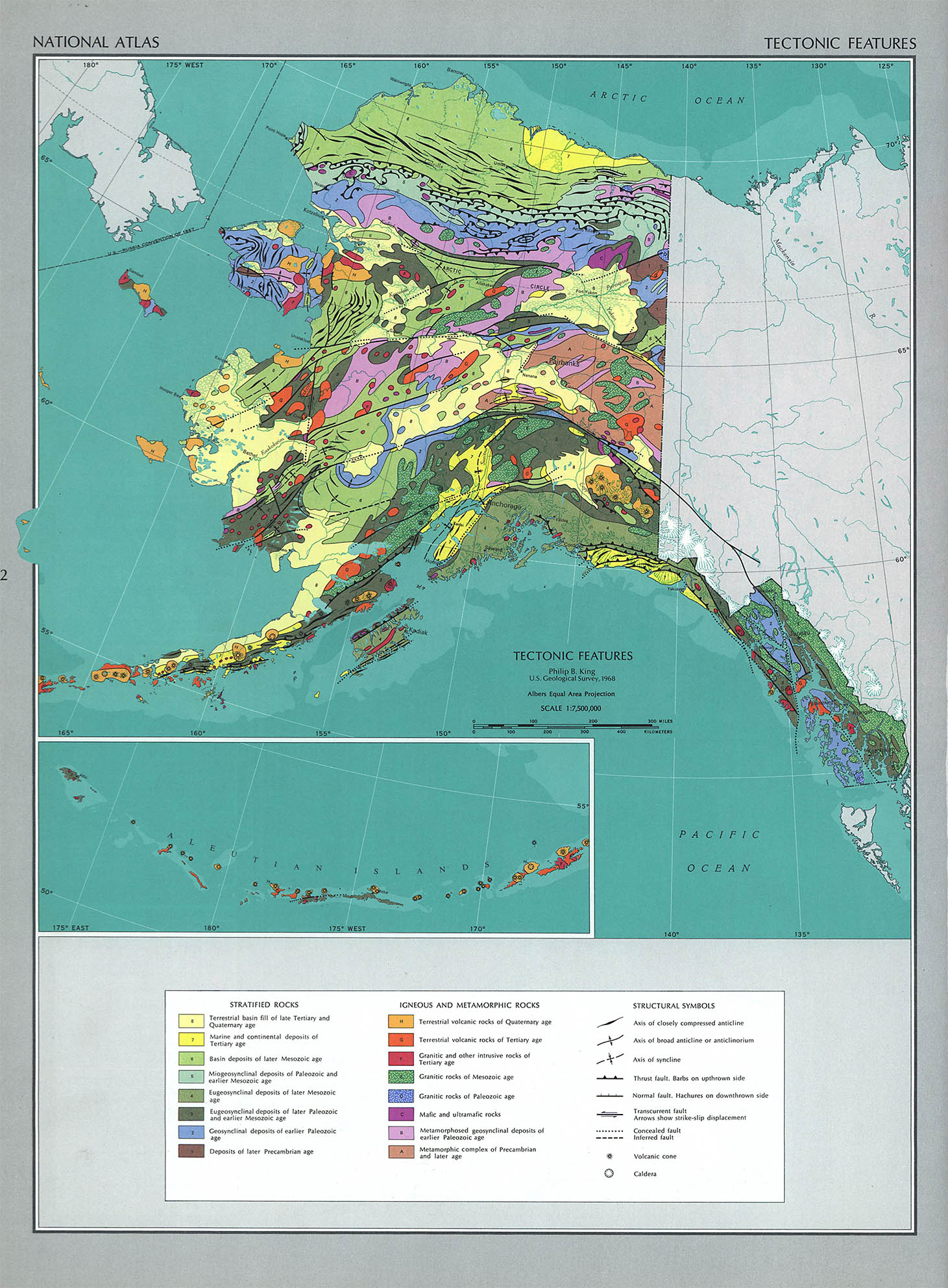
Tectonic Features, 1966, 1968
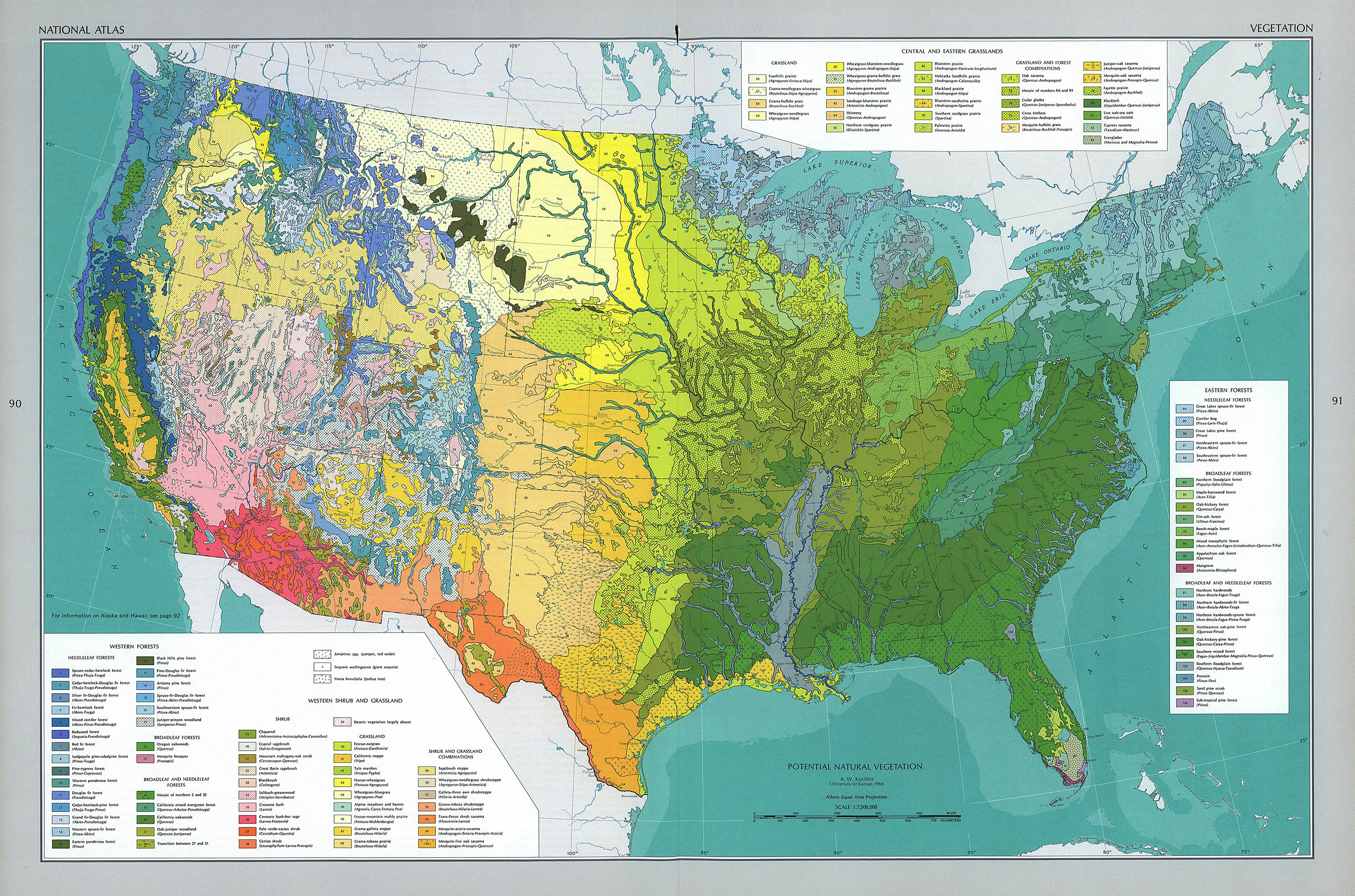
Potential Natural Vegetation, 1966
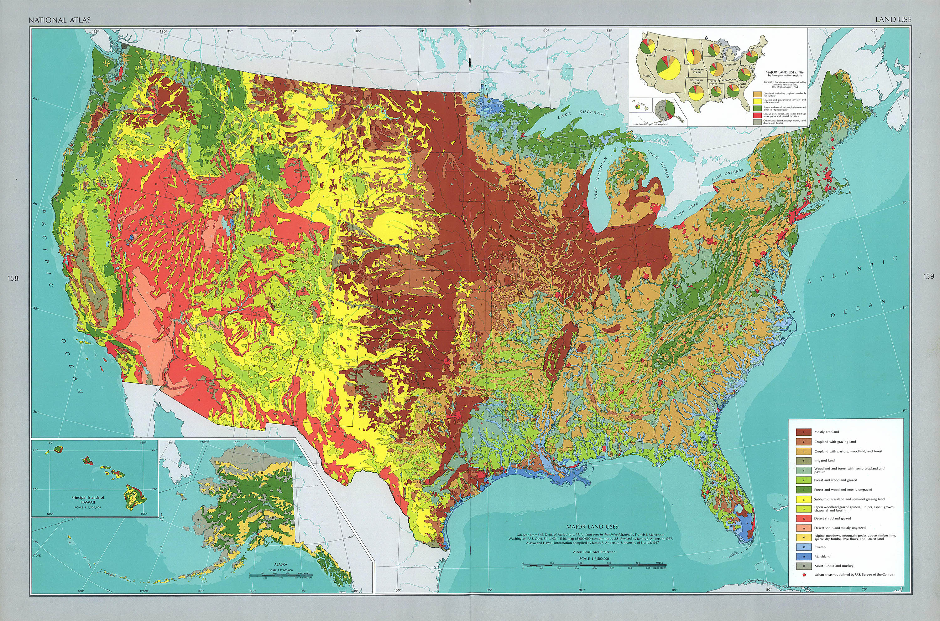
Major Land Uses, 1967
It took Gerlach nine years to compile 765 maps into a 417-page oversized monster – The National Atlas of the United States.3
The Altas attempted to be everything for everybody. It included reference maps with a 40,000+ name gazeteer, physical and geological maps, historical maps, socioeconomic maps, sociocultural maps, and sociopolitical maps. There are even maps about what things have (or haven’t) been mapped.
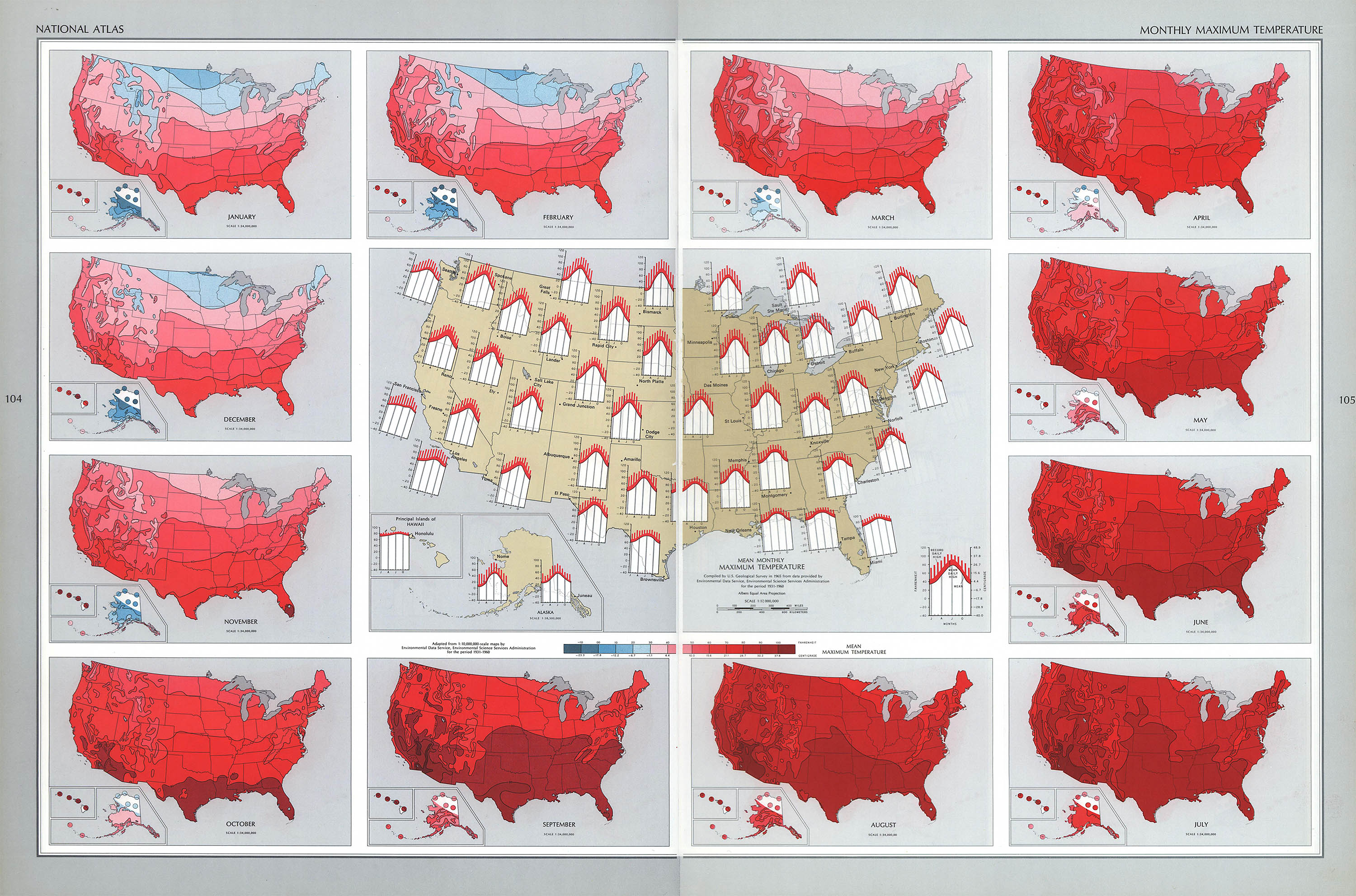
Mean Monthly Maximum Temprature, 1931–1960
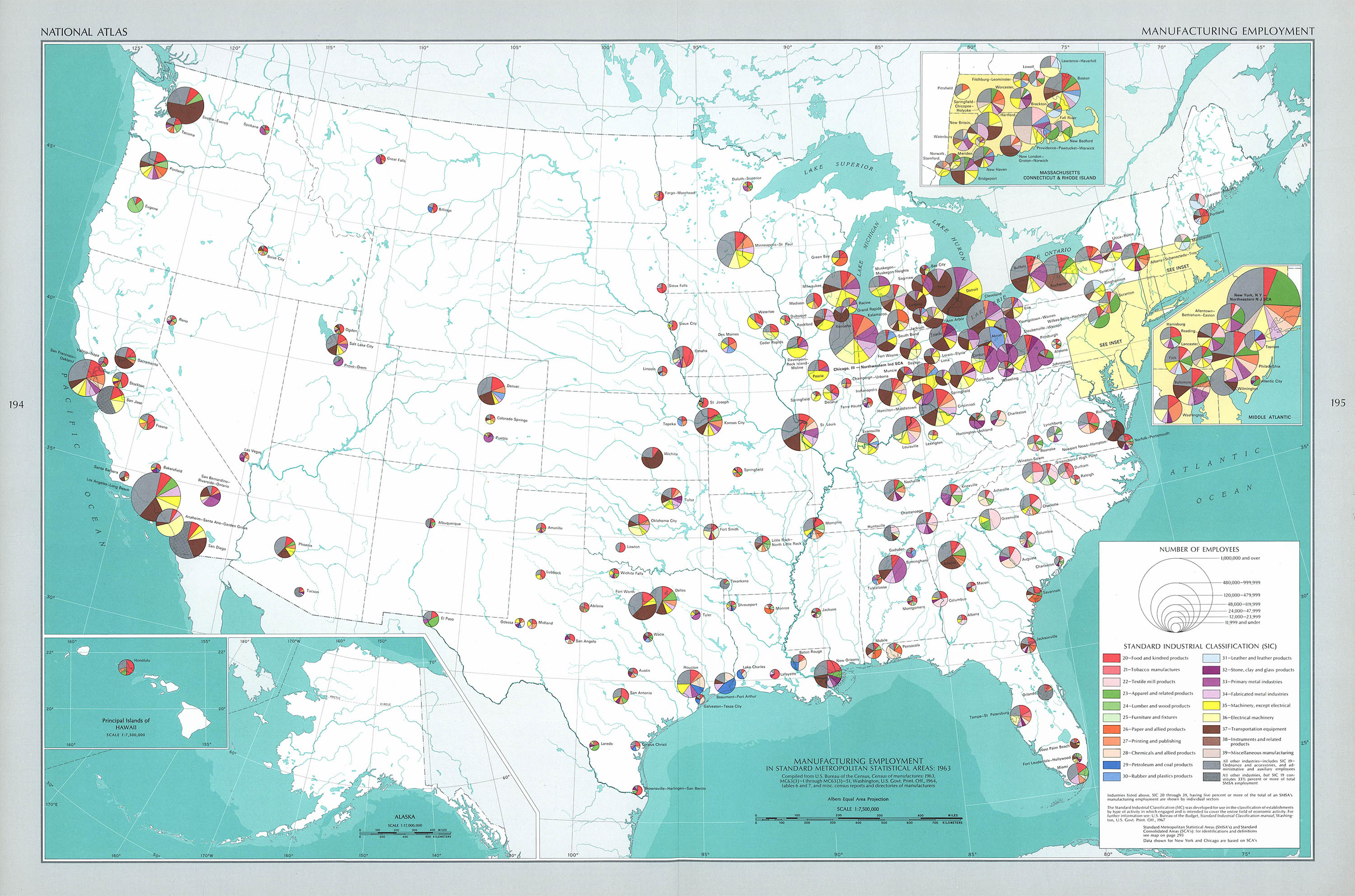
Manufacturing Employment, 1963
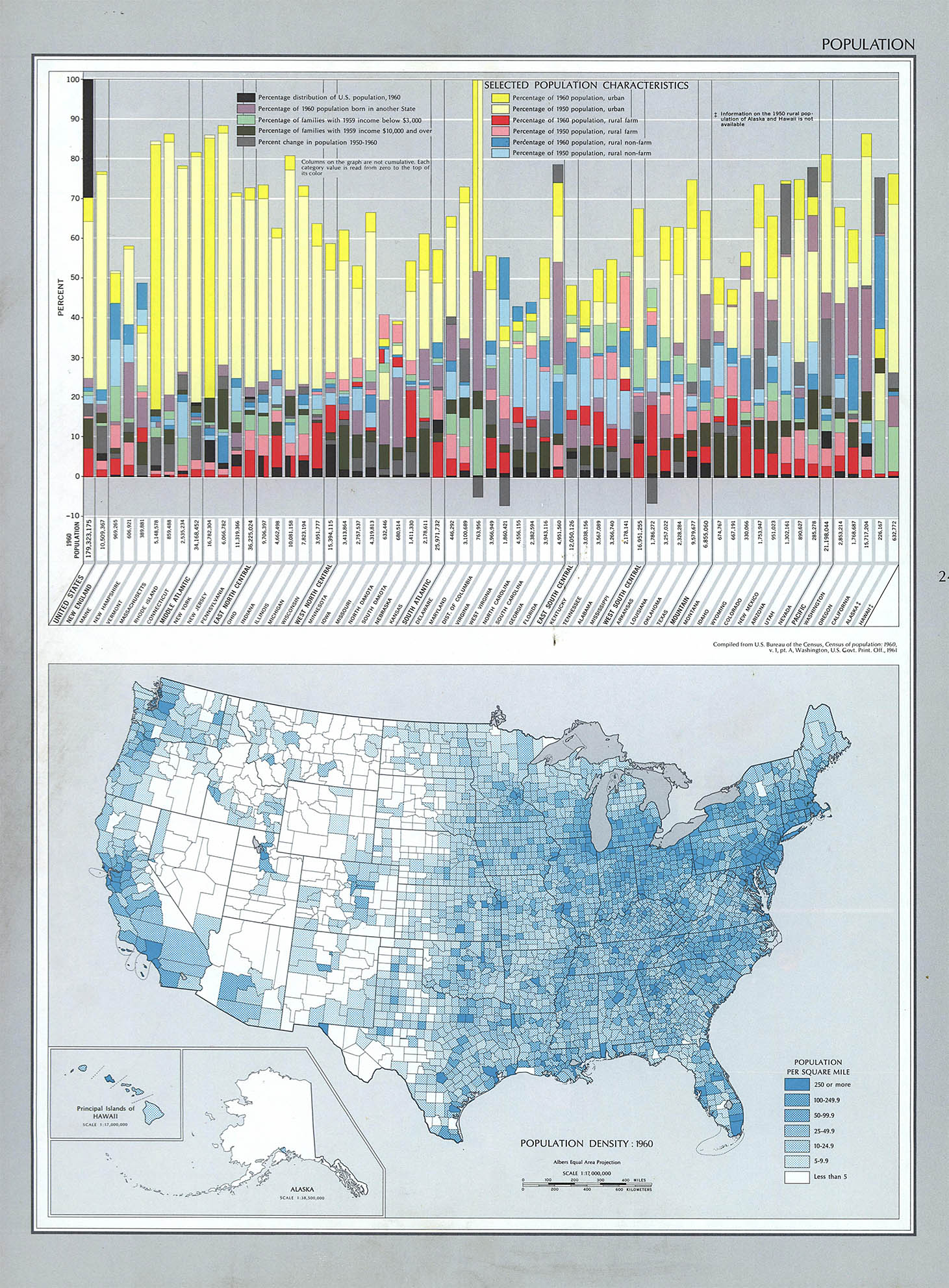
Population, 1960
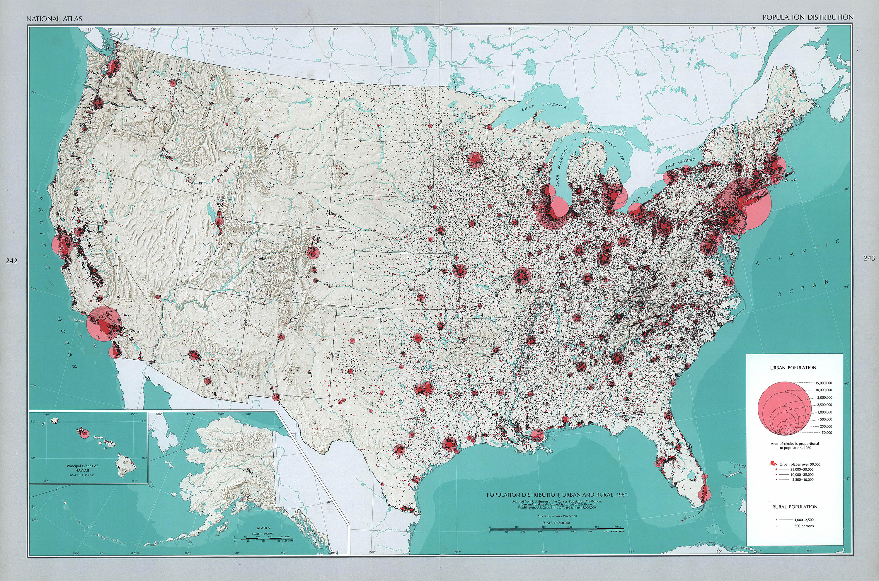
Population distribution, 1960
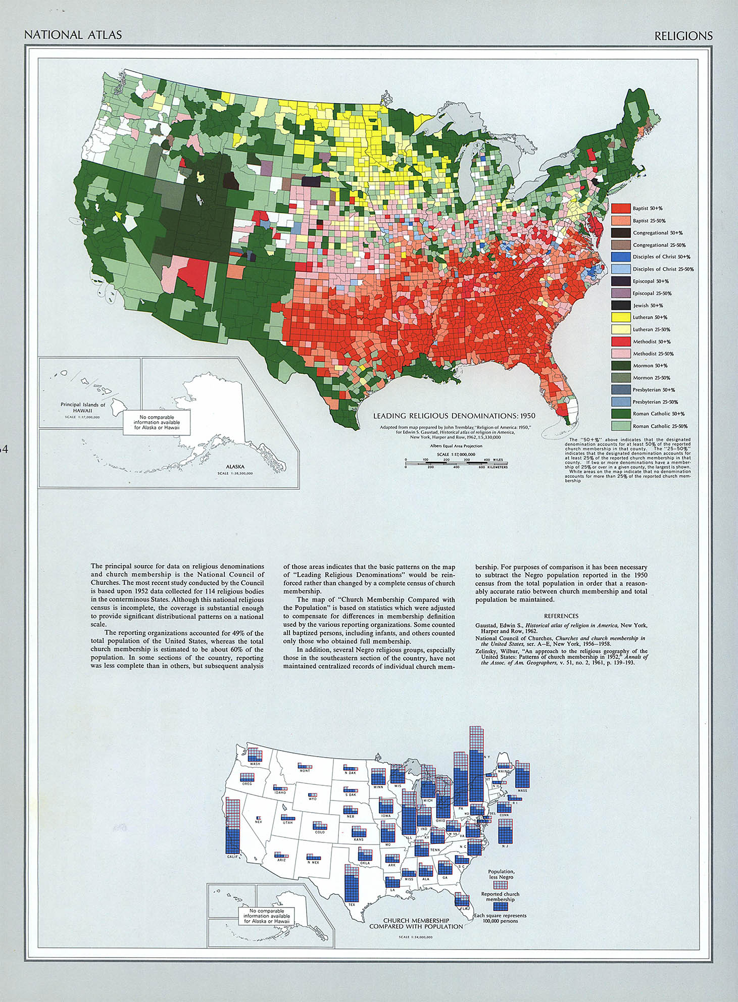
Leading Religions, 1951
Although some of the individual map sheets were updated, the Altas itself was never reprinted and the single edition was sold out by the early 1970s.4 In fact there has never been another printed National Atlas. In 1997 Congress appropriated funds for a completely digital version of the the National Atlas; an online collection of geospatial and geostatistical data. Although you can easily argue that there is no substitute for a well done paper map, there is a flexibility with digital data that cannot be replicated on paper. Here is a wonderful example of several combined datasets from the online Atlas:
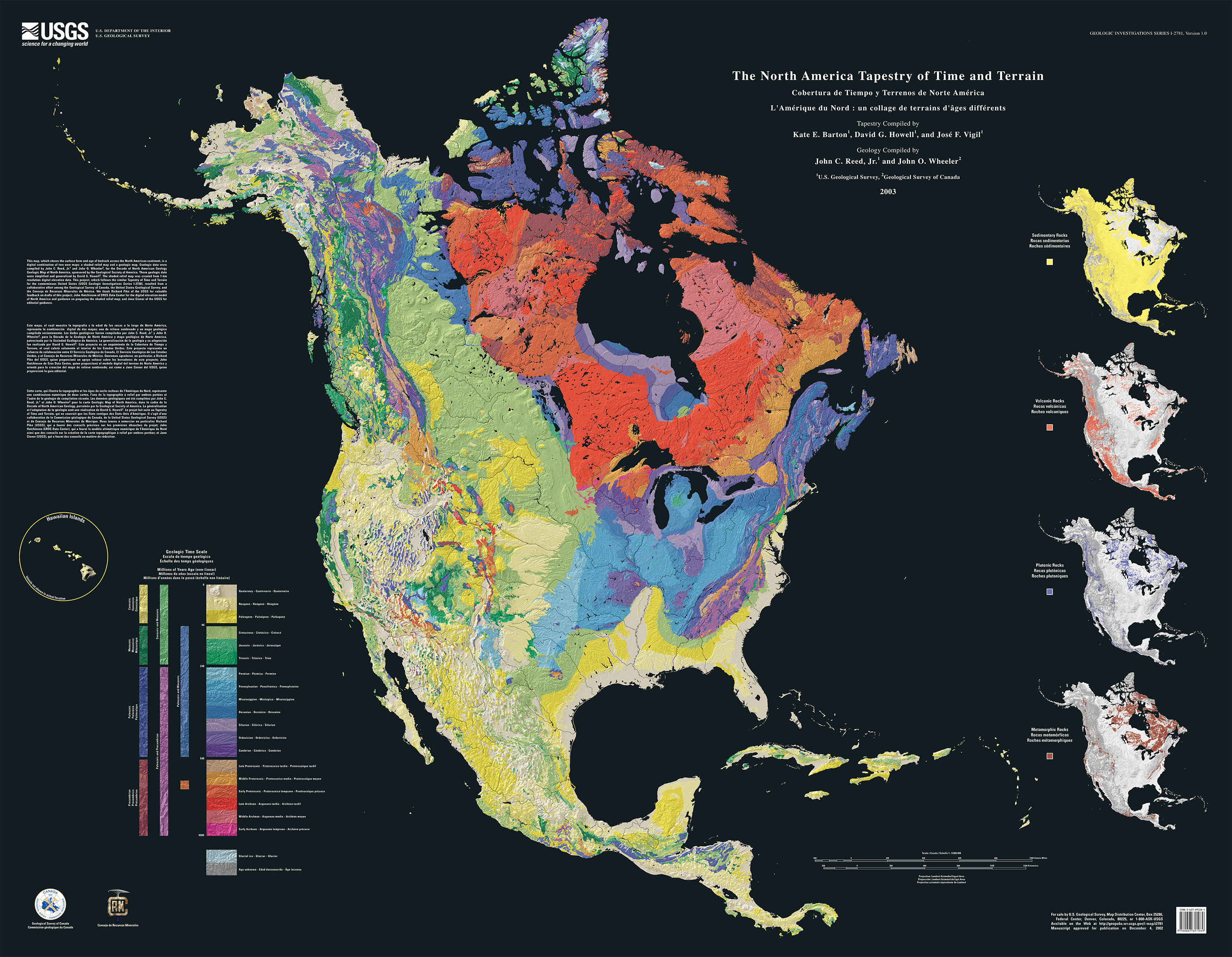
North American Tapestry of Time and Terrain, 2003. National Atlas
1. The proper idiomatic phrase is “like herding cats.”
2. For a brief biography see: Burrell, Meredith. “Arch Clive Gerlach, 1911–1972.” Annals of the Association of American Geographers. 1974 Mar;64(2): 293–296,
3. Gerlach, Arch (ed.). The National Altas of the United States of America. Washington, D.C.: The Government Printing Office, 1970. The book, which included six transparent acetate overlays, weighs 14 lbs and meausres 19 × 29" when opened. It is entirely too large to comfortably open in your lap and really requires it’s own table. As clean tables are in notoriously short supply at the Codex 99 World Headquarters, I mostly reviewed it on my bed.
A complete set of plates is available at the LOC or UT's Perry-Castañeda Library Map Collection. The images here are from the Perry-Castañeda Library.
4. The print run was 15,000 copies and the book was prohibitively priced at 100 USD (550 USD, adjusted to today), Needless to say nearly all the copies were institutional purchases. Interestingly, however, your humble narrators library sale copy (20 USD) carried this inscription: “To Carol & Ted, Bob & Laura. Love Pop & Papa. April 15, 1971.”
9 Sept 2012 ‧ Cartography