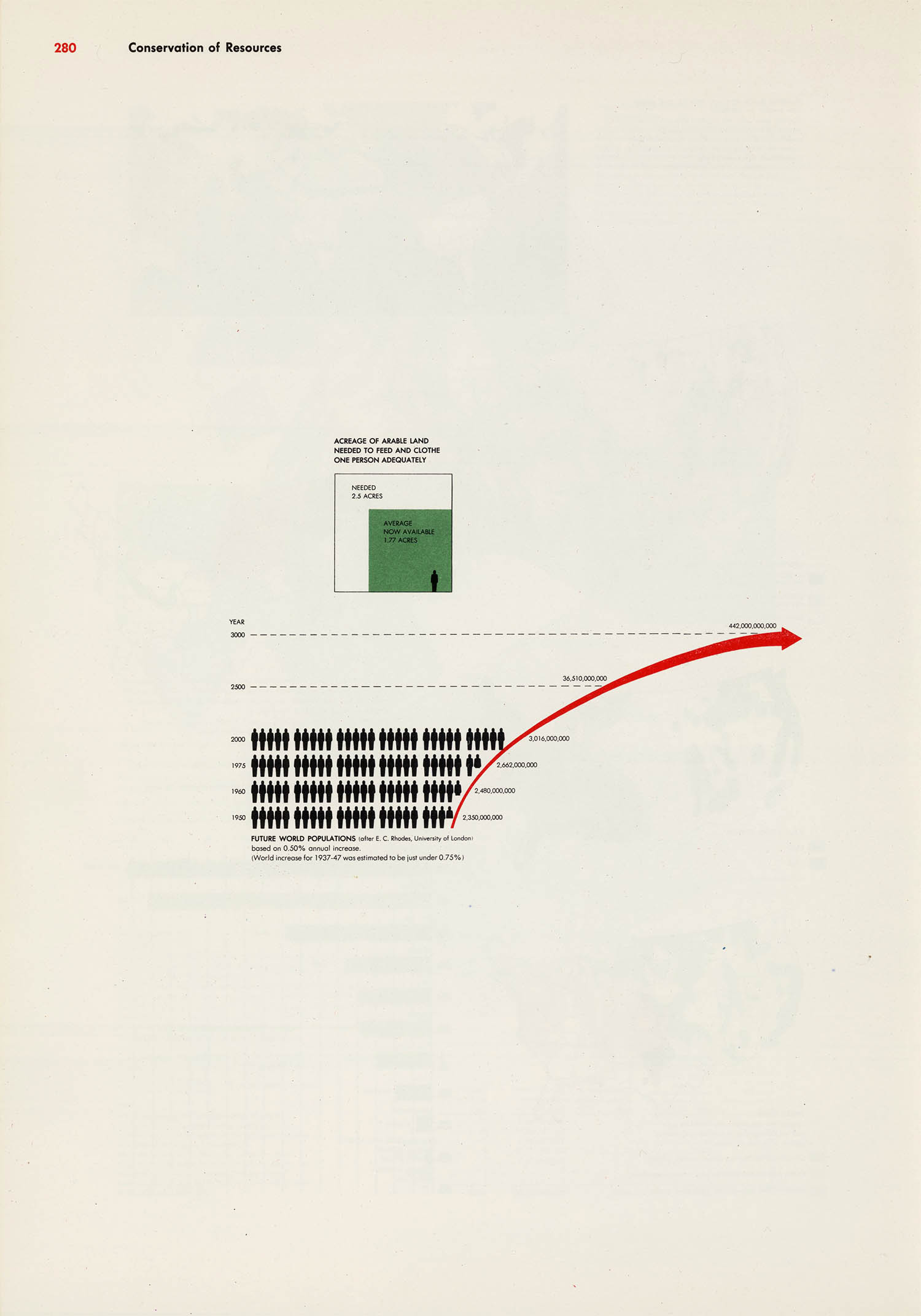
Actual 2000 population: 6.08 billion – even bleaker than Bayer’s estimate
The World Geo-Graphical Atlas
Herbert Bayer and the CCA
Herbert Bayer (5 Apr 1900 – 30 Sep 1985) began his career studying archirecture under Georg Schmidthammer and later painting at the Darmstadt Artists’ Colony. Inspired by Walter Gropius’ Bauhaus manifesto, he enrolled in the Weimar Bauhaus and studied painting under Wassily Kandinsky, Paul Klee and László Moholy-Nagy. After passing his journeymans exam Gropius appointed him as the junior master of the newly-created typography workshop. Bayer spent three years on faculity at Dessau before starting his own design firm in Berlin.1
Bayer was among the last of the Bauhaus faculty to emigrate from Germany, leaving for New York only after his work was singled out by the Nazis in their infamous 1937 Degenerate Art Exhibition.
The Paepcke’s interest in the Bauhaus came from Elizabeth’s interest in European avant-garde art and from the diaspora of Bauhaus designers, such as Gropius, Mies Van der Rohe and Moholy-Nagy, who settled in Chicago during the 1930s. Indeed, after financial difficulties forced the closing of Moholy-Nagy’s New Bauhaus school Paepcke personally offered his support to reopen it.
After Bayer arrived in America Paepcke and his art director Egbert Jacobson wasted no time hiring him as a design consultant. Following the war the Paeckpes even convinced him to move to Aspen to become the town’s architect, designer and artist-in-residence.
Bayer’s work for the CCA was rather wide-ranging. He supplied advertising art, created a corporate identity (including a new logo), designed factories and workspaces, oversaw the Great Ideas campaign and in 1953 compiled and designed the World Geo-Graphical Atlas.
Table of contents, key and outline
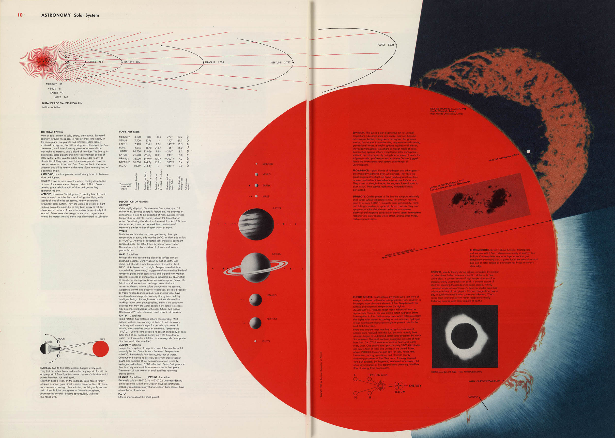
The Solar System
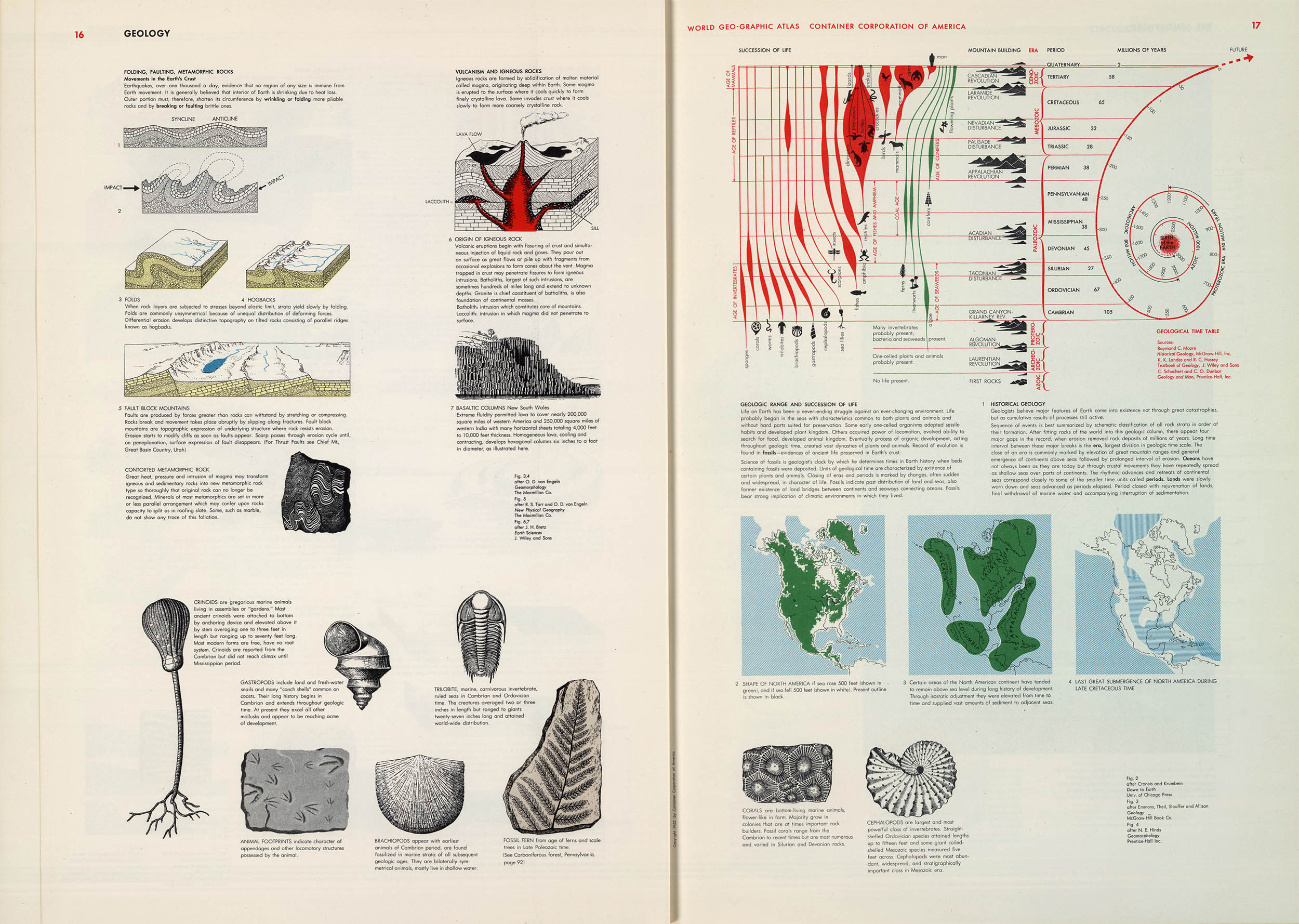
Geology
For the CCA’s 25th anniversary Paepcke wanted to publish an update of their 1936 Atlas of the World.2 Bayer decided that the altas wouldn’t simply be an update but a new graphical narrative of humans and geography – hence the full title: World Geo-Graphical Atlas: A Composite of Man’s Environment.3,4
Bayer had difficulty evaluating the scientific literature and found that “a scientist would not think in terms in which I worked.” He decided to do all his own research from scratch, even travelling extensively throughout Europe to find relavent maps and data. He called the five-year long process “a good adult education.”
For the project Bayer, with the help of the designers Martin Rosenzweig, Henry Gardiner and Masato Nakagawa developed a modernist graphical language never before applied to cartography. He used the color theories of of Egbert Jacobsen, the statistical representations of Otto Neurath and the dynamic design of Moholy-Nagy. The final layout was designed as integrated 2-page spreads intended to be seen as a single whole – the ultimate application of the Bauhaus ideal of complete design; the unity of art, craft, and technology.
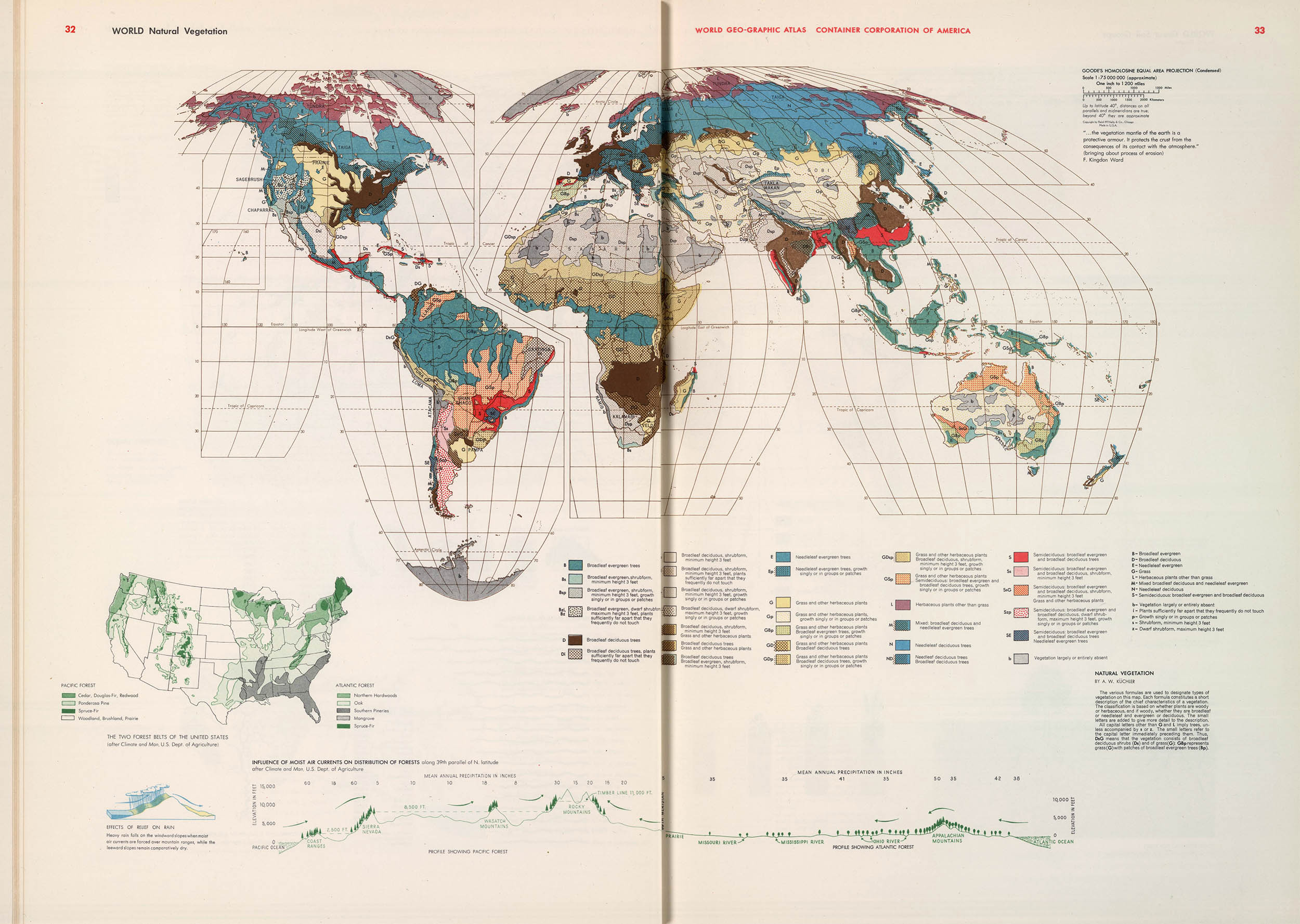
Natural vegetation
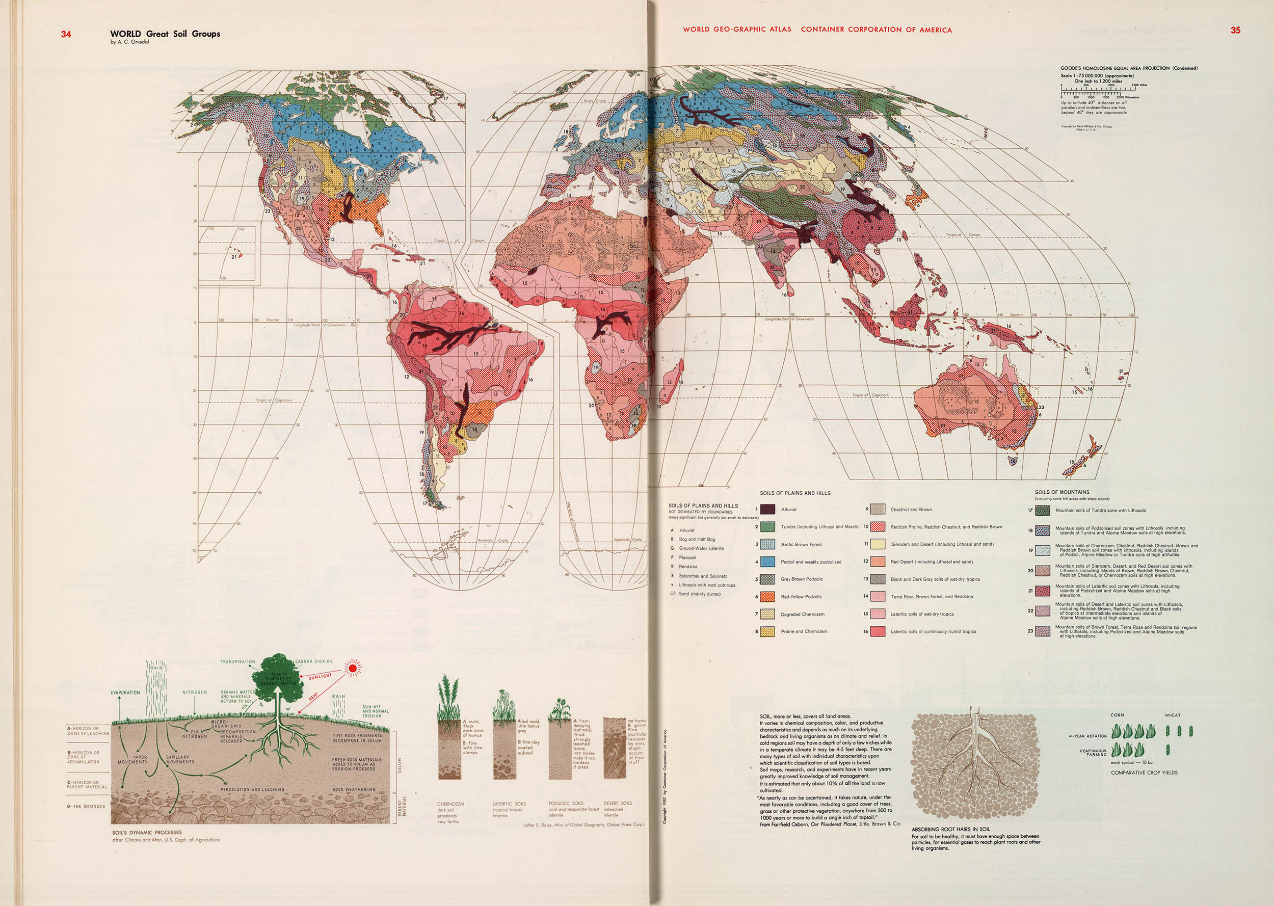
Soil types
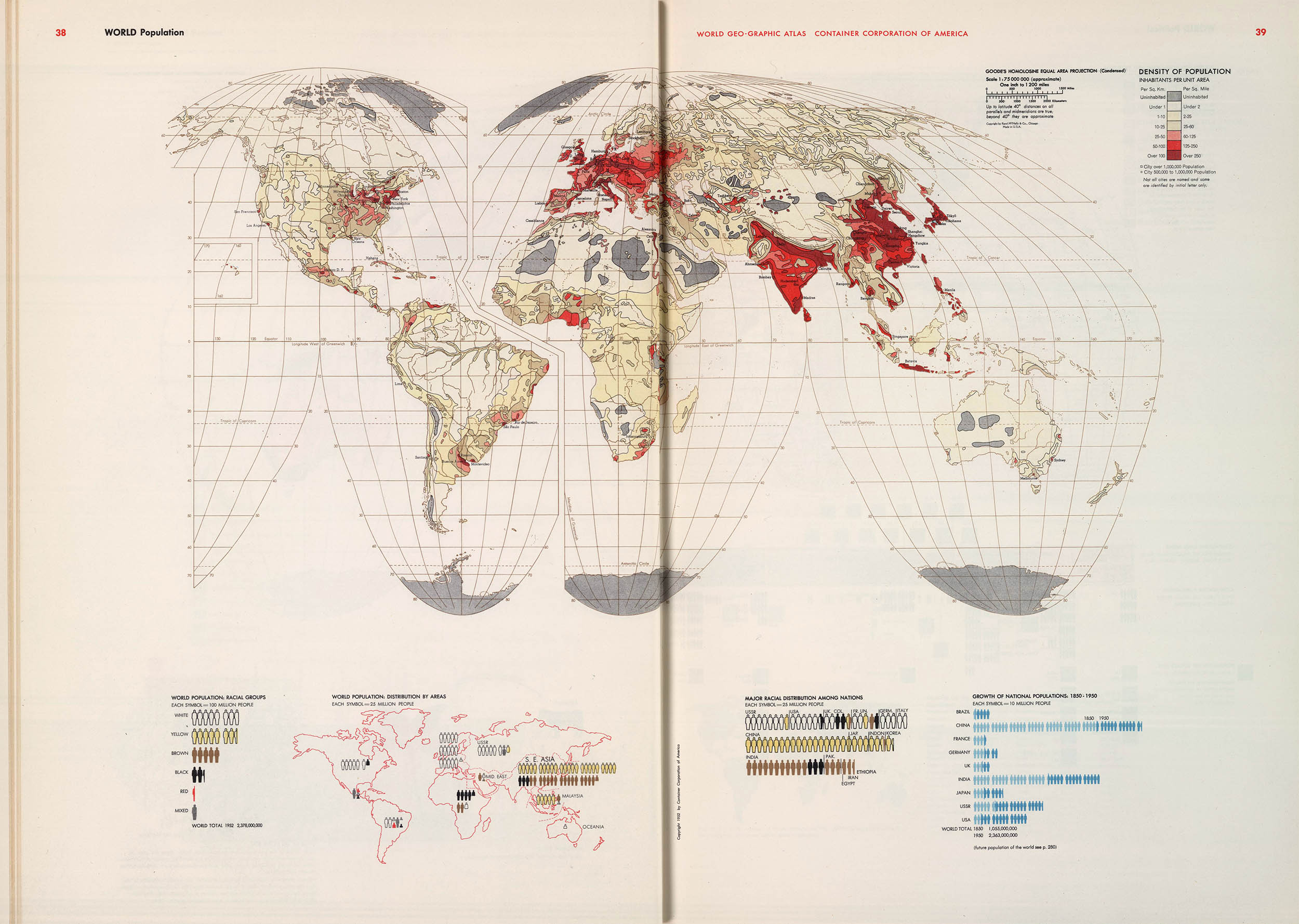
World population
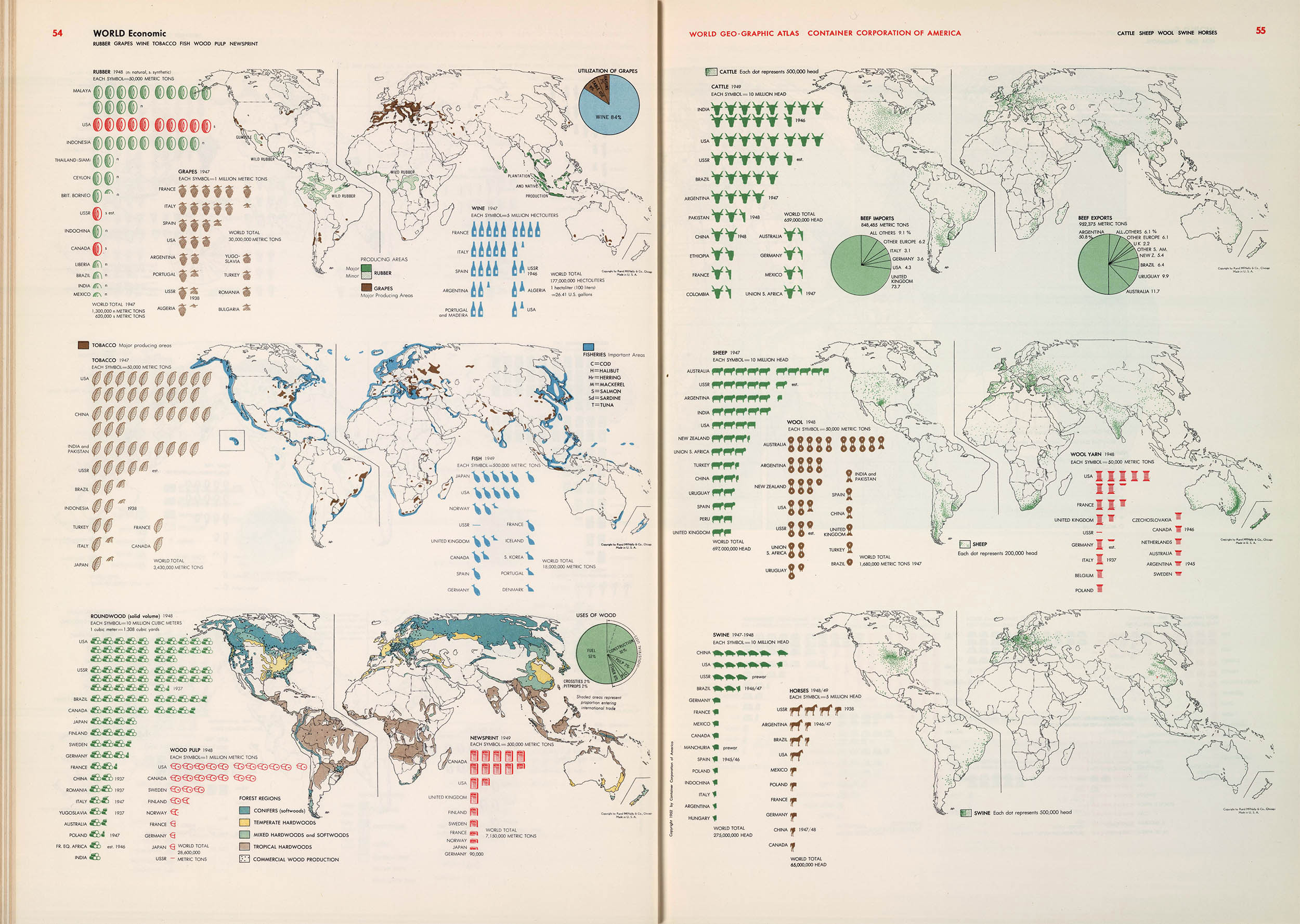
World economies
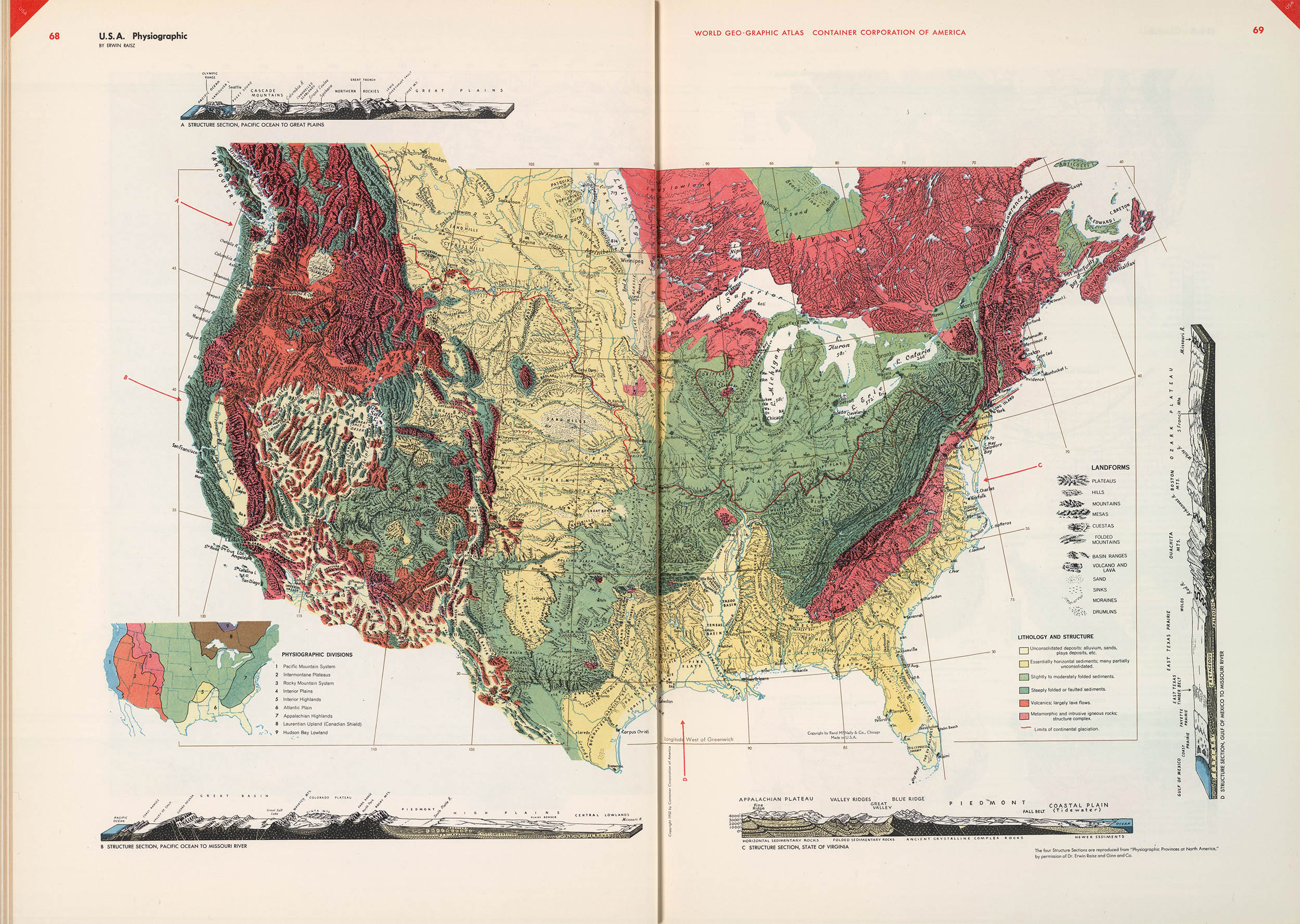
Erwin Raisz’s Physiographic map
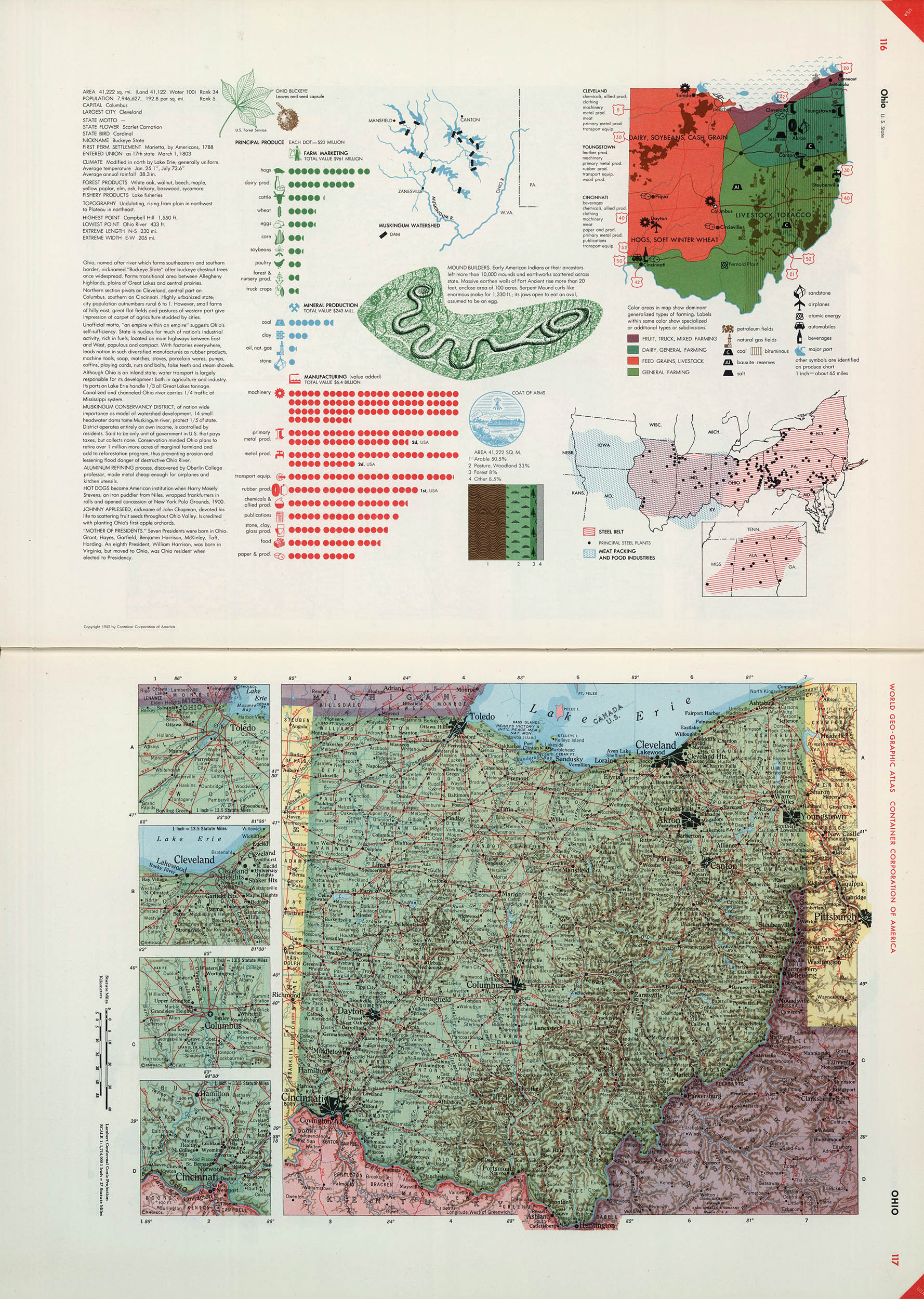
Ohio
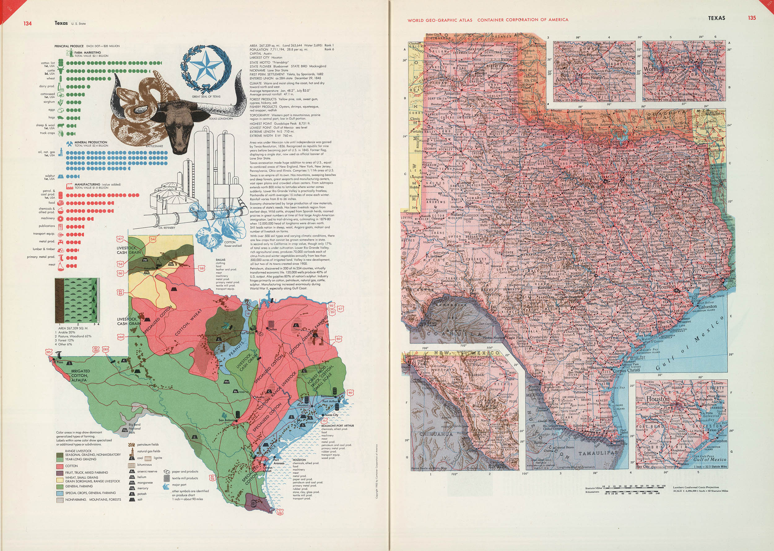
Texas
It was the most expensive atlas yet published. The single edition of 30,000 copies reportedly cost Paepcke more than 500,000 USD and like all CCA publications it wasn’t for sale, but was a gift to CCA’s customers. Paeckpe even declined offers from commercial publishers for trade editions.
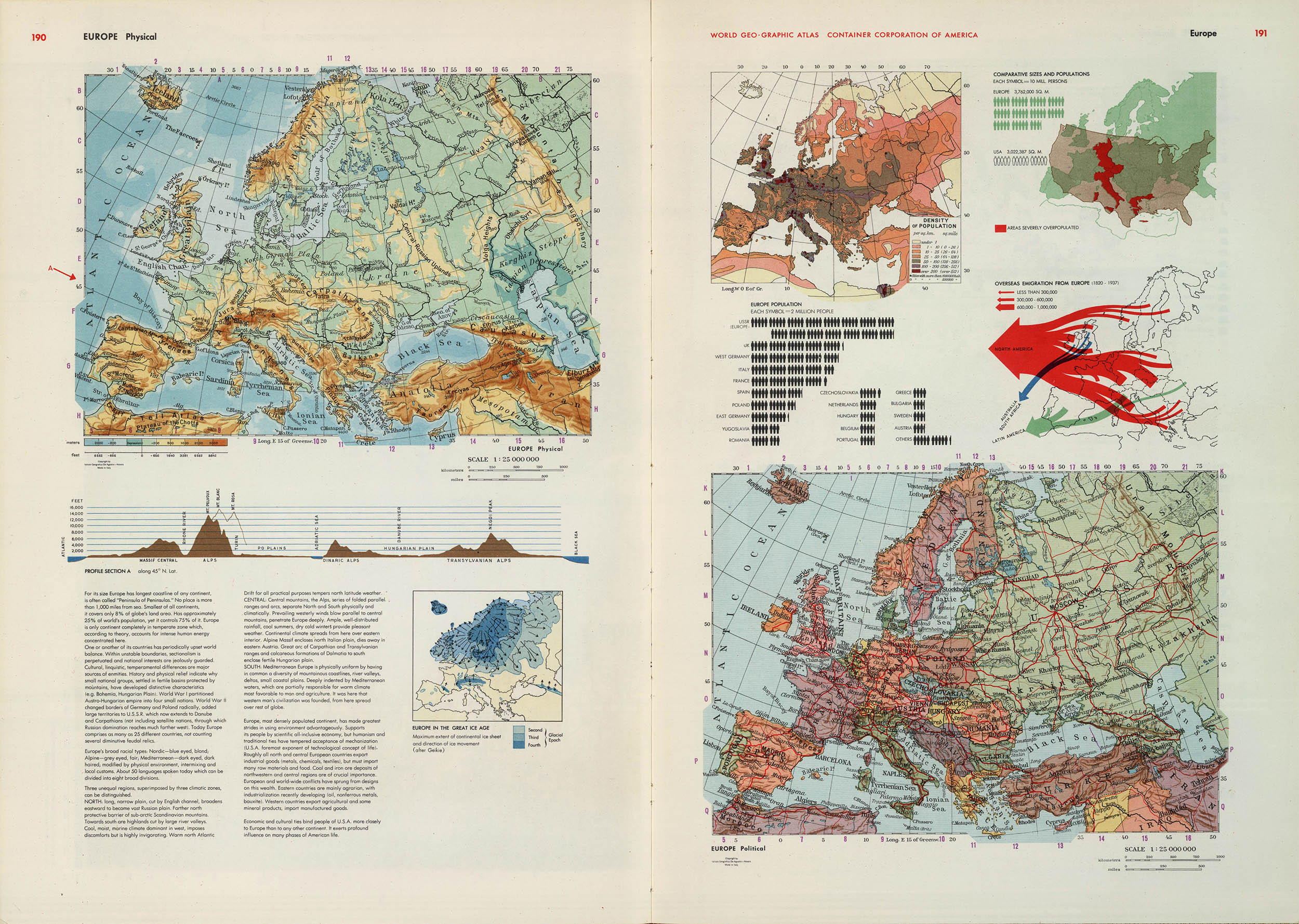
Europe
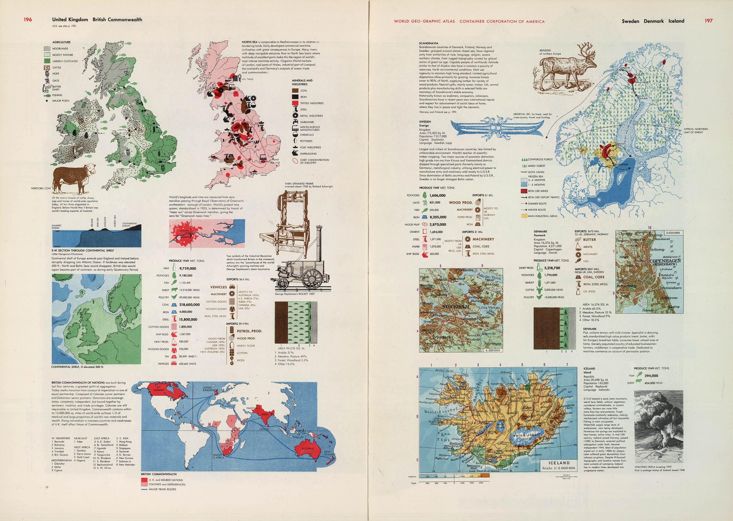
Great Britain, Scandinavia
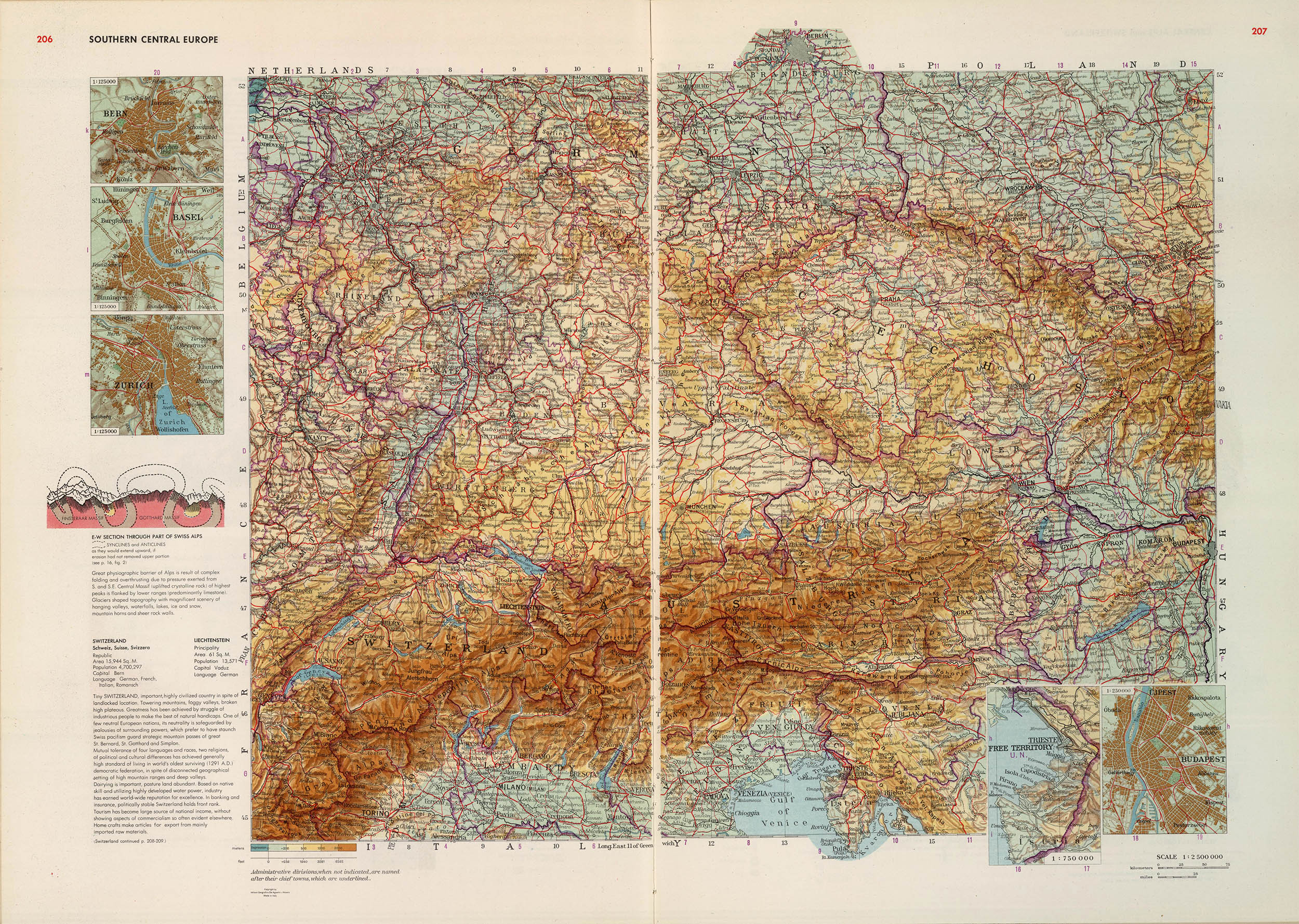
Central Southern Europe
To suggest that the Altas was well-received was something of an understatement. The Geographical Review stated that “it is probably the first ‘American’ atlas that properly belongs in the category of great world altases,” and the designer Geoff Conklin said its maps surpassed “any ever shown in an American atlas to a degree which is almost embarrassing; they are masterworks of the cartographer’s art.”5
Today, 60 years later there is still no other atlas so completely and relentlessly informative. Although much of the cartography is now dated, Bayers prescient narrative of humans and their environment is now perhaps more important than ever:
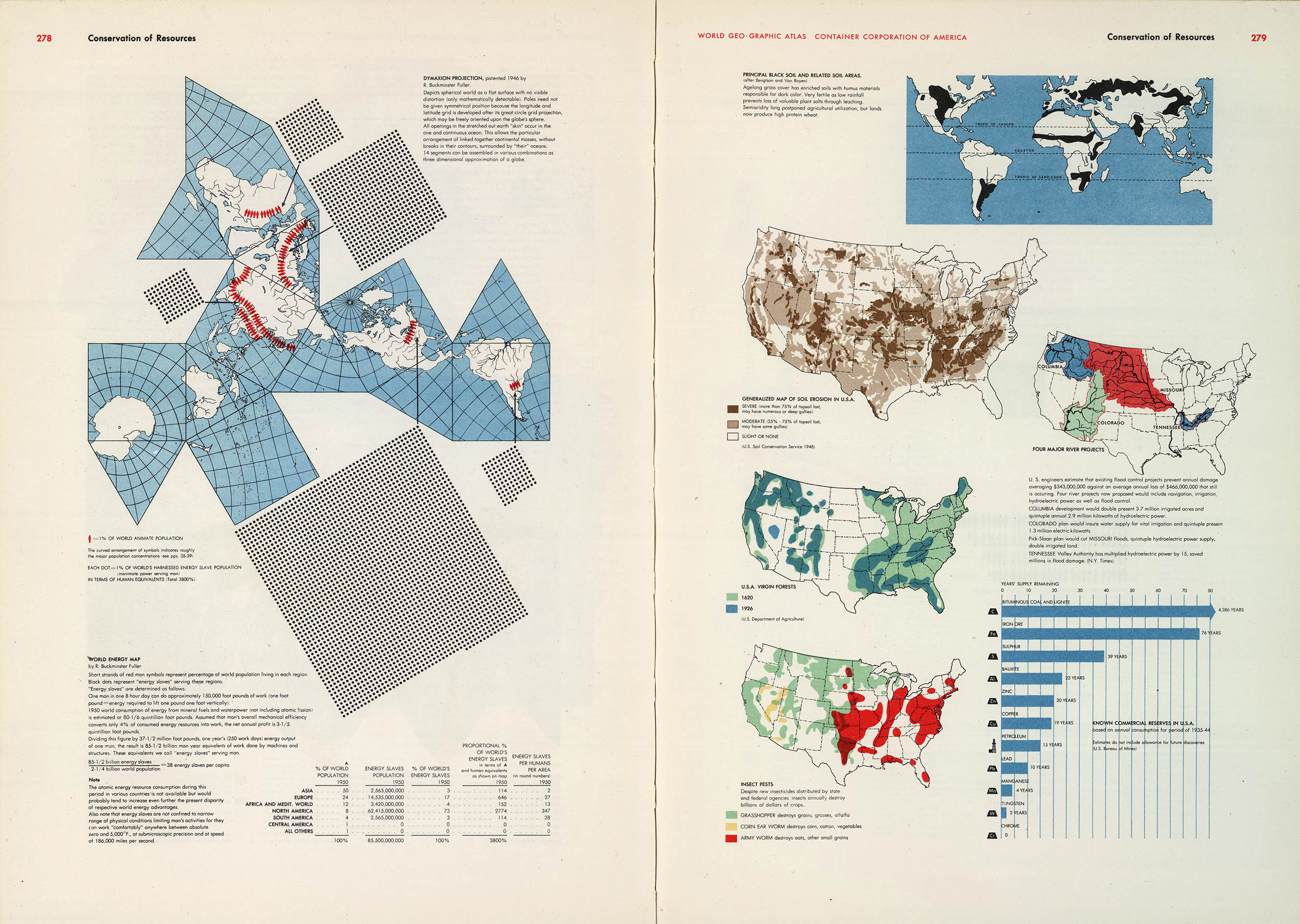
Buckminister Fuller’s World Energy Map
1. For a biography see: Cohen, Arthur. Herbert Bayer: The Complete Work. Cambridge, MA: MIT Press, 1984 (WorldCat).
2. Atlas of the World. Chicago; Container Corporation of America, 1936 (WorldCat). The Altas was prepared by Chicago-based Rand McNally for the CCA.
3. For an excellent review of Bayer and his Atlas see: Anker, Peder. “Graphic Language: Herbert Bayer’s Environmental Design” Environmental History 2007 Apr;12 254–78 (online)
4. Bayer, Herbert. World Geo-Graphic Atlas: A Composite of Man’s Environment. Chicago: Container Corporation of America, 1953 (WorldCat). The atlas was also published in a revised German edition: Goldmanns Grosser Weltatlas. Munich: Wilhelm Goldmann Verlag, 1955 (WorldCat). The 368-page oversized book (11½ × 15¾") was bound in gold-stamped monkscloth (i.e., burlap) and packaged in a cardboard slipcase.
True story: I found my copy of the Atlas at the Aug 2013 Friends of the Library book sale. Out of pocket cost: 6.00 USD. It soon became apparent that there would be no way I could properly scan it so the images here are from the David Rumsey Map Collection.
5. Ullman, E. L. “World Geo-Graphic Atlas: A Composite of Man’s Environment by Herbert Bayer.” Geographical Review 1955 Jan;45(1): 147–149. Groff Conklin. “World Geo-graphic Atlas.” Print 1955 Jul/Aug;9: 44–51.
10 Sep 2013 ‧ Design, Cartography